Sunday, July 7, 2013

MOUNT PULAG CLIMB

MOUNT PULAG
Location: Provinces of Benguet, Ifugao and Nueva Vizcaya, Philippines

Entry point: Babadac Ranger's Camp
Exit point: Babadac Ranger's Camp
Coordinates: 16°36'10"N, 120°53'32"E
Elevation: 2922 MASL (9,586 feet)
Days required / Hours to summit: 3 days / 3.5 hours
Specs: Major climb, Level III, Strenuous
Important Description: The third highest mountain in the Philippines and the highest in Luzon as it is dubbed to be the "Roof of Luzon". It is one of the most well maintained "premier" National Park in the country.


View mount pulag in a larger map


Taken at Mount Pulag's summit during Day Two's sunrise


The suggested Itinerary in Ambangeg-Ambangeg (Babadac Trail) is shown below:

Day 1

08:00 P.M. - Assembly time Victory Liner Pasay Terminal
09:00 P.M. - ETD to Baguio City

Day 2

03:00 A.M. - ETA Baguio City
03:30 A.M. - ETD for Kabayan, Benguet through jeepney transport
05:30 A.M. - Ambuklao Dam
06:00 A.M. - Breakfast (Karinderya)
07:00 A.M. - ETA DENR (Orientation/Briefing)
08:30 A.M. - ETD to Babadac Ranger's Camp
10:00 A.M. - ETA Ranger's Camp
10:30 A.M. - Start Trek to Campsite
12:00 NN - Lunch (on trail)
01:00 P.M. - Resume trekking
02:00 P.M. - ETA Campsite

Day 3

04:30 A.M. - Wake-up call
04:45 A.M. - Summit assault
05:45 A.M. - SUMMIT
08:00 A.M. - Start Descend
09:00 A.M. - Campsite Breakfast/Break camp
10:00 A.M. - ETD to Ranger's Camp
01:00 P.M. - ETA Ranger's Camp
02:00 P.M. - Late lunch
03:00 P.M. - ETD to Baguio City
06:00 P.M. - ETA Baguio City
09:00 P.M. - ETD to Manila

Day 4

03:00 A.M. - ETA Manila

The house at Ranger's Camp where climbers used to cook for their meals before and after the climb


This was my second time to scale Mount Pulag and yet more memorable. We left in Victory Liner Terminal in Pasay at 10 P.M. and arrived in Baguio City at 3:30 A.M. From Baguio, we boarded a jeepney for Babadak Ranger’s Camp and passed thru Ambuklao Dam at 5:30 A.M. We had breakfast at Jangjang Eatery along the highway located in Sitio Bangao, Barangay Ambuklao, Municipality of Bokod, Benguet Province at 6:12 A.M. and was in the Department of Environment and Natural Resources (DENR) Protected Area Office/Visitors Center of Mount Pulag National Park in Ambangeg, Daclan, Bokod, Benguet for briefing and orientation at 7:20 A.M. conducted by the gorgeous, wacky, humorous and fashionable Protected Area Superintendent, Divorcee Emerita Albas. The rough and exhausting jeepney trip continued and we arrived at Babadak Ranger’s Camp at 10:06 A.M. where we had our early lunch, actually a packed lunch bought in Jangjang Eatery. Trekking started at 10:55 A.M. using the Ambangeg/Babadac Trail.

At first, the trail was just gradual. It was a long walk but refreshing due to cool weather.


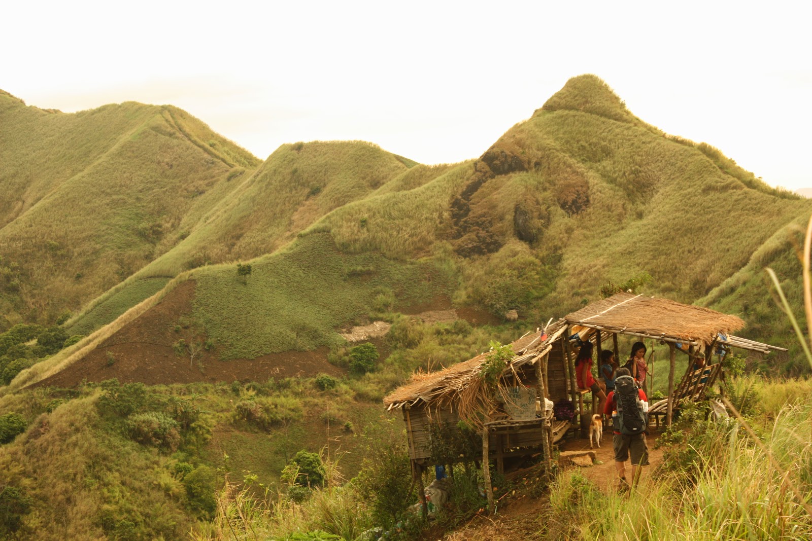
Mount Pulag Climb is actually a major climb. It is Level 3 and strenuous and it is dubbed as the “Roof of Luzon”. The entire mountain is located within the municipalities of Buguias, Kabayan and Bokod in Benguet; Tinoc in Ifugao and Kayapa in Nueva Vizcaya where it is characterized to have deep ravines, gorges and steep terrains. Mount Pulag has been a part of the folklore of the various mountain tribes for generations. It is believed to be the home of forest spirits who protect the ethnic tribes and assure bountiful harvests. Four of these tribes, actually, reside within the park --- Ibaloi, Kalanguya, Kankaney and Ibanag. These tribes consider Mount Pulag as a sacred place not only because it is the resting place and playground of their gods and goddesses but also they bury their dead. In fact, the Kabayan side of the park is frequented by visitors because of the mummy caves and burial grounds of natives residing at the foot of the mountain.

Then we passed thru shady area grown by pine trees which made our trek very relaxing.


While taking short rest of five minutes to regain our lost energy


With its uniqueness and majestic beauty, climbing this mountain is a feast for one’s senses. It is the home of the nation’s rare and endangered species of fauna including the cloud rat, cock’s pita, serpent eagle, Philippine deer, Philippine pig, and the Luzon mountain racket-tail parrot. It also has a collection of rare, endemic species of flora particularly the high altitude types like the dwarf bamboo and different kinds of pine trees, mosses and grasses. Its slopes are covered with pine trees and grassy meadows.

Everybody was excited to witness the unfolding beauty of the scenic Mount Pulag at sunrise. (Photo taken by Dada Macusi)


On the other hand, we had more than three hours trek leading to Camp 2 where we pitched our tents and have to stay for an overnight. Pitching tents and beyond was fun as we wander the beauty of the surroundings grown with a rich and rare variety of flora. Grinding cameras followed leaving us in extreme awe as we put our overwhelmed senses in great appreciation of what is in store for us. Our dinner and socials was quite freezing and we almost decided not to go out from our tents to have dinner. Food for dinner which was cooked and served by the organizer was superb, namely: menudo, tinolang manok, coleslaw and unlimited rice. We like the coleslaw of Kenneth for its taste can edge out the commercially prepared coleslaw of KFC outlets. Dinner was indeed great with great company and a great organizer’s cook whose intention is beyond customer satisfaction. Being surprised with such a set-up, we stayed longer for dinner to sip more hot soup of tinolang manok; savor the meat and vegetable mix of menudo and chew freshly prepared coleslaw with accompanying wine.

And lo and behold!!! as the moment of truth unfolded to our naked eyes, the sea of clouds!


Socials was held after dinner which lasted till 12 Midnight with a drinking spree coupled with the getting-to-know-each-otherconversational exchange. It has been a tradition that socials should be done with a moderate drinking party. Though, with the presence of the spirit of wine, our group was still manageable and wholesome discussing topics ranging from travels, mountain climbing, spelunking, work and career, hobbies, interests, sharing of insights with a little of green jokes ideal in mature conversational exchange. Green jokes are meant to inject humor to warm up our freezing adrenalin. The venue for the socials was just an open tent giving us a temporary roof to shield us from thick mists. The night then was freezing at 4 Degrees Centigrade, still moonless and the color of the night was completely pubic black. Most of us had chilled because of extremely cold temperature. Chilling has detonated the power of snoring to some of us and instead moaning as if extremely suffering from pain and illness became more evident.

Everybody was excited and a lot of climbers showed up looking for the best angle they can capture the scenery at its best.


Day 2 was the most awaited moment where we had our wake-up call at 3:30 A.M. Though, extremely cold, nobody has resisted to wake up out rightly for we have to trek for 1 ½ hours leading to the summit. Clad in thick and layered clothing with flashlights and headlamps, ungurgled mouth, unfixed hair and entire appearance, we trailed to the wilderness with the moon above us emitting not so bright light just enough to supplement our flashlights and headlamps. The stars were not as many as I normally see in the sky. Along the established trails were dwarf bamboo, mosses and grasses. Trekking at dawn was less exhausting since the air was crisp and the serenity of the environs adds up to the mysticism of the mountain. As we approached the summit, we noticed that sizable trekkers were coming from different directions highly expectant of what will unfold in the next few moments. Though still dark when we arrived in the summit, everybody was seemed to be very excited. Code of silence was evident and the clicking of cameras can be heard instead. There was an Austrian family who stayed in the summit equipped with only sleeping bags but the rest of the climbing enthusiasts were 95% Filipinos. The crowd at the summit can be roughly estimated at almost 500.

mountain slopes and clouds blended into one majestic scenery


Gradually, the silhouette of the sun appeared until the sunrise gave a glow of golden hue of yellow and its color variances. The view was absolutely majestic --- as if the sky looked like God’s palette, as He was about to finish painting the dawn into a bright morning. Clouds besieged the lower part of the summit particularly the ridges near its saddle giving such a magnificent scenery somewhat a sea of clouds. There was a 360 degrees panoramic view. We felt victorious having felt we conquered the summit of the THIRD highest peak of the Philippines at 2,922 meters above sea level or 9,610 feet above sea level. As per record, the first two highest mountains are in Mindanao which are both inactive volcanoes with Mount Apo in Davao as the highest peak at 2,954 meters or 9,692 feet and followed by Mount Dulang-Dulang at 2,938 meters or 9,637 feet located in Kitanglad Range. Our eyes have feasted with the magnificent beauty around us. Everybody was occupied grinding their cameras. We were like in heaven with the heavenly clouds within our horizon and the serenity of the place adds up to our golden moment savoring every minute of our stay in the summit. IT WAS SUCH A PERFECT MOMENT! We felt so close to Our Almighty Creator.

This shows God's glory as a Mighty Creator!!!!


This photo was taken by Mr. Vincent Ray Endonilla


Finally, we have to let go of this moment and decided to descend going back to Camp 2 where we pitched our tents. A sumptuous breakfast awaited us, namely: Spam, Corned Beef, Dilis, Scrambled egg, Hotdog, Coffee, Hot Chocolate and unlimited fried rice. Breakfast was Service De Luxe considering that we were up in the highlands of Mount Pulag. We had our break camp at 9:00 A.M. Trekking started then at 10:00 A.M. and arrived in Ranger’s Camp at 1:18 P.M. where we had our late lunch there. We left the Ranger’s Camp at 2:20 P.M. and travelled back to Baguio City in a jeepney though we had a stopover in the DENR Protected Area Office/Visitors Center. Finally, we arrived in Baguio City at 7:24 P.M. We had our dinner in SM Baguio and left Baguio City at 10:40 P.M. boarding an airconditioned Victory Liner Bus No. 46.

Our group returned to our campsite for our breakfast and break camp later


Part of the our side trip where we stopped along the highway still a part of Benguet


Still at the hanging bridge


As we summed up, this great experience in Mount Pulag, we can say, that this became all possible with the mighty hands of the organizer who cradled us for utmost convenience. It was so well organized that not even one untoward incident was encountered by us. The organizers, indeed, has TOUCHED OUR LIVES. It was like having a home away from home that made this climbing so comfortable and convenient. Somewhat like a FAMILY in the midst of chilling environs. We just love it. To commend for this, our main organizers are: Mr. Kenneth C. Taguilaso who can be contacted in his mobile phone at 0917666000 or email address at kennethtaguilaso@yahoo.comand his brother, Peter Glenn C. Taguilaso with mobile number at 09163571131 and email address at busingot_89@yahoo.com. Along with the organizers were the core group members who were as accommodating as the aforementioned, namely: Glenn Glindro, Apple Bucayo, Mark Stephen Endonilla and Vincent Ray Endonilla. TRY TO AVAIL OF THEIR PACKAGE AND THE REST WILL BE HISTORY!!!!

MOUNT APO CLIMB

MOUNT APO
Location: Kidapawan, Northern Cotabato, Philippines
Entry point: Brgy. Ilomavis, Kidapawan City
Exit point: Brgy. Ilomavis, Kidapawan City
Coordinates: 7°0'30"N, 125°16'33"E
Elevation: 2956 MASL (9,698 feet)
Days required / Hours to summit:4 days / 12 hours
Specs: Major climb, Difficulty 7/9, Trail Class 3
Descriptive Summary: Mount Apo is unique for the charm of Lake Venado that it contributes to the mountain which is in an elevation of 2,280 MASL. According to my guide, our group has trailed through Mandarangan. The climb could have been shortened but our group opted to have overnight in Lake Venado on the first day; overnight on the summit - second day; overnight again in Lake Venado - third day; and fourth day was the descent to the jump-off point.

View Mt Apo in a larger map


Just one of the few river crossing we had in the Marble River


This climb was a long time dream for me considering that Mount Apo is the highest peak of the Philippines where we scaled through Mandarangan Trail where its jump-off point is more than an hour drive from Kidapawan City. We started the trek at 9:16 A.M. at Day 1. The picture above was taken when we were having our river tubing along Marble River which is still a part of Day 1.

Crossing bamboo bridge no. 5


Crossing bamboo bridge no. 6


Along the trail, we crossed a total of 6 wooden/bamboo bridges, trekked through a Sayote plantation and we regrouped in Junction-Matiaw Campsite at 11:11 A.M. We had our lunch near Ko-ong Creek at 12:04 Noon. We happened to have an ample rest in the century-old Almasiga Tree at 12:58 Noon. After that, heavy rains followed and we were soaked in water with our shoes being heard squelching as we managed to trek in a muddy and sticky trail. We arrived in Ko-ong Emergency Campsite at 2:38 P.M. The rain had stopped as we continue our trek though this time the trail was giving us an extreme difficulty as it was so stiff and made us strove with exhausting cardiac assaults.

Lake Venado at 5:00 P.M. A lake at 2,280 MASL.


Finally, we arrived in the scenic Lake Venado at 4:54 P.M. where we stayed overnight. Lake Venado is an endorheic lake located at the foot of Mount Apo in the province of North Cotabato, Mindanao, Philippines. It is the highest lake in the country, found in coordinates 7°00′8″N 125°16′10″E, with an estimated surface elevation of 7,200 feet (2,194 meters above sea level). The lake is feed by local run-off and there is no outflow from the lake. The lake usually loses two-thirds of its size during dry months due to evaporation.

The name of the lake comes from the Spanish word "venado", which means "deer," owing to the deer-like shape of the lake. However, the local people living in the area called the lake "linaw", a Cebuano term for "clear", because the water of the lake is crystal-clear reflecting the peak of Mount Apo. The lake is believed to be enchanted by spirits living in the lake, according to the local tribes people.

Lake Venado at 5:00 A.M.


Day 2 was more exciting as Lake Venado early in the morning offers such a magnificent scenery with the kind of reflection of its crystal clear waters. Then after breakfast, we ascended to the summit starting 9:32 A.M. and reached the summit at 1:48 P.M. based on my personal record. For me, it was an achievement, to reach the summit of the Philippines’ highest peak of Mount Apo at a record of 2,954 meters or 9,692 feet. The trail was even stiffer and exhausting where I needed much rest for every 20 steps I made ascending.

The rocky summit grown with wild berries and cogon


The summit campsite was spacious where our big group pitched our tents. It was so rewarding to stay for an overnight in the summit campsite as we had the chance to experience the glory of being on top of the Philippines. I was so amazed picking and eating wild berries growing abundantly near the summit campsite.

Sunrise at Davao Side Peak of Mount Apo


The sulfuric vent or fumarole at Mount Apo's summit captured on a  sunrise


Mount Apo's Peak at Davao Side


Mount Apo's Peak at Kidapawan's side


Day 3 was even more rewarding as we woke up as early as 5:00 A.M. to witness the sunrise at Peak 5 (Davao side) overlooking the Dead Lake and the crater. We stayed longer there and after an hour or two, we went back to the campsite to take our breakfast. Together with my porter Argie Amad and Sandawa-Apo Members: Arvin Languido, Jet Fritch Norbe and Renan Rebosura, we scaled Peaks 1 and 2 (Kidapawan side); Peak 3 (Magpet side) and Peak 6 (Davao-Calinan-Tamayong side). We failed to scale the other two peaks, namely: Peak 4 (Makilala side) and Peak 7 (Digos-Bansalan side). After the breakfast, we started to descend from the summit at 9:55 A.M. and reached Lake Venado at 11:21 A.M. as per my personal record. The scenery from the summit overlooking Lake Venado was superb and magnificent.

Still a part of Mount Apo's Peak at Davao-Calinan-Tamayong side


Scenery from Peak 7 in Digos-Bansalan side


Taken passed midpoint from the summit on our way to Lake Venado


Overlooking Lake Venado while our group was descending from the summit


During Day 4, we had an ample time along Lake Venado. We were not in a hurry then. We just enjoyed the cool experience of being there. We started the ascent from Lake Venado at 8:56 A.M. trekking through Mainit Trail and reached the Marble River at 10:18 A.M. for a river trekking. We reached the Junction-Matiaw Campsite at 12:14 Noon just timely for our lunch. We reached the jump-off point at 2:04 P.M. and proceed to Lake Agco for a refreshing swim on its hot spring.

Below is the suggested Itinerary for this trail:

Day 1

07:30 A.M. Take van from Kidapawan City to Brgy. Ilomavis
09:00 A.M. ETA Brgy. Ilomavis
09:30 A.M. Start trek
01:00 P.M. ETA Mainit Hot Springs
05:00 P.M. ETA Lake Venado; set-up camp
07:00 P.M. Dinner and social onwards

Day 2

05:00 A.M. Wake-up call
06:30 A.M. Breakfast
07:30 A.M. Start summit assault.
10:30 A.M. ETA summit of Mt. Apo
11:00 A.M. Set-up camp and lunch preparation
12:00 NN Lunch
01:00 P.M. Start of siesta time
05:30 P.M. Dinne preparation
07:00 P.M. Dinner and social onwards

Day 3

04:30 A.M. Wake-up call
05:00 A.M. Sunrise at Mount Apo's crater
06:30 A.M. Start of peaks hopping
08:00 A.M. Breakfast/Break camp
09:00 A.M. Start descent to Lake Venado
11:30 A.M. ETA Lake Venado/Set-up camp
12:00 NN Lunch Preparation
01:00 P.M. Lunch
02:00 P.M. Start of siesta time
05:30 P.M. Dinner preparation
07:00 P.M. Dinner/socials

Day 4

05:00 A.M. Wake-up call
05:30 A.M. Breakfast preparation
06:30 A.M. Breakfast
07:30 A.M. Break camp
08:00 A.M. Start descent to Brgy. Ilomavis
12:00 NN Lunch on trail
03:30 P.M. ETA Lake Agco Hot Spring Resort
05:00 P.M. ETD Lake Agco Resort
06:00 P.M. ETA Kidapawan City

You may also like reading a related climb by an iconic and professional climber Gideon. Click here to view his blog.

ENCHANTED RIVER

ENCHANTED RIVER

Location: Barangay Cambatong, Municipality of Hinatuan, Surigao del Sur

Blogger Note: The Hinatuan River is a river on the island of Mindanao in the Philippines. It flows into the Pacific Ocean at Hinatuan, Surigao del Sur. The River is also referred to as the "Enchanted River" by many locals and tourists. The place identified by tourists as "Enchanted River" is 87-meter deep. (Source: Wikipedia) Its deepest point is in Jonathan's Joint at 87 meters while its largest chamber named Mayor's Chamber is at 52 meters. Beyond these points are already unknown and unexplored. The Doc's Door which is an entry point to the Mayor's Chamber is at 42 meters.

View Enchanted


The name Enchanted River is very much fitted to this enchanting river where it is located in Brgy. Talisay, Municipality of Hinatuan, Surigao del Sur. Indeed, Surigao del Sur has gems of tourist spots unparalleled in beauty and splendor.


Visiting this place is such a long travel where I came from my vacation base in Cagayan de Oro City which is 8 hours bus travel going to Butuan City and another four hours from Butuan City to Hinatuan town (Surigao del Sur). I stayed overnight in Hinatuan since I arrived there at 1am.


The following day, I rented a habal-habal for P200 where I was just the lone passenger going to Brgy. Cambatong, a kilometer ahead of Enchanted River. The road from Hinatuan going to Cambatong is not cemented though it is not that rough. However, during rainy season, the road is sticky due to its abundance with clay. The transportation going there is only habal-habal but with local arrangement for groups, one can get a van at an affordable price.


The picture above is not one of my taken photos but it has captured the other side of river that is why I grabbed it from a Facebook Account with a link at Enchanted River: The Hidden Paradise!


Having a swim in this river is really a different experience with the crystal clear water where you can have an alternative from the shallow part to the deep portion where fish of different variety come out during feeding. Feeding is done twice in a day and the one I witnessed was at 3:00 P.M. Fish of unidentified species and genus can be seen during feeding with sizes varying from small to big. Multiple divers have reached the bottom. The river is estimated to be 24 meters (81 feet) deep.


There is an entrance fee which they call park’s fee of P30 but the enjoyment one may get is priceless. The park itself has been developed to have more attractions and cottages are available. Guests can prepare barbecue and cook some food stuff. Stores are also available selling basic commodities ideal for picnic and outdoor partying.

An illustrative depthness of Enchanted River from the link Enchanted River: The Hidden Paradise!


HOW TO GET THERE:

Butuan City or Bislig City can be reached by air or sea travel from Manila or Cebu via Cagayan de Oro City or Butuan City. Commercial buses or vans for hire are available, around 4 hours from Butuan City and 6 hours from Davao City. Within Mangagoy go to integrated bus terminal and look for a jeepney that will bring you to Hinatuan Enchanted River.

Saturday, July 6, 2013

MOUNT GUITING-GUITING TRAVERSE CLIMB


MT. GUITING-GUITING
Location: Sibuyan Island, Romblon, Philippines
Entry point: Sitio Olango, San Fernando, Sibuyan Island
Exit point: Brgy. Tampayan, Madgiwang, Sibuyan Island
Coordinates: 12°24'50"N, 122°34'4"E
Elevation:2058 MASL (6,751 feet)
Days required / Hours to summit:3 days / 18 hours
Specs: Major climb, Difficulty 10/9 (until 12/2009)
Trail: Class 6
Blogger Note: The most death-defying, difficult and challenging climb ever but still he wanted to climb it again for five days to stretch the time to make it more lighter avoiding the freezing night trek towards the summit

View Mt Guiting-Guiting in a larger map


The seventh picture of this post has been featured in Hiking Feed as one of the eight most scenic trails in the Philippines.

The last two major assaults before reaching the summit


I consider this climb as a climb of the decade – a major one at 2,058 MASL or 6,751 feet above sea level. The actual climb is dated November 2-3, 2012. In terms of difficulty, this surpassed all my climbs ever. I had first scaled this mountain on October 31 – November 2, 1999 in a traditional trail with PNB Mountaineering Club. This time, I was with Sir Dennis Hisanan (with CP No. 09334881403) , the organizer, along with his girlfriend, Matel Rivera; Ced de Guzman together with our guide (Remy Robiso with CP No. 09217322462) and porter (Junior Rollon). It became too exhausting since instead of having it for three days, it was compressed for only two days. The trip was long and exhausting but I had the opportunity to see the three islands of Romblon consisting of Tablas, Romblon and Sibuyan.

The breathtaking Peak of Deception


The actual travel/scaling time was documented as follows:

First Day

01:50 P.M. Left Buendia LRT Station (Pasay) boarding JAM Bus Transit
04:36 P.M. Arrived Batangas Port
06:05 P.M. Left Batangas Port boarding Reina del Rosario Ferry Boat

Second Day

04:20 A.M. Arrived Odiongan Port of Tablas Island, Rombon
04:50 A.M. Left Odiongan Port boarding a mini-bus heading to San Agustin Port
06:45 A.M. Arrived in San Agustin Port (Tablas Island)
08:35 A.M. Left San Agustin Port boarding a big boat (Damgel)
09:50 A.M. Arrived Romblon Port (Romblon Island)
10:00 A.M. Left Romblon Port boarding a big boat
12:00 Noon Arrived Ambulong Port of Magdiwang in Sibuyan Island
01:10 P.M. Left Ambulong Port boarding a chartered tricycle
02:30 P.M. Arrived at Tatay Remy Robiso’s house in Sitio Olango
03:50 P.M. Courtesy call with Mayor Dindo Rios in his residence in San Fernando
04:40 P.M. Food marketing in San Fernando market
06:30 P.M. Dinner
07:30 P.M. Rest Overnight at Tatay Remy Robiso’s residence

Third Day

02:30 A.M. Wake-up Call
02:45 A.M. Breakfast
03:30 A.M. Start Trekking
04:15 A.M. First water source (river)
06:40 A.M. Camp 1
08:00 A.M. Bobit’s Peak
09:45 A.M. Camp 2
10:30 A.M. Helipad Clearing
11:30 A.M. Camp 3 (Lunch)
12:24 Noon Crash Site
02:30 P.M. Trina’s Spring
04:10 P.M. Remvaldely’s Peak
06:20 P.M. Summit
06:30 P.M. Pitch tent in Summit’s Campsite
07:30 P.M. Dinner
08:00 P.M. Rest Overnight (RON)

Fourth Day

05:00 A.M. Wake-up Call
06:00 A.M. Breakfast
07:20 A.M. Summit for pictorials
07:45 A.M. Start Descent from Summit
09:27 A.M. Peak of Deception
10:37 A.M. Mabel’s Spring
11:10 A.M. Face the Wall Crossing
01:05 P.M. Start scaling the Knife Edge
02:50 P.M. Mayo’s Peak (Lunch)
03:35 P.M. Camp 3
04:00 P.M. Bulod’s Spring
06:05 P.M. Camp 2
07:20 P.M. Camp 1
08:15 P.M. First River Crossing
08:25 P.M. Second River Crossing
09:40 P.M. DENR Office
10:35 P.M. Magdiwang Beach House
11:00 P.M. Dinner
12:10 MN RON

Fifth Day


05:00 A.M. Wake-up Call
05:30 A.M. Beach Walk
07:20 A.M. Breakfast
08:40 A.M. Beach House Check-out
10:35 A.M. Left Ambulao Port in Magdiwang boarding Maria Querubin Ferry
12:45 NN Arrived Romblon Port and transferred to Maria Zenia Ferry
03:00 P.M. Left Romblon Port boarding Maria Zenia Ferry
11:30 P.M. Arrived Batangas City Port 11:50 P.M. Left Batangas City Port boarding bus for Manila

Taken from the Remvaldely’s Peak


Mount Guiting-Guiting was declared as Natural Park and is situated between the boundaries of the three municipalities of Sibuyan Island, namely: Cajidiocan, Magdiwang and San Fernando. Its name was drawn from the shape that is formed from its peak which is consist of granite stones that look like the teeth of a saw. For locals, the mountain is a legend, a mystery, a sacred place and to some natives a taboo mountain. Old folks usually associate the mountain as the sighting area of the “Golden Ark” – a bad omen which brings disaster and bad weather. Testimony of survivors of sea tragedy – ships, & boats, say that just before the “tragedy” happen, they saw the mountain in a “golden glow” as if like an X-Files episode.

Descending the death-defying heights from the Peak of Deception


From right to left: Summit, Peak of Deception and Mayo's Peak


While resting at a certain part of Knife Edge


For the academe, Mt. Guiting-Guiting is a prized sight of research teams. The more popular teams that studied the area were the Smithsonian Institute, Columbia University and the National Geographic Society. It’s an interesting research site because it is the home of various endemic wildlife, fauna and flora aside from being a Natural Park not just a National Park. The mountain is the home of the Philippine Fox, the smallest rat in the word and various instinct rats and birds.

For the true-blooded mountaineers, the mountain was rated among the top 3 among the popular mountains because of the degree of difficulty in scaling it and the other two are Mt. Halcon (2,587 meters or 8,488 feet) and Mt. Mayon. But unanimously rated as the most thrilling mountain to scale because of the feeling of mystery entwined with fear. Personally, successfully climbing this mountain is an event and more than an achievement. Climbers are advised to have doses of medication one week before and after the climb since this mountain is continuously on the red of malaria alert.

A wide angle shot taken while descending the Peak of Deception


As per record, it has taken a death toll of four and reportedly injured a number of careless climbers. On the other hand, descending the summit was even terrifying, death defying and an energy exhausting activity. We were scaling very stiff sandstone ridges for a number of hours and I somehow felt very close to seeing our Creator in every move I made. For us then, gravity was not the only enemy we have been facing with. But rather, we dealt with the climb mentally to stifle our inner demons of fear, to formulate and adopt a strategy in the face of fatigue and self-doubt. It was a day-long mental battle to survive the risk we have been into. And so, conquering the mountain’s summit was really a mental challenge which I somewhat experienced euphoria at the top that can be described as primal satisfaction.

The glory of moments after sunrise at the summit


Fear of heights of the narrow ridges particularly in the Knife Edge and cliffs at a backdrop of more than 6,000 feet, too much fatigue slowed down my motion and forced us to have a night trek again for the second day just to reach the jump off point. Furthermore, scaling this time the traverse trail even made more challenging from the very start of Camp 1, to Camp 2, Camp 3 and the Remvaldely Peak which are all packaged in an endless cardiac assaults.

TINUY-AN WATER FALLS

A distant picture of the first level of Tinuy-an Water Falls


It was so rewarding to visit this majestic Tinuy-an Water Falls which is situated in the forest of Borboanan in the outskirts of Bislig City of the province of Surigao del Sur. This falls is approximately 95 meters wide and 55 meters high and is dubbed as the “The Little Niagara Falls” of the Philippines. Tinuy-an is one of the most visited tourist spots in Caraga region being known for its wondrous white water that curtains and flows in three different levels and is said to be one of the widest waterfalls in the country.

The second level of the water falls


From the town of Mangagoy, this can be reached through a chartered habal-habal, as the locals call a single motor bike for P250 round trip. The driver can wait for you while you are enjoying the place and it all depends if you will give additional payment. After all, they have no fixed rates for this kind of transaction as long as you provide them the food. If you are in big group, you can charter van at affordable price. You can ask some assistance from your lodging house owner. Accredited local guides are also available within the area where charging will depend on your kindness. They can take you pictures and accompany you till to the third level of the falls. If you want to ride in the raft, you will be charged for P100 per head and the environment fee is only at P20. To minimize my accommodation expenses, I stayed overnight in Saint Francis Lodging House at P100 per night in Mangagoy proper. This is my second time to be in this town.

Taken upon arrival from the main entrance


The place itself pride giant and centuries-old, mossy trees and varieties of green ferns and brown vines which enclose the water falls. This is a superb treat for bird watching enthusiasts and nature photographers. Since the falls is multi-layered, there are three natural swimming pools to swim around. The paths to these pools have already been established and getting there is never a problem at all.

A photo shot taken midpoint from the main entrance


Bislig City can be reached by air or sea travel from Manila via Davao City or Butuan City or Surigao City. The easiest way to get to Bislig City is to take the direct flight from Cebu City during Mondays and Thursdays (Yes, a commercial airline is currently offering this service). Commercial buses or vans for hire are available: 3 to 4 hours from Butuan City or 5 to 6 hours from Davao City. When in Mangagoy, head over to the Integrated Terminal and rent a jeep or van which will take you directly to Tinuy-an Falls. While I personally reach this water falls coming from Cagayan de Oro City which is 8 hours away from Butuan City.

Another shot taken on the second level of the falls


HOW TO GET THERE

BY AIR

You have the option to book with major airlines with direct daily flights from either (1) Manila to Surigao City, (2) Manila to Butuan City of Agusan del Norte or (3) Davao City. One can also have a flight from Cebu to Surigao City.

BY SEA

Inter-island vessels like the Super-ferry and Sulpicio Lines serves the Manila-Butuan or Cebu Butuan routes on regular schedules with Nasipit Port as transit point. Aircon vans are available at the port area or take a jeepney to the city terminal for the regular bus trips going to Mangagoy in Bislig City.

BY LAND

From Butuan City. Ride in a bus (non-aircon) bound to Mangagoy (Bislig City)- 5-hour travel. In Mangagoy, go to the tricycle/habal-habal terminal in the market – there you can hire a habal-habal for P250 to P350 (depending on your haggling skills) - back and forth including waiting time. Travel time is less than 1 hour.

You can also ride in an air-con bus bound to Davao City- that’s 2-hour travel, get-off at San Francisco terminal and transfer to non-air-con bus or van bound to Mangagoy. Then follow instructions above.

For group tour (minimum of 5-6 pax) better to hire an air-conditioned van from Butuan City as the cost is quite close or much cheaper, less time consuming/tiring.

From Surigao City. Ride in a bus/van bound to Butuan City- 3-hour travel. At Butuan City Bus Terminal, ride in a bus bound to Mangagoy (Bislig City). Then follow instructions above.

You may also ride in an AC or non-AC Bus in Surigao bus terminal bound to Davao City then get-off in San Francisco. Then follow instructions above.

From Davao City. There are non air-conditioned buses in Davao Ecoland Terminal directly bound to Mangagoy in Bislig City. Travel time is more or less 6 hours. Another option is you can ride in an air-con bus going to Butuan City, get-off at San Francisco Terminal and ride in a bus or van going to Mangagoy. Then follow instructions above.

Thursday, May 19, 2011

REVISITING MOUNT BATULAO

Location: Nasugbu, Batangas, Philippines
Jump-off: KC Hillcrest Hotel and Golf Course (formerly Evercrest)
Coordinates: 14.0408 N 120.8011 E
Elevation: 811 MASL (2,660.24 feet)
Days required / Hours to summit:1 day / 2-4 hours
Specs: Minor climb, Difficulty 4/9, Trail Class 3 with 60 - 70 degrees assault
Last Update: June 21, 2014

Descriptive Summary: The most accessible and nearest mountain from Manila with such a breathtaking scenery. It is equally popular for day hike/workout climb and overnight climb. Its proximity to Tagaytay City gives it a cool weather but most importantly, a "bulalo" treat in Tagaytay City aftr climbing it which makes it more rewarding.

View Mount Batulao in a larger map


The scenic Mount Batulao at night


Mount Batulao is the most closest to my heart when it comes to climbing mountain. It is like a friend that I can talk to whenever I want to unwind. I highly recommend it to friends and beginning climbers as well as here you can experience nature at its best most especially if you stay overnight. Camp 1 in the Old Trail is really ideal for overnight camping since there is a water source. In this camp, too, you can buy a supply of water for P10 per pail in case, summer dries up the nearby water source.

A halo-halo and buco stop to quench the thirst


One of the perks in scaling Mount Batulao is the fact that it has a lot of halo-halo and buco stops at P15 per serving and fresh buco at the same price. In addition to that, day climbers who find preparing food difficult for the climb can have their meals in the eateries near the KC Hillcrest either for dine-in for take out at the most of P45 per meal. This same place also offers shower for P10 per head.

An overnight in Camp 1 of the Old trail


Camping overnight in Batulao is such a rewarding experiencing for it makes you closer to mother nature and one of it is stargazing at night. In this specific climb, I was in company with Atty. Gilbert Gordove, soon-to-be-lawyer Isagani Dionela and sweetheart Carmila Uy, Rizaly Dionela and her younger sister.

Full moon as viewed from Camp 1 of Old Trail


Personally, I find Old trail the best to offer scenery and for staying overnight. It has around 9 campsite, as far as I can recall in different elevation up to the point where it is almost near to the summit.

Another scenic nightscape in Mount Batulao


Mornings are really that good in Mount Batulao as you see the dramatic landscape of the mountain. A lot of campers stay overnight and by the time we were there, I happened to see two young couples with siblings ranging from two to four years old. The kids really enjoyed the climb.

This stretch of connecting hills is a part of New Trail


Indeed, this climb is not expensive as you will only spend P110 one way from BSC Bus terminal near EDSA MRT Station going to KC Hillcrest in Batulao or for P220 round trip. From the KC Hillcrest, you may opt to take tricycle for P25 per head for one way or P50 round trip. There is registration of P20 in the Old Trail and another P20 in the New Trail. It is better to climb from Old trail to New trail than the other way around.

You may take a guide who are usually young kids so that you can help them earn for their school allowance. There is really no need to take a guide because the trails are quite defined but if you want to help these kids, then you may take one.

Photos courtesy of Rizaly Dionela who happened to be a part of my group in spending an overnight in this very majestic mountain.