Sunday, October 13, 2013

SIARGAO ESCAPADE

Location: Municipalities of Dapa and General Luna
Province: Surigao del Norte, Philippines
Coordinates: 9°52′N 126°03′E Total No. of Islands: 48
Municipalities: Dapa (Island’s capital), General Luna, Pilar, Del Carmen, San Isidro, San Benito, Santa Monica and Burgos while Buscas Island has the lone municipality of Socorro
Land Area: The combined total land area of Siargao and Buscas Grande Islands is 62,796 hectares

Siargo is known for being the Surfing Capital of the Philippines where it hosts annually domestic and international surfing competition sponsored by the provincial government of Surigao del Norte.


View Siargao Island in a larger map


Trying to learn surfing at Cloud 9


Siargao Island is a much publicized destination compared to Surigao del Norte, the province where it belongs. And this fact has stirred more my excitement to visit the place. My curiosity lies with the question of what really the island has to make it a highly must-see destination.

Teresita Sea Star Express boat which I boarded from Socorro port of Bucas Island coming from Sohoton National Ecopark at 1:00 P.M. and arrived in the Port of Dapa at 2:15 P.M


Mangrove forest reserves while approaching the port of Dapa


Siargao Island contains the largest mangrove forest reserves in Mindanao, at Del Carmen. Long stretches of wetlands indicate a potential for commercial seaweed propagation. Siargao Island is greatly influenced by the winds and currents coming uninterrupted from the Pacific Ocean, intensified by the Mindanao current running westward through the Siargao Strait.

This is habal-habal, the only alternative transport if a tourist has no chartered car


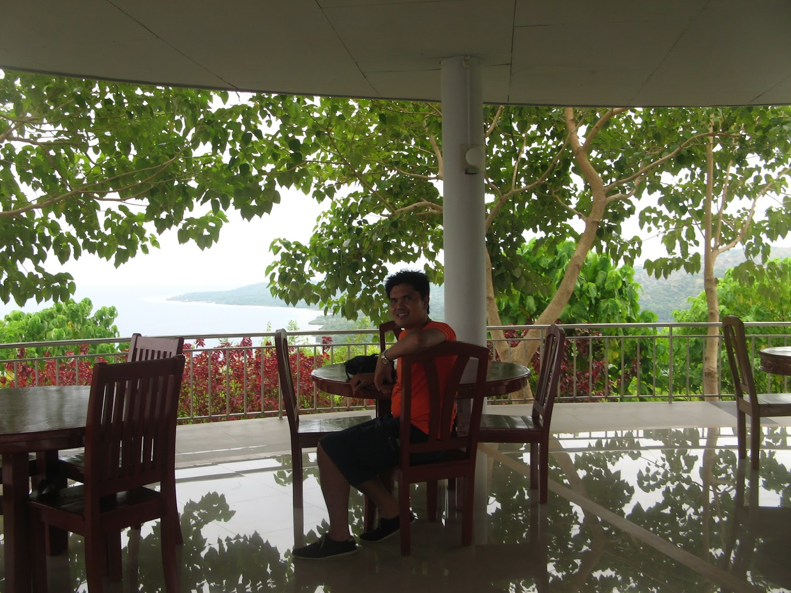
Arriving in Dapa, our group decided to check in at MEM's Pension House – a clean, modern and the best accommodation in Dapa. Since it was still early, we contracted a habal-habal to travel to General Luna - the municipality where the famous Cloud 9 Surfing area is located.

Cloud 9 Entrance


Curious of what surfing can offer, we hired a local boy to train us with surfing, a young, tall but slim teener who charged us with P500 for an hour. it was really exciting but I was hesitant to have it seriously as I have ear infection.

The long boardwalk leading to the surfing site


It was refreshing to walk along the boardwalk in one pleasant and windy afternoon. There were few surfers around which include the local surf trainors and some surfing enthusiasts both Filipinos and foreigners.

Surfers in action


An Australian national (left) just about to start his surfing routine


The waves of Siargo are noted to have combined the best quality features of the top-rated waves of Hawaii’s fabled “pipeline” and the top-billed waves of Indonesia. Its huge, powerful rollers have been ranked the top five breaks in the world, including the “Cloud Nine” which is considered as one of the world’s top surfing waves.

As they said, September to October the best months for surfing in Siargao where waves are like that of Hawaii’s best surfing waves.

One real picture of surfing


Done with our 3-hour surfing training at Cloud 9 of Barangay Catangnan of General Luna, we headed to Poblacion of General Luna along their refreshing Boulevard where its inviting boardwalk enticed us to have an afternoon walk.

The scenic boardwalk along the Boulevard as they call it in General Luna town proper of Poblacion


Along the Boulevard, is a row of Grill and Restaurants where guests can have their fresh seafood cooked bought from wet market in a very minimal charge of P30 in our part where we had four kilos of tuna and two kilos of blue marlin grilled and sinigang-cooked for just the four of us including our habal-habal driver.

Trees lined along the Boulevard giving more beauty to the beach scape and blue skies


It was not really boring to wait for our food cooked since the amazing scenery around was quite rewarding. We had chance to chat with some Filipino and foreign tourists. We learned that two of those who were drinking next to our table were Australians who opted to reside in the Siargao after they retired from their public post in their country.

The picturesque Guyam scenery as seen from the Grill house where we had our sumptuous dinner


Morning scenery while on board with a ferry for Surigao City


After dinner, the three of us, boarded again in the same habal-habal going back to Dapa where it took us 35-minute drive along concrete roads early evening at around 7pm. While on board the vehicle, I smelled the countryside from the vast riceland and rolling hills we passed by. We rested in our accommodation at MEM's Pension House for an overnight and left for Surigao City early in the morning the following day.

HOW TO GET THERE

BY AIR: Airphilippines flies daily from Surigao to Manila and vice-versa, and Surigao to Cebu and vice-versa every Monday, Wednesday, Friday and Sunday. Cebu Pacific likewise flies every Tuesday, Thursday and Saturday from Surigao to Cebu and vice-versa. Cebu Pacific flies every Monday and Friday at 10:40 A.M. from Cebu and returning from Siargao (Sayak Airport) at 11:50 A.M. and vice versa.

BY LAND: Buses from Pasay City have trips going to Surigao several times a week via Lipata Ferry Terminal. Daily bus trips from Surigao City to Butuan, Cagayan de Oro City or Davao City are also available at regular intervals only up to Surigao City. Roro and ferry are available for Surigao City – Siargao Tirp.

BY SEA: Passenger boats direct from Manila and Cebu City are also available daily. And from Surigao City, passenger boats and Roro are available daily at 6:00 A.M. and 12:00 Noon via PPA Port for Roro at Boulevard Port.

CONTACTS

Provincial Governor’s Office
Provincial Capitol, Surigao City
Tel. Nos. (086) 826-7778 Telefax (086) 826-0462

Provincial Tourism and Cultural Office
Provincial Capitol, Surigao City
Tel. Nos. (086) 232-6962 local 410; +639088963975
Email address: surigaodelnortetourism@yahoo.com
Website: www.surigaodelnorteph.com

Monday, September 23, 2013

SAN RAFAEL FARM (BABATNGON, LEYTE)

Location: Brgy. Pagsulhugon of Babatngon, Leyte, Philippines
Nearest Airport: Tacloban Airport

Blogger's Note: Google has not yet included a locator map for San Rafael Farm. Hence, this post has no Google map to show.

It’s worth to visit San Rafael Farm as you will be fascinated by its marvelously designed landscape. At one glance, one might think, it is a natural landscape but as you stroll around the place, you will discover it is purely man-made and you will admire the one who conceptualized its amazing landscaping. Located in Brgy. Pagsulhugon of Babatngon, Leyte which is 25-minute drive from downtown Tacloban, this place is perfect for meditation or even for social functions like wedding, baptism and birthday occasions.

The man-made lagoon


I came to know the place when I read the blog of Journeying James . By then, I obliged myself to include it as part of my trip itinerary when I attended the wedding of my colleague in Ormoc City. I have been to Tacloban City for a number of times since I am from the province of Samar but I have no idea that such a place like this exist. Thanks to James.

The scenery from inside the restaurant


Fortunately, a high school friend of mine resides in Tacloban City and so we planned together on how to squeeze my trip schedule so that I can include San Rafael Farm in my trip along with my Kalanggaman Island escapade.

The pavillion where the restaurant is housed


Together with another high school friend, we visited this San Rafael Farm and they treated me with a sumptuous lunch there. As far as I can recall, there is an array of choices for any refreshment or meal one may choose like the kilawing tanigue, farmer’s salad, herb-roasted chicken, string potatoes, turon (ripe banana saba), baked scallops with butter and garlic, baby- back ribs, green rice, lemon grass tea, carrots and corn side dish, buko gelatin, big servings of halo-halo, house-brewed iced tea. I tried the Kilawing Tanigue, herb-roasted chicken, green rice with carrots and corn side dish. The big serving of halo-halo was more than enough for me to seal my stomach to its maximum limit.

Trees provide shades leading to the man-made lagoon


While dining on its main building which is a restaurant, I was amazed with the interior designing made inside it where intricate pieces of antiques creates an ambiance of serenity and somewhat I was travelling in a time machine meeting up the characters in the era of Spanish colonizers of the Philippines where Ibarra could possibly been also there. Outside the restaurant is an infinity pond inhabited by a number of Japanese koi.

Garden stations and nipa huts are covered with vines


Going further outside, I enjoyed the garden stations almost covered with vines. There is a tree house which seems so magical and it was so cool enjoying the soothing cool breeze from trees around. The tree house can serve as a view deck to see in totality the man-made lagoon where a boating is available. One can do rowing moat. A moat is a deep, broad ditch, either dry or filled with water, that surrounds a castle, other building or town, historically to provide it with a preliminary line of defence during the Medieval era in Europe. In some places moats evolved into more extensive water defences, including natural or artificial lakes, dams and sluices. In later periods the moat or water defences may be largely ornamental.

Boating in the man-made lagoon


The refreshing and magical tree house


Just to give you an idea, you can have a drive of 30 minutes going to San Juanico Bridge or visit the historical Leyte Landing Park in Palo, Leyte.

Wednesday, September 11, 2013

KALANGGAMAN ISLAND

Location: Palompon, Leyte, Philippines
Nearest Airport: Ormoc Airport
Next Nearest Airport: Tacloban Airport

Blogger's Note: Google has not yet included a locator map for Kalanggaman Island. Hence, this post has no Google map to show.

I visited this tourist spot when I attended a wedding in Ormoc City of my colleague in Manila though prior to that I also toured around Tacloban City as well as in San Rafael Farm in Babatngon, Leyte.

The long stretch of sandbar in one side of the island


Kalanggaman Island is a virgin island which can closely rival the fine beaches in some other parts of the country. It is considered to be a pride of the province of Leyte in the municipality of Palompon for being a photographer’s delight. Its shape with stretch of sandbars on both sides makes it unique. The good thing is, the island is not highly commercialized yet and so it is not crowded though it has already structures like huts, kiosk, grilling stations, simple volleyball court, concrete comfort and bath rooms and wooden tables and benches where guests can relax and unwind enjoying the island’s cool breeze. Before settling on the island, food marketing including the drinking water can be done in Palompon from its public market and grocery stores. This island is maintained and operated by the local government of the municipality of Palompon.

The mode of transportation to and from the island


From the port of Palompon, the island can be reached by a regular pump boat for an hour and 35 minutes by a speedboat. Boat fares and rentals are already regulated by the Palompon Municipal Eco-Tourism Council, Inc. to help the guests and visitors travel safely and no overpricing of the rates. In addition, it can be reached for approximately two hours boat ride from Malapascua of Cebu Island. However, it is advised that since the water can get rough anytime traversing from Kalanggaman to Malapascua, late afternoon is not the best time to do it. It is more safer to have it early at around 6:00 A.M. and one will even be fortunate to see dolphins swimming alongside the boat.

Guests and tourists are enticed by its clean and clear waters


Guests and visitors are all assured of no dull moments in the island as aside from a refreshing swim, they can also have snorkel, kayaking, aqua-biking, scuba diving and overnight picnic. A stroll around the island can be done for even half a day but preferably it can be done late in the afternoon during low tide. Each part of the island is a postcard perfect material.

The other side of the island during low tide


Afternoon walk is at its best during low tide as one can explore the island. The island is a home to a varied species of sea shells and is rich of vegetation endemic to the place. The topography of the island varies from powdery white sand to flat rocky formation.

The sandbar on the other side of the island during low tide


Low tides can help the guests and visitors maximize their opportunity to see the island into its minutest detail --- its dramatic massive shore bed rock, to loose rocks sprawling in decadence on its shoreline. This moment can be serene that one will like to experience as he can completely commune with nature far from surging effects of technology.

Its picturesque sandbar at low tide on a breathtaking sunset


Sunset in this part of the island can be captured at its best. It can be romantic to lovers and magnificent to photo enthusiasts. In fact, a painter can fix his canvass in this part of the island and paint the perfect sunset scenery.

That sunset!!!! only in Kalanggaman Island!


I have witnessed so many sunsets from my various travels but this one here is quite unique. Maybe because, less tourists and guests are here to rival that good experience.

As darkness slowly invades the island


Unlike other island destinations, Kalanggaman has no electricity. Thus, one may experience the night in complete darkness. With this, stars in the sky can be more visible and a shining moon can have its own glory to give its glow.

The island at a far distance


As we sail away from the island, we felt that urgency to visit it again and spend more time basking on its white powdery white sandbars. I would keep this promise to reunite again with its unparalleled beauty.

Tabuk Islet and its lighthouse


Tabuk Islet is closer to the Port of Palompon by around 3 minutes boat ride only. It is a mangrove sanctuary and one can enjoy bird watching on it. It has bamboo boardwalk where visitors can use for strolling around the islet.

Our lady host and the newly wed couple along the bamboo boardwalk in Tabuk Islet


I boarded a PAL flight going back to Manila through Tacloban Airport which was also my entry point since I stayed overnight in Tacloban with a former high school classmate before I pushed to Ormoc City for the wedding and finally went to Kalanggaman.

Thursday, September 5, 2013

MANILA BAY

Location: Luzon Island, Philippines
Coordinates: 14031’N 120046’E
Area: 1,994 square kilometers (769.9 square miles)
Coastline: 190 kilometers (118.1 miles)
Maximum Length: 19 kilometers (12 miles)
Maximum Width: 48 kilometers (30 miles)
Surface Area: 2,000 square kilometers (770 square miles)

Manila Bay is a natural harbour which serves the Port of Manila, in the Philippines. The bay is considered to be one of the best natural harbours in Southeast Asia and one of the finest in the world.

Luneta Park is the best part of Manila Bay where its magnificent sunset can be enjoyed.


View Manila Bay in a larger map


Note: This was updated on October 9, 2019.

Manila Bay Skylinescape


Manila Bay never fails to give one of the best sunsets in the world. Any person will undoubtedly be mesmerized by the beauty of its sunset. Lovers would love to exchange their vows at the Manila Bay while the sun dramatically sets to its rest. Families and groups of friends just love to spend an afternoon to witness the magnificent sunset of the bay. More importantly, Manila Bay as per record, is known to be one of the best natural harbors in Southeast Asia and one the finest in the world. It is a natural harbour which serves the Port of Manila (see the images of North Harbor and South Harbor) in Luzon of the Philippines where its coastline surrounds the western shores of Metropolitan Manila, - the country’s capital city. It has a historical significance dating back the pre-Spanish occupation.

Specifically, it is situated in the western part of Luzon and is bounded by Cavite and Metro Manila on the east, Bulacan and Pampanga on the north, and Bataan on the west and northwest. Entrance to the bay is 19 km (11.8 mi) wide and expands to a width of 48 km (29.8 mi). However, the width of the bay varies from 22 km (13.7 mi) as its mouth and expanding to 60 km (37.3 mi) at its widest point. Manila Bay also hosts four islands on it, namely: Corregidor Island, Caballo , El Fraile and Carabao Island of Cavite or Fort Frank.

The majestic Manila Bay sunset


The presence of a number of skyscrapers along Manila Bay adds up sophistication and majestic scenery where its showcase how Manila thrives into a metropolitan city with very impressive economic growth. Manila Hotel and Sofitel Hotel Manila are two of the closest with proximity to Manila coastline where the breathtaking sunset scenery can be captured.


The North and South Harbours both facilitate maritime activities in the bay where North Harbor is used for the inter-island shipping while the South Harbor is used for large ocean-going vessels.


Roxas Boulevard is almost a frontliner next to Manila Bay. Part of this is the CCP Park Complex where a lot of important cultural facilities were erected like the Cultural Center of the Philippines or known as Tanghalang Nicanor Abelardo. This is a reclaimed area which was developed into full scale and now a very important alternative for families to spend bonding activities during afternoon walking and jogging as well as during weekends.

The stretch of Roxas Boulevard along Manila Bay as copied from Wikipedia


The seawall fronting part of the Manila Bay which starts from the edge of the CCP Complex and beyond the Philippine Navy Headquarters can serve as a flat form for fishing enthusiasts. They may not have a good catch but it satisfy them as part of their hobby. The seawall primarily serves as an obstacle structure to stop ships and small boats to be drained to Roxas Boulevard due to destructive typhoons which carries strong and giant waves.

The imposing seawall fronting Manila Bay


The Grand Boulevard Hotel along Roxas Boulevard


The inner part of Roxas Boulevard is dotted by a number of hotels and one of them is the Grand Boulevard Hotel which has its accessibility to bay walk where afternoon and morning walk and jogging can be done.

Cruise ships available for Corregidor Island Trip and other destinations


An old picture of mine at the Manila Bay's sea wall near the CCP Complex


Taken from one of the bay view rooms from the Sofitel Hotel


An October 9, 2019 photo at the poolside of the Sofitel Hotel


An October 9, 2019 photo with a historical statue at the Baywalk along Roxas Boulevard


Manila Bay skyline as viewed from SM Mall of Asia


Going mid south of the bay is the booming Mall of Asia which directly captures an imposing bayscape of Manila coastline.

NOTE: Most of the information contained in this post was taken from the Wikipedia – The Online Dictionary.

Saturday, August 10, 2013

SIQUIJOR ISLAND

Location: Central Visayas, Philippines
Region: VII
Coordinates: 9012’N 1230 30’E
Total Land Area: 343.5 km2(132.6 sq mi.)
Capital: Municipality of Siquijor
Founded: September 17, 1971
Component Cities: 0
Municipalities: 6
Barangays: 134
Districts: 1
Time Zone: PHT (UTC+8)
Zip Code: 6225 - 6230
Dialing Code: 35

Blogger’s Note: The small island of Siquijor which is considered as the third smallest province of the Philippines has six (6) municipalities, namely: Enrile Villanueva, Larena, Lazi, Maria, San Juan and Siquijor.

View Siquijor in a larger map


St. Isidore de Labrador Church in Brgy. Catamboan, Lazi, Siquijor or simply known as Lazi Church built in 1884 through the supervision of the Recollects priests


Siquijor at a closer glimpse is an island full of charm with its tranquil and endless coastal beaches. It is just an hour travel through ferry from Dumaguete City. It is just a continuation of our Bohol and Cebu trips The first time I visited it wayback 1998, through a four-island (Cebu, Bohol, Dumaguete and Siquijor) tour package which I organized it by myself, was that, I was occupied with the idea of witchcraft which the place has been noted for. But my recent travel there turned out to be so successful and enjoyable one. Gone were the days filled where I was filled with so much pessimism about the place. My group instead has traveled around the island without any trace of hesitation. What we had in our mind was to maximize the tourist spots we might visit in this beautiful idyllic island.

The interior of St. Isidore de Labrador Church


It is surprising to see such a creative architectural design like this of St. Isidore de Labrador Church. Across is the Lazi Convent, which is said to be the biggest convent in Asia completed by Filipino artisans in 1884. Both the Lazi Church and the convent was declared as National Historical Shrines and are being maintained now by the local government.

The altar of St. Isidore de Labrador Church


St. Isidore de Labrador Church and its convent is just 15 kilometers away from the town of Lazi. It is very interesting to tour inside the two majestic structures for it will reveal what life was during its glorious days.

Lazi Convent - the biggest convent in Asia


Recalling the trip, we first landed in Siquijor Port and just a few meters away, one can see the laid back town and a few stores which offers basic commodities. Then from there, we visited the Saint Francis of Assissi Church.

Saint Francis of Assissi Parish Church built on February 1, 1783 by the Franciscan priests


Siquijor Port is in the Municipality of Siquijor province and Saint Francis of Assissi Church is a part of this municipality. After a short prayer inside the church and a quick tour around the town and the church's vicinity, we headed to the municipality of San Juan.

Part of Capilay's Spring Park


This natural spring park is very accessible for it is located at the heart of the town and is open to everyone for free. It is consist of three main areas, namely: the upper pool, the swimming pool and the laundry pool where it all empty to the nearby sea. To complete the fun, the local government has equipped the park with a playground, booths, and kiosks to cater for the needs of visitors most particularly the bigger groups and for family functions.

The Creepy 400-Year Old Balete (Dalaquit) Tree


Driving further had led us to the enchanted 400-year old Balete Tree in Barangay Campalanas, Lazi Municipality.

The cascading Cambugahay Water Falls


This water falls is just two kilometers north from the town of Lazi nestled in a forested area consisting of cascading multi-tiered waterfalls coming from a collection of water sheds from the neighboring mountains, natural springs and small rain forests which empties to Lazi Bay.

While waiting for a sumptuous lunch at the picturesque Larena Triad Cafe


The scenery on top of Larena Triad Cafe is just so spectacular most particularly during sunset. Staying at the cafe is so refreshing not only with the food that it serves but most particularly with the fresh air that you breathe and the high definition colors of the skies, far sea and the rich green down the hills.

The spectacular view from the top of Larena Triad Cafe


Taken at the Cantabon Cave during my first visit in Siquijor

Scaling Mount Bandilaan National Park

Check on the links for other tourist spots to visit in Siquijor as follows:

Siquijor Butterfly Sanctuary
Paliton Beach and nearby hotels and resorts
Hotel Agripino and Salagdong Beach
Salagdong Forest Reserve
Bulalakaw Forest Reservation
Mount Bandilaan National Park
Kagusuan Beach
Guiwanon Spring Park
Tulapos Marine Sanctuary
Cang-isok House
Our Lady of Divine Providence
Eugenia Cave

HOW TO GET THERE

From Manila to Siquijor

Budget airlines like Cebu Pacific have daily flights to Dumaguete City of Negros Oriental for an hour travel
From Dumaguete City Airport (Sibulan Airport), you can charter a tricycle going to Dumaguete Port
From Dumaguete Port, you can have a choice of a ferry where you can board to Siquijor for an hour trip

From Cebu City to Siquijor

From Cebu City, take a bus bound to Liloan, southern part of Cebu Province, from its South Bus Terminal. Travel time varies from 2.5 to 5 hours depending on the traffic conditions.
From Liloan Port (Cebu), take a ferry to Sibulan, Negros Oriental, with a separate charge on the terminal fee for about 30 minutes
From Sibulan Port, take a jeepney for Dumaguete City
From Dumaguete City, take a ferry of your choice which will take you to Siquijor for an hour travel