Wednesday, December 25, 2013

MOUNT TAPULAO CLIMB

Location: Palauig, Zambales, Philippines
Major jump-off: Sitio Dampay, Brgy. Dampay-Salaza, Palauig, Zambales
Coordinates: 15.4833 N, 120.1166 E
Elevation: 2037 MASL/6,682 feet above sea level
Days required / Hours to summit:1-2 days / 6-12 hours
Specs: Major climb, Difficulty 6/9, Trail Class 1-3

Blogger's notes: The name "tapulao" is a dialect name which means pine trees where these pine trees can be seen from Bukot Baboy Hill to the bunkhouse and it also has a mossy forest. Its trail which consist of more than 85% which is once a chromite mining site gives the mountain a distinctive characteristic not to mention its semi-temperate climate. It is also very rewarding to see the majestic views of the West Philippine Sea while on its summit.

View Mt Tapulao in a larger map


While on the "World Tree" at Mount Tapulao's summit


This is so far my second climb where my first climb was dated December 25 – 28, 2011. Despite having difficulties in climbing it for the first time due to its rocky trail, I still preferred to climb this due to its rewarding views grown with pine trees just like that of Mount Pulag and Mount Ugo. During my first climb here, I was then with the company of Gani Dionela (fellow PNB Mountaineering Club member); Jun Ilao and Genrose C. Encarnacion. In my recent climb, I was with Jenbelle Richard Macasero. The pictures here is a mixed of my two climbs. The whole climb is a 34-kilometer trek/assault which is broken down as follows: Jump-off point/Registration House to Summit is 17 kilometers and the Summit back to the Registration Office is another 17 kilometers.

It is highly recommended that trekkers should start early even before dawn, as it can be quite hot trekking through the rocky road in long open fields with rolling and gradual terrain. By doing this, when the sun is already high, trekkers should have passed already the two water sources and reached the dipterocarp forest with cooler temperature. But in our own experience, we started almost 8 o’clock in the morning that we ended up spending overnight in Kilometer 10 where the second water source is located.

This is a part of a long open and gradual trail from the registration site


Trekking Mount Tapulao even for the first timers do not need a guide since the trail is wide passable by a 4 x 4 truck since this long road that connects to the chromite mining site near the bunker house is wide though filled with loose rocks which causes an exhausting trek since you keep on balancing every step you make.

The trail to the top of Mount Tapulao is on rolling and gradual terrain that takes hikers through a number of distinct ecosystems from lowland grass and scrubland dominated by talahib (cogon grass) to its flanks of secondary to primary dipterocarp forest, mossy montane forest and pine forest above 1,800 meters (5,900 feet) that extends to the adjacent mountains (extracted from Wikipedia).

This is how the rocky trail looks like


With the kind of trail the mountain has, one has to have patience to continuously do the exhausting rock scrambling. Combined with the heat of the sun, heavy backpack and endless battle of the loose rocks applying the highly conscious footwork, the trek could really be challenging.

After four hours of trek almost near to the first water source


Though, we brought enough water with us, we still had refilled in the first water station with the assumption that we still have a long, long way to go.

As the elevation increases, cardiac assaults were more evident. Thus, we need to have frequent rests to breathe out fatigue. At this point, the trail was still open where we are exposed to the direct heat coming from the sun.

Overlooking the clouds below


Climbing higher is very rewarding as the sea of clouds is visible to our naked eyes. The effort we exert in the endless cardiac assaults is worth it.

Camping at Kilometer 10 during our first night


We actually passed through Kilometer 10 for more than a kilometer where the second water source is located and refilled some water. However, it was already getting dark and we were then so tired and so we headed back to Kilometer 10 to stay for an overnight.

The nightscape while at Kilometer 10 Campsite for an overnight


We realized, it was a right decision to stay overnight at Kilometer 10 as its ground can accommodate a space for our tents. Unlike in some other parts that the grounds are tilted and no better space can accommodate our tents. As a bonus, we enjoyed amazing nightscape shots after our sumptuous dinner.

Breakfast in abundance at Kilometer 10


Indeed, staying an overnight at Kilometer 10 had given us a number of benefits since as we near the second water source, we can clean-up of bodies after having our breakfast as well as we were able to clean all our utensils not by usual wiping of tissue papers but with clean water. Breakfast then was cooked just like when we are in our house abundant with water supply.

Overlooking the Bukot Baboy Hill


Entering the forest in Bukot Baboy is the start where one can see pine trees. At least, the shade of the pine trees gave us a refreshing breath.

A close up photo with Bukot Baboy at the background


At this point, the photographers can feast on the 360 degrees scenery which is visible to them. We stopped there then to have more pictures.

Approaching the narrow plateau after the Bukot Baboy


At this point, the air was so cool and we can't resist but to stay longer. It was like, you are trekking the trail of Mount Ugo and Mount Pulag grown with fresh smelling pine trees. With me in the picture above are Gani Dionela and Genrose Encarnacion.

More cool trail with the presence of pine trees


The trail is more friendlier as the dry brown mud serves as the host of our tired soles making our trek relaxing and better compared to the previous ones.

A friendlier and shady trail


As the picture above shows, the trail becomes better where one can have an executive and relaxing walk without thinking that stones might hurt one in every step he does.

An absolutely amazing tree with the sky as its backdrop


This point here is almost near the bunkhouse as one climber told us when we asked him. The trail here was back to rugged but the air was becoming colder.

Uncollected mined deposits of chromite stones are evident here


Looking around, one will be reminded that once this mountain was a chromite mining site but deposits of it were not collected as its operation was already closed.

The road leading to the bunkhouses


This part is more refreshing as the trail is no longer rocky and the cool breeze of the pine trees give the trekkers a relaxing walk.

A scenery of Sumatran Pine trees taken from the Bunkhouse


The abundance of Sumatran Pine trees of this mountain, known in the local Zambal dialect as tapulao is where its name was derived.These countless pine tress can be viewed best from the bunkhouse.

An entry before approaching the bunkhouses where the comfort room is located


The sight of the bunkhouses is a absolutely a relief. We had rested the whole windy afternoon. We cleaned up in the nearby water source just 10 meters away. Preparing dinner was next to what we did. As the evening is getting late, the wind was becoming strong. The extreme coldness which penetrates to my bones kept me almost awake the whole night.

An abandoned payloader used in the closed chromite mining operation.


We had much time to enjoy the place the rest of the afternoon. We had the chance to chat with some other climbers who decided to stay overnight in the bunkhouse. Most of the climbers when they reach the bunkhouse in the afternoon would not push for the summit and they do it early the following day.

A steep ascent via the pine forests to the mini-campsite


This is just in front of the bunkhouse leading to the mini-campsite. From this campsite, is another forest line which leads to the summit for more than 30 minutes. Based on what we did, we left our backpacks in the bunkhouse where we camped overnight when we ascended to the summit and just took with us a bottle of water and digicam. We did not pitch our tents since we stayed in the bunkhouse but used thick sleeping bags instead. But mind you, it was really very, very cold at night and going out from the bunkhouse at night may not be comfortable as one may experience the strong cold winds. By the way, the bunkhouse which was used to be a place for the miners has been abandoned already but occasionally, some guides or locals can be seen spending their night there.

A chromite mine pit in the mountain’s summit with my travel buddies in the picture: Gani, Genrose and Jun Ilao


Lucky that Gani Dionela was with me in this climb. Few of the pictures posted here was taken by him through his camera. Thank you, Gani.

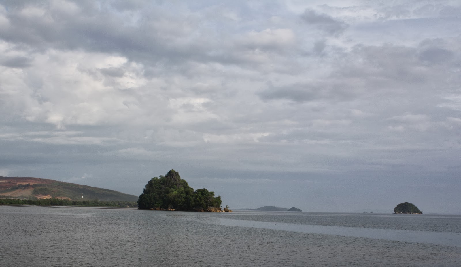
The summit offers a 360-degree scenery where other Zambales mountains can be viewed on the eastern side, Lingayen Gulf to the north, and on the western side, the Zambales lowlands and the South China Sea stretching to as far as Pundaquit in San Antonio, Zambales.

A background of thick varicolored flowers and exotic plants at the summit


OTHER CONCERNS

The Registration site can provide a shower of P20 per person and an electric power where gadgets can be charged. Climb registration fee is P30 per person. There is an ample space for a maximum of 15 persons who wish to take a rest or sleep in the registration site for free. Certificate of climb completion is also available for P50. “Manang”, a volunteer, the one manning the registration just lives near the Registration site and she can be hired to cook food for a minimal fee. You can also order from her a whole chicken for “tinola” which you can eat after the climb.

HOW TO GET THERE

Take a Victory Liner bus from its Monumento Terminal with a sign board of Iba, Zambales for P372 preferably the last trip at 11:00 P.M. where you will arrive at 3:00 A.M. in the Iba Bus Terminal and take a tricycle going to the Registration site for P160 per head in Dampay Resettlement Area, Brgy. Salaza, Paluig, Zambales. Alternatively, you can take a Victory Liner bus from Monumento Terminal with a sign board of Sta. Cruz for P394 preferably the last trip at 11:30 P.M. and you will not drop in the Iba Bus Terminal but continue along the Zambales Regional Highway and drop at the corner of Dampay-Salaza where a tricycle for P200 will take you along 8-kilometer rough road going to the Registration site. The jump-off from the registration site starts at an altitude of 114 MASL.

Monday, October 14, 2013

OTHER JEWELS OF BUCAS GRANDE ISLAND

Location: Bucas Grande Island, Siargao Island Group
Province: Surigao del Norte, Philippines

As my trip to Siargao Island concluded, I realized that there's a lot of things to see and do in Bucas Grande Island than in Siargao Island just to see the famous Cloud 9 Surfing Paradise. In Bucas Grande, you can find the Sohoton Ecopark with the Jellyfish Sanctuary and the other jewels of the island are: Club Tara Resort, Hidden Island Resort, Bubon Islets and many other nameless white beaches. For me, a visit to the fishing village of Barangay Bay-ang is plus factor. Bucas Grande is one of the 48 islands of Siargao Islands group. It belongs to the municipality of Socorro, one of the six municipalities of Siargao Islands group.


View Bucas Islands in a larger map


The pristine and tranquil Club Tara Resort


Going to Socorro Port from Sohoton National Ecopark, one will pass thru a state-of-the-art resort in the name of Club Tara Resort which offers every luxury a guest would wish to have.

Club Tara Resort is equipped with swimming pool with a bar along its sides


Club Tara Resort is equipped with a docking port and physical sports facilities as well as aqua sports facilities to complete the fun of guests who wanted to stay for long vacation.

Still a part of Club Tara Resort


Indeed, Club Tara Resort is a haven where guests will love to stay as they are pampered with all the luxuries they need.

Truly a hidden paradise with lots of fun to offer


Our next stop was the Hidden Island Resort where it offers a complete fun for individuals and families who wanted to enjoy their vacation in a very secluded but paradise location.

One of the islets in Bubon


Bubon group of islets are picturesque and each islet has its unique charm to entice the visitors to stay for a swim, a picnic or an overnight camping.

An entry to the fishing village of Barangay Bay-ang


We were suppose to head to Socorro Port which is still more than an hour boat ride to catch the 1:00 P.M. boat trip to Dapa of Siargao Island but we almost ran out of gasoline and so we were forced to drop by at Barangay Bay-ang to buy fuel for our boat.

A house in the middle of the sea?


This house may seem odd in terms of location but I find it picturesque and unique. After all, we can't see this in a metropolitan city.

Simple joys in simple dwellings


Kids around their simple shanties enjoy their playful moments satisfied with what they have in a completely surrounded environment by seascape.

A time for playing, a time for bonding


Unmindful of where they live, these kids still have the enthusiasm to play and bond with each other. If you live here, will you do the same?
A real picture of sadness


While we were still at a distance, I saw the girl in the picture to be too busy with something. As we approached near, she sat down and stared towards our boat with gloomy facial projection. Why the sudden change of emotion?

Resting after a tiring swim


After enjoying a round of swimming race, this kid rested at the back of their house to regain his energy.

Kids are having a swim without the presence of their parents


I can still recall when I grew up in our coastal town. We are not allowed to swim in any body of water like beach or river without the presence of our parents no matter how shallow they are. While these kids are given the liberty to do their swimming stuff unguarded.

They are not the typical camera-shy kids


As these kids saw us, they posed for posterity sake. They are not those typical kids in the remote areas where they will shy away with the click of a camera.

The kids have there ever-ready smile every click of my camera


As long as they knew that the camera is grinding, they are ever-ready to flash their smile. They even became more acrobatic on the water just get our attention.

He must have a problem since he did not join the other kids


I noticed this kid in the picture to have been sad and did not even bother to glance to other kids who were enjoying their swimming. He must be sick.

An improvised swimming pool in the middle of their houses


Maybe for safety reasons, the kids were told by their parents to swim unguarded near their house rather than at the open beach. At least, it is safe.

Part of the fishing village is grown with mangroves


Curious of what life is in that fishing village, I had a stroll there and chat with a few residents.

The coastline leading to Socorro Port


After having three picturesque stopovers, we headed to Socorro Port with a travel duration of more than one hour to catch for our trip to Dapa Port of Siargao Island.

JELLYFISH SANCTUARY (SURIGAO DEL NORTE)

Location: Tujuman Lagoon, Sohoton National Park, Bucas Grande Island, Siargao Island Group
Province: Surigao del Norte, Philippines

This Jellyfish Sanctuary is a part of the Sohoton National Park. In this part of the globe, you can experience to swim along with hundreds of harmless jellyfish in the 20-feet deep Tujuman Lagoon. Kayaking is the only means of transport to visit this site so that the jellyfish thriving here will not be disturbed by the noise of the engine of the boat and at the same time they will not be harmed with the motor boat's propeller. It is also a part of the island of Bucas Grande, one of the 48 islands of Siargao Islands group. It belongs to the municipality of Socorro, one of the six municipalities of Siargao Islands group.


View Bucas Islands in a larger map


It's fun to swim with a school of jellyfish


To get to the sanctuary, each of the three of us, was provided with a boat with our own paddler. It was just 20 minutes from the Management Office.

One of my companions, Tess Corpuz. The green structure is just opposite the Management Office


The entry point to Tujuman Lagoon offers a refreshing experience as you see the 20-feet deep seabed through the aquamarine blue waters.

The school of fish welcome us upon entry to Tujuman Lagoon


I can feel the warm welcome of the school of fish as we enter the jellyfish sanctuary. the white sparkling colors in the picture are fish jumping from above the water.

That is how a jelly fish looks like. Would you dare swim with them?
Never in my life I dared to touch a real jelly fish. This time, I had so much fun with them. They were as tender as cottons.

Feeling the texture of the jellyfish in my palm


From the boat, we immersed ourselves right to the habitat of countless jellyfish. We scooped a few of them in our palm.

A fun-filled swim with a school of jellyfish


I really treasured this moment having experience once in my lifetime this not-so-common communing with God's creation --- the harmless jellyfish.

Regretful of leaving the Kingdom of the Jellyfish


One hour bonding with the jellyfish was not really enough. If I have the time, I will revisit this place again and be a part of their kingdom for another hour or two.

HOW TO GET THERE

If you are already in Surigao City, you can either take a bus with a signboard of Tandag with a bus fare of P120 or a chartered van of P1,000 from Surigao City going down in Bgry. Hayangganon of the Municipality of Claver for 1 hour and 10 minutes and from there take a boat for 40 minutes to Sohoton Ecopark.

Alternately, there is a route from Surigao City through big boats to Dapa of Siargao for almost 3 hours or through Roro for 4 hours which usually leaves Surigao City at 6:00 A.M. and another at 12:00 Noon. from Dapa of Siargao Island, one can have a regular boat trip (once a day) to Socorro port of Buscas Grande Island for 1 hour and 15 minutes and from Socorro to Sohoton Ecopark is a boat for another one hour.

CONTACTS

Provincial Governor’s Office
Provincial Capitol, Surigao City
Tel. Nos. (086) 826-7778 Telefax (086) 826-0462

Provincial Tourism and Cultural Office
Provincial Capitol, Surigao City
Tel. Nos. (086) 232-6962 local 410; +639088963975
Email address: surigaodelnortetourism@yahoo.com
Website: www.surigaodelnorteph.com

Mr. Rolando “Dodo” Henson
Operations Manager
Sohoton Ecopark
Mobile Number +639394235793

SOHOTON NATIONAL ECOPARK (SURIGAO DEL NORTE)

Location: Bucas Island, Siargao Island Group
Province: Surigao del Norte, Philippines

Sohoton National Ecopark is unique of its kind as this pristine emerald paradise has magnificent underwater small caves and lakes, crystal clear water, corals of high definition colors and lush vegetation growing from limestone walls. It is uninhabited and luxuriant in vegetation complemented with emerald waters. This natural wonder is in the island of Bucas, one of the 48 islands of Siargao Islands group. It belongs to the municipality of Socorro, one of the six municipalities of Siargao Islands group. “Sohoton” is a term which means to pass through a narrow and low passage to the extent of crawling. It is highly advisable to visit this natural wonder during lowtide.


View Bucas Islands in a larger map


The crystal clear emerald cove of Sohoton


This trip started when we left Surigao City at 5:40 A.M. boarding a chartered a van going to Brgy. Hayanggabon in the Municipality of Claver at 6:50 A.M. From Hayanggabon port, we boarded a chartered small motor boat at 7:20 A.M. crossing the sea waters of Hinatuan Passage and arrived in Sohoton Ecopark Administration Office at 8:02 A.M. of Bucas Grande Island where we met its Operations Manager for tour briefing. in the name of Mr. Rolando “Dodo” Henson.

This is what you will see in Hayanggabon Port.


This is what you will see standing at Hayanggabon Port looking at the vast sea afar


Sohoton!!! You crawl flat to the ground to fit it with the low lying massive rock entrance


After the briefing from the Management Office, the thrill started as we drove through crystal clear cove. I felt so breathless wondering of how creation on this part of the earth was made. Was God more creative when He made this part of the planet?

We were extremely amazed as its second unfold to us the mystical beauty of Sohoton


Second by second, our eyes, screwed to its detail of the cove. The place was so serene. Nobody was around except our group with God so happy to see us amazed of His unparalleled creation.

These rock formations can tell the age of the Earth


For its turn of the boat, different rock formations are revealed. Every second then was a new experience.

Another treat to our feasting eyes


We had three guides with us. They are well-trained to explain to us what are those we see around.

One of our guides explaining what was in that rock wall formation


As we silently navigate the interior of the cove, we can see the small underwater caves inhabited with species endemic to the place.

The entry point to Hagocan Cave


We first had a minor spelunking in Hagocan Cave where it has a very small and narrow entry point. The entire cave has water coming from the cove outside and one has to swim inside to enjoy its beautiful scenery.

Swimming inside Hagocan Cave


We enjoyed our moments inside Hagocan cave where we had a refreshing swim and endless pictorials to document our unique experience.

Outside Magcocoog Cave while waiting for my companions who tried to have a dive from the atop a wooden flatform


Just minutes away, we proceed to have another minor spelunking in Magcocoog Cave where its topmost elevated exit served as a diving flatform down to the clear aquamarine waters of Sohoton Cove.

Our group inside Magcocoog Cave with our guide


According to our guides, these two caves are the caves where the Teleserye Asian Treasure topbilled by Robin Padilla and Angel Locsin were partly shot.

Having spelunking in the interior of Magcocoog Cave


We were advised by our guides not to stay long inside the cove or else during high tide or else you will climb the rocky cliffs just to have an exit to real world.

After savoring the beauty of the cove, we returned to the Management office and have different guides for the non-stinging jellyfish sanctuary.

HOW TO GET THERE

If you are already in Surigao City, you can either take a bus with a signboard of Tandag with a bus fare of P120 or a chartered van of P1,000 from Surigao City going down in Bgry. Hayangganon of the Municipality of Claver for 1 hour and 10 minutes and from there take a boat for 40 minutes to Sohoton Ecopark.

Alternately, there is a route from Surigao City through big boats to Dapa of Siargao for almost 3 hours or through Roro for 4 hours which usually leaves Surigao City at 6:00 A.M. and another at 12:00 Noon. from Dapa of Siargao Island, one can have a regular boat trip (once a day) to Socorro port of Buscas Grande Island for 1 hour and 15 minutes and from Socorro to Sohoton Ecopark is a boat for another one hour.

CONTACTS

Provincial Governor’s Office
Provincial Capitol, Surigao City
Tel. Nos. (086) 826-7778 Telefax (086) 826-0462

Provincial Tourism and Cultural Office
Provincial Capitol, Surigao City
Tel. Nos. (086) 232-6962 local 410; +639088963975
Email address: surigaodelnortetourism@yahoo.com
Website: www.surigaodelnorteph.com

Mr. Rolando “Dodo” Henson
Operations Manager
Sohoton Ecopark
Mobile Number +639394235793