Location: Negros Occidental, Philippines
Entry point: Guintubdan, Ara-al, La Carlota City
Exit point: Guintubdan, Ara-al, La Carlota City
Coordinates: 10°24'44"N, 123°7'55"E
Elevation: 2,434 MASL (7,989 feet)
Days required / Hours to summit:2 days / 8-10 hours
Specs: Major climb, Difficulty 8/9, Trail Class 4
Descriptive Summary: Mount Kanlaon ranks 6th among the TOP TEN "TOURIST GEMS" of the Philippines as shown is this link. It is the highest mountain in Visayas and is considered to be the Philippines largest active volcano. It has two known craters, one is the old extinct crater called Caldera with a crater lake in Margaja Valley just below the Makawiliwili Ridge with the size of 2 by 0.8 km (1.24 by 0.50 miles) and the second one is the active Lugud crater which already killed 7 mountaineers on its deadly eruption in 1996.
|
View Mt Canlaon in a larger map
|
This is a part of my April 11 – 15, 2014 Mount Kanlaon – Negros Occidental Trips which includes:
Mambukal Mountain Resort;
Bacolod City Tour;
The Ruins of Talisay; and
Balay Negrense .
This was my second climb in Mount Kanlaon where the first one was recorded on August 24-25, 2013 but due to Low Pressure Area (LPA), our group was not allowed to go beyond the Pagatpat Campsite for safety reasons. It was during my second attempt to climb that we succeeded to conquer its summit on April 13, 2014. To make sure that we get the scheduled we desired, our group climbing permit request was sent to DENR-PENRO addressed to Mr. Angelo Bibar on September 26, 2013 through LBC. Our group consisted of eight, namely: Peter J. Zabala, Alan A. Valenzuela, Benedick I. Manalang, Cesar H. Garcia, Rome A. Frias, Timothy E. Mislos, Jonathan L. Reales and I. DENR-PENRO only approves a maximum of 10 climbers for a day excluding the guides and porters. I was the Expedition Leader of the group for the second time.
 Conquering the summit of Mount Kanlaon
This exciting climb has started with a PAL flight from Manila at 8:00 P.M. and arrived in Silay International Airport at 9:05 P.M. Our pre-arranged chartered van picked us at the airport and we drove to Bacolod City for dinner. Peter, Jonathan, Tim and Rome took the morning flight and so we picked them also from an agreed place and headed to Guintubdan Pavillon for an overnight.
 One of the pools I saw in Guintubdan Pavillon Resort in my early morning walk on April 12, 2014
Bong Marcelino, our head guide, met us at Guintubdan Pavillon as we arrived there at almost 12 midnight and we arranged our meals to be cooked by them for breakfast and pack lunch for the following day. The groceries, butane and other necessary items were marketed by Rome Frias as an advance party and these items were equally divided to all our three porter guides.
 Our accommodation of two rooms in Guintubdan Pavillon
We had a soundly and tight sleep in a Guintubdan Pavillon where due to its elevation of 900 meters above sea level gives a cooler temperature. The Pavillon is so picturesque overlooking the scenery down the place.
 Connie Vasquez having her breakfast in the scenic Guintubdan Pavillon dated August 24, 2013, one of our climbing buddies during our unsuccessful first Mount Kanlaon Climb
Having breakfast in Guintubdan Pavillon is just rewarding as you see lush green scenery of rolling hills and mountains. How we wished, we stayed longer and savored the joy that this awesome sight had delighted us.
 Our Climbing Team of Eight
The moment of truth has started as we carried our backpacks and in a moment of silence, our group prayed hard for God’s guidance and presence to give us safety all throughout the climb. The Pavillon serves as the jump-off point. We took the Guintubdan-Guintubdan trail which we believe is easier than the Guintubdan-Mananawin Trail. At exactly 8:00 A.M., we left the jump-off point.
 The Busay Buslugan Falls as taken on April 12, 2014 (Summer Time)
We regrouped in Busay Buslugan Falls at 9:15 A.M. and had an endless pictorials. Our guides warned us that at this point “limatik” abounds and we have to avoid them by not sitting on the ground. The water then was so clear and quite inviting for a swim. We stayed in the place at 9:55 A.M. up to the point where we were dropped dead tired in our pictorials.
 The Busay Buslugan Falls taken on August 24, 2013 (Rainy Season Time) during our unsuccessful first climb
I still recalled the first time we visited this water falls last August 2013, it was filled with cascading water and the place was foggy and quite cold. By that time, it was not inviting for a swim as the water was freezingly cold.
 Taking a lengthy rest at Patay na Suba
We just passed in Patay na Suba (Dead River) at 10:15 A.M. Panoy and I did not stop there but the rest of the group when they passed through this point had a lengthy siesta including a snacks break. As you see, Panoy and I were not in the picture.
 Our group had regrouped at Camp 1 for our lunch
We arrived in Camp 1 at 11:56 A.M. just timely for our lunch. As far as I can remember, my exclusive guide in the name of Rexon “Panoy” Pieldad and I being in the lead pack, had only rested for thrice from Buslugan to Camp 1 at a maximum of 2 minutes each. Longer rests made me feel chillingly cold and so I avoided it. Thus, we both arrived first in Camp 1 and the next pack arrived at 12:15 Noon. With our excitement, “limatik” (a sucking leech) was remote in our minds. Before we reached Camp 1, we had to hurdle three long assaults.
 A 5-minute rest at Camp 2 with Jonathan Reales and my guide, Panoy
Trekking from Camp 1 to Camp 2 is only 18 minutes all of which are cardiac assaults where we left Camp 1 at 12:55 noon and arrived there at 1:13 P.M. From Camp 2 to Pagatpat Campsite, deep ravines were evident. Cardiac assaults were increasing in number and I have to stop to catch my breath. In some instances, I have to call Rexon to stop for a while and usually for barely two minutes, we resumed.
 The first ravine after descending Camp 2
The scenic foliage is becoming richer, thicker and closely intertwined as the we trekked deeper into the rain forest of Mount Kanla-on Natural Park. This park was reenacted into law through Republic Act No. 9154, Series of 2001 establishing Mount Kanla-on located in the cities of Bago, La Carlota, and San Carlos and in the municipalities of La Castellana and Murcia, all in the province of Negros Occidental, and in the City of Canlaon and Municipality of Vallehermoso, both in the province of Oriental as a protected area and a peripheral area as buffer zone providing for its management and for other purposes.
 Another deep ravine between Camp 2 and 3
As a background, Kanlaon Volcano, also spelled as Kanla-on or Canlaon, is an active stratavolcano which is the favorite spot for mountain climbers being the centerpiece of Mount Kanlaon Natural Park which was originally established on August 8, 1934. It is a part of the Pacific Ring of Fire.
 Another deep ravine almost near Camp 3
Mount Kanlaon has three hot springs on its slopes: Mambukal Hot Springs on the northwest, Bucalan Hot Spring and Bungol Hot Spring. Its adjacent volcanic edifices are Mount Silay and Mount Mandalagan, north of Kanlaon.
 Carefully scrutinizing the trail of a ravine if it is slippery
Left Camp 2 at 1:13 P.M. and was in Camp 3 at 2:05 P.M. We passed through the crash site at 2:35 P.M. where former President Ramon Magsaysay plane had crashed. Panoy and I were at Pagatpat Campsite at 3:40 P.M. and waited for the rest of the group.
 The tranquil Pagatpat Campsite
We stayed longer at Pagatpat till 4:15 P.M. to ask the rest of the group if they can still manage to push for the Saddle Campsite for overnight and since it was still early, the rest gave a resounding "yes" to resume the trek to the Saddle Campsite where we reached there at 4:45 P.M.
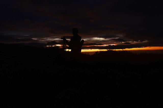
 The sunset at the saddle (photo courtesy by Peter Zabala)
I felt cold when I arrived at the Saddle campsite for I have been wet with perspiration and so after Panoy helped me to pitch my tent, I comfortably had an ample rest and waited for the call for dinner. The rest of the group went out to enjoy the sunset. There was no socials as everybody wanted to sleep but the campsite was so noisy with the LGU official climbers of Negros Oriental who had boisterous laughter until dawn. Our group had barely slept.
 The sun sets completely at its rest as viewed from the saddle (Photo courtesy by Peter Zabala)
The night was not so freezing as compared to Mount Pulag but somehow one may not afford to have a comfortable sleep without socks and cold clothing gears as the coldness was really annoying.
 Ascending from the Saddle to the Summit (Photo courtesy by Jonathan Reales)
 Scaling midpoint from the Saddle to the summit
The wake up call was at 5:00 A.M. for us to witness the beautiful sunrise. And so without anything in our stomach, we headed up to the summit where it took us 40 minutes to completely conquer the summit. We first kissed the big stone on the foot of the summit as first timers to climb the summit.
 The Margaja Valley – the old extinct crater of Mount Kanlaon (Photo courtesy by Jonathan Reales)
Scaling up to the summit has given us opportunity to capture the totality of the Margaja Valley where it really looks magnificent. It was so breathtaking and no word can ever describe how beautiful it is.
 A closer glimpse of Margaja Valley or Caldera Crater Lake (photo courtesy by Benedick Manalang)
Scaling the summit was quite dangerous as the trail is consist of loose rocks and down to Margaja Valley is approximately a thousand feet below. Thus, how can I afford to miscalculate a step where it will cost my life.
 I almost have seen the hole of the active Lugud crater
The summit has an active crater on it but we were advised not to look down for a strong wind can blow us down into it. We have to crawl and the guides were obliged to hold our feet for safety.
 The hole of Lugud crater was not really possible to be seen by mere crawling (Photo courtesy by Jonathan Reales)
More or less, this is the only view available to our naked eyes as it is very dangerous to go beyond. We were following closely the instructions of our guides for our own safety. We cannot even stand at this point.
 The hole of the active Lugud crater as captured by our camera through extended arms
Though it was scary, I managed to extend my arms to capture what is beyond my sense of sight but I was completely held by my guide in my two feet. This summit has a peak elevation of 2,435 meters above sea level (7,989 feet) and the mountain has a base diameter of 30 km (19 miles) and is dotted with pyroclastic cones and craters.
 Our group with the backdrop of the Makawiliwili Ridge taken from the summit (photo courtesy by Jonathan Reales)
Based on what I've learned from my online research, Mount Kanlaon has erupted for 26 times since 1919. Eruptions are typically phreatic explosions of small-to-moderate size that produce minor ash falls near the volcano. In 1902, the eruption was classified as strombolian, typified by the ejection of incandescent cinder, lapilli and lava bombs.
 Peter Zabala or Pete Zee provided most of the pictures in the climb
Grateful to meet, Pete for the first time who is a friend of my friend, Jrich Macasero where his artistic inclination in photography has provided me a lot of materials for this post.
 Timothy Estanislao Mislos jubilant while at the summit
Another travel buddy made a difference in this climb as I learned some tips from him regarding some photography and IT tips. So glad to meet him for the first time.
 Jonathan Lusares Reales – a keen macro-specie photographer
A silent but deep photographer has its own way of documenting every specie he captures with his camera whether it belongs to flora or fauna category.
 Cautious of every step I made while descending the summit
While loose rocks are so dangerous for any false move, I made it to a point that I surely locked my feet in every single step I made for me not slip out.
 Relaxed as I set foot at the Saddle Campsite
When I was at the summit, I was so worried of the research I made that on August 10, 1996, a group of 24 mountain climbers were on the same summit when the volcano suddenly erupted without any warning killing British student Julian Green and Filipinos Noel Tragico and Neil Perez, who were trapped near the summit. The authorities rescued the 17 others including 10 Belgians, another Briton and six Filipinos. The 17 were identified as Belgians Frederick Carraso, Philipp Couche, Caroline La Grange, Sophie La Benne, Darmien Gaitan, David Rycaert, Florence De Corte, Jean Francois Ossengeld, Caroline Verlinde and Delthme Ferrant, Briton Gordon Cole and Filipinos Pepito Ibrado, Wovi Villanueva and Albert Devarras.
We had then our breakfast as we returned to the saddle campsite and had breakcamp afterwards. The following is my personal record on how I descended the mountain with my guide, Panoy which I made it for FOUR HOURS AND 8 MINUTES to Guintubdan jump-off without taking any trail food and lunch and literally I was non-stop then. Left saddle - 9:20 A.M.; Pagatpat – 9:37 A.M; Crash site – 10:04 A.M. ; Camp 3 10:17 A.M.; Camp 2 – 10:49 A.M; Camp 1 – 11:03 A.M.; Patay na Suba – 12:17 Noon; Buslugan – 12:38 Noon and Guintubdan jump-off – 1:28 P.M.
On the other hand, I scaled Mount Kanlaon from the Guintubdan jump-off point to the saddle campsite for a total of EIGHT HOURS AND 45 MINUTES inclusive of occasional rests due to excessive cardiac assaults, lunch break, trail food and water break and siesta time in Buslugan for a lengthy pictorials. From the saddle to the summit is only 30 minutes if no pictorials are made along the trail.
Below is a suggested Itinerary:
Day 1
08:00 ETD Guintubdan
09:30 Buslugan picture-taking
11:30 Lunch at Camp 2
03:30 Pagatpat Campsite
04:30 Pitch tents at the saddle - There is an option to scale the summit if weather permits
06:30 Dinner afterwards socials
08:00 RON:
DaY 2
05:30 Wake-up call:
06:30 Breakfast
07:30 Breakcamp
08:00 Scale the summit with backpack
08:45 Start descending from summit
09:45 Pagatpat Ridge
12:00 Lunch at Camp 1
04:00 ETA Guintubdan Jump-off point
04:30 ETA Guintubdan Pavillon
04:35 Shower in Guintubdan Pavillon
06:00 ETD Guintubdan Pavillon
07:20 ETA Mambukal Resort
BUDGETARY CONCERNS
The total budget does not include the plane fare which is P3,500. These expenses include the registration of P300; 3 porter /guides for P7,000 including a tip of P1,000 for their extra services for cooking and made us like boarders waiting for sumptuous meals inside our tents; all meals from/to manila airport; all grocery items, butane, bottled water and other climbing supplies; chartered van of P3,200 from Bacolod airport to guintubdan; chartered jeep from guintubdan to mambukal for P1,500; mambukal accommodation of P3,300; guintubdan pavillon accommodation for P1,200; airport terminal fee in Bacolod for P200; hotel accommodation and taxi fares for the advance party in marketing food – P800 and other common expenses which were all divided into eight persons.
OTHER CONCERNS
Porter/Guides have a rate of P1,000 per day. On our part, we hired 3 porter/guides where we paid P6,000 and an additional of P1,000 for our tip. Our porter/guides had served also to be our cooks, photographer and safety advisors.
HOW TO GET THERE
Take any daily flight from Manila to Bacolod. Hire a chartered van from Bacolod airport to Guintubdan Pavillon for overnight so that the following day the climb can start as early as 8:00 A.M. It is cheaper to have a side trip to Mambukal than to hire again a chartered van from Guintubdan back to Bacolod. Chartered jeep from Guintubdan to Mambukal is only P1,500 and the minibus from Mambukal to Bacolod is P35.
Mount Kanlaon Climb is a part of our 5-day Bacolod-Mount Kanlaon Climb-
Mambukal-
The Ruins of Talisay Trip and I am sharing what we spent in the entire trip which does not include the "pasalubong".


