Saturday, February 11, 2017

SHRINE OF OUR LADY OF ASSUMPTION AT THE JALLECA HILLS

Jalleca Hills, Brgy. Mantahan, Maasin City, Southern Leyte, Philippines


Note: This is a part of my 4-day Maasin City Trip which includes: Shrine of Our Lady of the Assumption and the Most Precious Blood of Jesus, Shrine of Our Lady of the Assumption at Jalleca Hills, Our Lady of the Assumption Parish Cathedral of Maasin, Maasin City Tour, Saint Francis Javier Shrine and Canigao Island.

The 36-meter Statue of the Blessed Virgin Mary


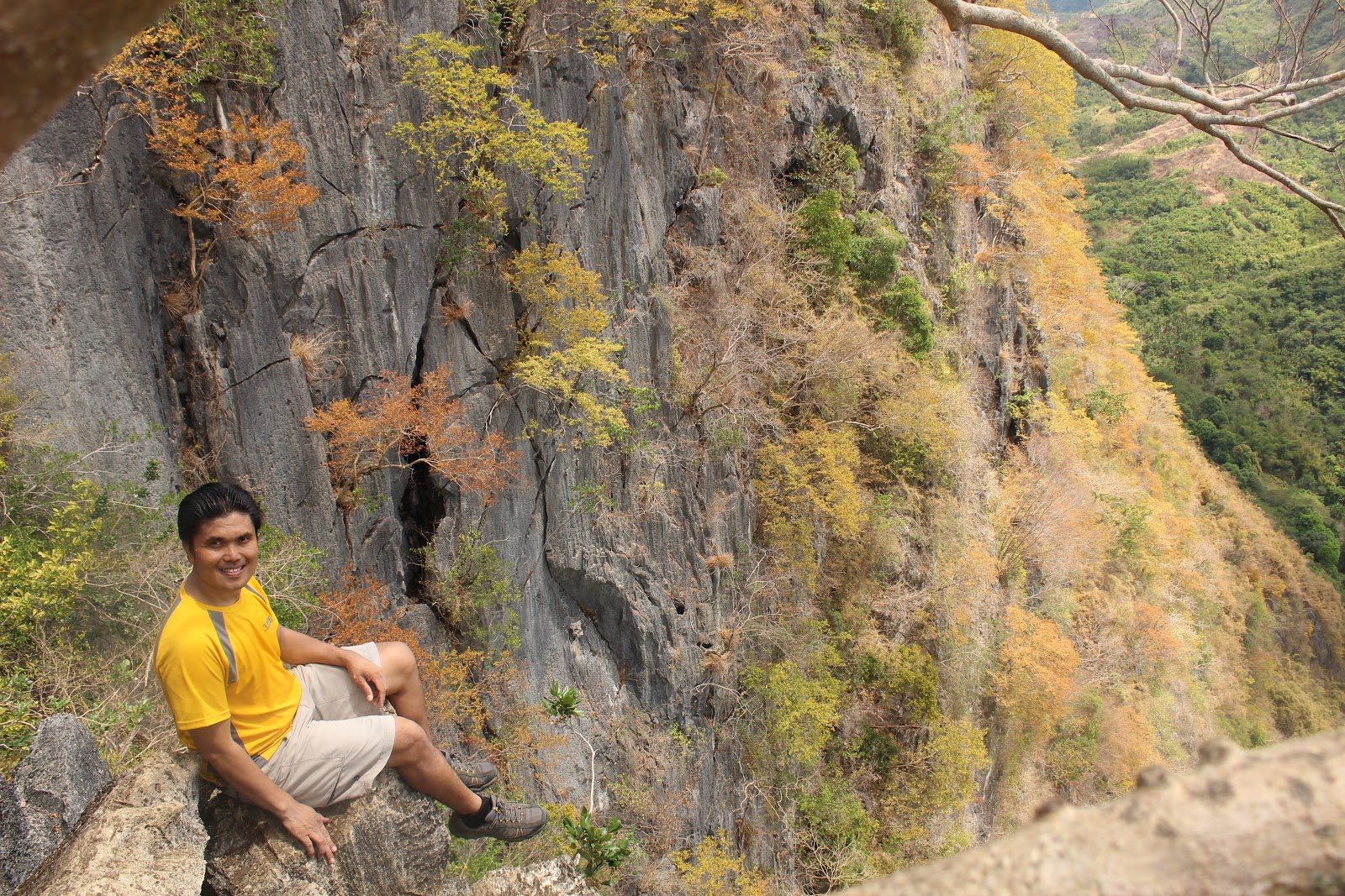
From a 20-minute drive coming from Shrine of Our Lady of Assumption and the Most Precious Blood of Jesus, I went to this shrine, the second shrine of Our Lady of Assumption of Maasin City. Unlike the other one, this is located within the city proper.

The main gate to the shrine where the first step of 235 starts


This shrine built on top of a hill summit at 104 MASL is lower by 68 meters compared to the other Lady of Assumption shrine. Because of its accessibility, more people are scaling it. However, I noticed that some who did it have their concern on their fitness and wellness routine. I can see them repeatedly ascending and descending in jogging and dry fit suits. Others are there for the reason of breathing in fresh air.

The stairs leading to the Shrine at the hills summit


From the readings I had, I learned some facts about the shrine. Firstly, it was built in 1994 where according to the residents the city has not been hit by a typhoon until that of tropical storm named "Ramon".

A closer look of the shrine


Secondly, it was built because a certain Mila Gaviola had a dream in 1990 where Virgin Mary appeared and told her to build a shrine in her honor behind the provincial hospital overlooking the city. This was the same case with Chung, where he built the Monte Cueva shrine due to the request of the Blessed Virgin Mary through a dream.

Overlooking the city and the open seas


Thirdly, the place was called Jalleca Hill after its owners—the Jarabe, Llevares and Cadavos families. Gaviola told the Catholic owners, about her dream and persuaded them to donate the land. They readily did.

The shrine's chapel


Fourthly, the group which managed the shrine was organized in 1992 even before it was completed. It is composed of Marian devotees, some of whom belong to known families in Maasin. The late Bishop Vicente Ataviado of Maasin gave his blessing when Gaviola informed her about the project. The shrine was completed four years later through the help and donations of devotees.

While I was at the shrine


Finally, unlike the Monte Cueva, the shrine on Jalleca Hills has not been recognized as the official Marian Shrine in Southern Leyte by the Palo Archdiocese. Gaviola says the Church officials want her to turn over management of the shrine, but she refuses because it was built through the initiative of devotees like her. Without the recognition, masses are no longer held there, except on Sept. 8, the birthday of the Blessed Virgin, and in October, the Holy Rosary month. (source: Inquirer Net)

HOW TO GO THERE


The nearest airports to Maasin are Cebu City, Ormoc City and Tacloban City. But plying from Cebu City would require you to board a ship from Cebu City's Pier 4 to cross to Hilongos, Southern Leyte for P286 which is around 5-6 hours sea travel of which we boarded M/V Joyful Stars. Then from Hilongos to Maasin is a bus service of P87 for more than 1 hour road travel.

If you are coming from Ormoc City, then it is approximately 3 hours drive at P150 fare for 131.9 kilometers via Baybay-Inopacan Road. While if you are coming from Tacloban City Airport, then it is approximately 4 -5 hours drive at a fare of P270 for 194.8 kilometers via Bato - Bontoc Road and Eastern Nautical Highway.

If you opt to take a land travel via Bicol Peninsula and Samar, take Pintados Airconditioned Bus for P1,688 fare including ferry fare in Matnog (Sorsogon)-Allen/Alegria (Northern Samar) crossing or with the same route with Philtranco airconditioned buses for P1,706 excluding the ferry fare. This is either coming from Cubao or Pasay terminals to Maasin City. The travel time is approximately 26 - 28 hours excluding the waiting time for the availability of the ferry boat from Matnog to Allen.

SHRINE OF OUR LADY OF THE ASSUMPTION AND THE MOST PRECIOUS BLOOD OF JESUS

Location: Brgy. Rizal Interior, Monte Cueva, Maasin City


Note: This is a part of my 4-day Maasin City Trip which includes: Shrine of Our Lady of the Assumption and the Most Precious Blood of Jesus, Shrine of Our Lady of the Assumption at Jalleca Hills, Our Lady of the Assumption Parish Cathedral of Maasin, Maasin City Tour, Saint Francis Javier Shrine and Canigao Island.

The Shrine of Our Lady of the Assumption


Maasin City is indeed a very religious city. The proof of the matter were its two shrines of Our Lady of the Assumption in separate locations and the establishment of its first Roman Catholic church by the Spaniards in 1700. One of these two shrines is that of Our Lady of the Assumption and the Most Precious Blood of Jesus or most commonly known as Monte Cueva Shrine.

The right-wing concrete stairway of 552 steps


The shrine is erected on top of a hill of 172 MASL or 564 feet in elevation where the shrine faces the ocean and the whole town of Maasin. Because of its height, devotees and pilgrimes have to scale the concrete stairways on the right which serves as the entry point with 552 steps while the left one as the exit side has more than 300 steps. Why is this so? Because, the left wing has stairways with longer steps while the other one has shorter stairs.

Part of the open chapel


There is a store when you reach the open chapel where you can buy refreshing drinks and religious items and souvenirs. It is a very green open garden equipped with seats. Only the altar has the roof.

The open chapel annexed to the verdant garden


With regular masses being held here, pilgrims and devotees flock in big numbers. After all, it is just 2 kilometers away from the city proper of Maasin which is 10-15 minutes drive with tricycles as the only transport going there.

A cathedral within a cave


Just few steps from the open chapel is the entry point to a cave with a cathedral inside. Surprisingly it was cold inside the cave. The wall stone is cold and it is equipped with lights inside.

One of the holy images inside the cathedral


I think the cathedral has specific schedule when it will be opened on a regular basis to the public for I noticed that the narrow entry to it has metal door casing. Considering that holy masses has regular schedule, then only by this time that it will be opened to the public. Unfortunately, by the time I was there, I need to wait for the holy mass at 6:00 P.M. but I was rushing to go to the other Shrine of Our Lady of the Assumption at the Jalleca Hills.

Capturing a lighted cathedral's interior


Even if there was no mass going on, still there were a lot of pilgrims in and out the cathedral and the open chapel. I had a short conversation from the other pilgrims there, I learned that some came from Cebu City, Davao, Ilocos and a few were American citizens of Filipino blood having their home visit to the Philippines.

The image of Our Lady of the Assumption


It was so spiritually relaxing staying inside the cathedral. It was so solemn inside. There were so many people around but you can hardly hear any footstep. That feeling of being holy was just so contagious.

The 30-foot image of Our Lady of the Assumption


I thought then after coming out from the cathedral that I have to go down and leave the sacred hill but I noticed that people were moving to one direction for a few steps going up where it looks like an open veranda. I followed them anyway, and to my surprise, there I saw the image of Our Lady of the Assumption with arms outstretched towards the city and the ocean which according to the staff it indicates love and protection for its beloved city, Maasin.

I saw a group there with a guide I suppose telling them the details of the shrine and so I listened and according to him, the shrine was canonically established by the bishop of Maasin, it is officially called the Shrine of the Most Precious Blood of Jesus and the Our Lady of the Assumption, the city’s patroness, according to Fr. Garnet John Dy Quirong, diocesan shrine director for five years. He further narrated that the shrine was a donation by the philanthropists Odong and Loring Chung in 1992 to the Diocese of Maasin where the couple was the land owner of this site. Prior to its construction, Odong had a dream where Our Lady of the Assumption was asking him to build a shrine in Her name. He added that there was a time when Maasin City was to be hit by a tidal wave and the people had already evacuated to the highlands. A witnessed has revealed that Our Lady of Assumption had motioned to stop the huge tidal wave and gradually, it subsided.

Part of the Via Crucis


Finally, I learned from one of the staff that residents once referred to the place as a mountain cave or what the locals call as "aghuban" while some others called it Sitio Tinibgan, meaning a carved rock shaped like a wooden basin on the lower portion of a brook. On the other hand, the cave where the cathedral was built used to be a habitat for bats and birds. Stalactites can still be seen embellished on the ceiling, but a few of them were later ripped off and sold as decorative items.

HOW TO GO THERE


The nearest airports to Maasin are Cebu City, Ormoc City and Tacloban City. But plying from Cebu City would require you to board a ship from Cebu City's Pier 4 to cross to Hilongos, Southern Leyte for P286 which is around 5-6 hours sea travel of which we boarded M/V Joyful Stars. Then from Hilongos to Maasin is a bus service of P87 for more than 1 hour road travel.

If you are coming from Ormoc City, then it is approximately 3 hours drive for 131.9 kilometers via Baybay-Inopacan Road for a fare of P150. While if you are coming from Tacloban City Airport, then it is approximately 4 -5 hours drive at P270 for 194.8 kilometers via Bato - Bontoc Road and Eastern Nautical Highway.

If you opt to take a land travel via Bicol Peninsula and Samar, take Pintados Airconditioned Bus for P1,688 fare including ferry fare in Matnog (Sorsogon)-Allen/Alegria (Northern Samar) crossing or with the same route with Philtranco airconditioned buses for P1,706 excluding the ferry fare. This is either coming from Cubao or Pasay terminals to Maasin City. The travel time is approximately 26 - 28 hours excluding the waiting time for the availability of the ferry boat from Matnog to Allen.

Thursday, February 2, 2017

WITH ONLY P308 YOU CAN HAVE A DAY CLIMB AT MOUNT HAPUNANG BANOI

Location: Rodriguez, Rizal, Philippines


Major jumpoff: Brgy. Wawa, Rodriguez, Rizal
LLA: 14°44′25.3′′ N, 121°11′30.4′ 517 MASL (+460m)
Days required / Hours to summit: 1 day / 2-3.5 hours
Specs: Minor, Difficulty 4/9, Trail class 1-4 with limestone scrambling
Features: Limestone formations, scenic views of Sierra Madre and Rizal province
(Source: Pinoy Mountaineer)

Just one of the scenic rock formations of Mount Hapunang Banoi


Hapunang Banoi is just one of the three mountains in Rodriguez, Rizal which I climbed where all of them are notably with limestone formations. The other two where I climbed earlier were Mount Binacayan and Pamitinan. I climbed the latter for twice. According to the locals, its name Banoi is a Tagalog word for eagle, where its name was derived which means a folkloric seat as the ‘place where eagles come to dine’.

The hanging bridge leading to the jump-off point of Pamitinan and Banoi


Banoi and Pamitinan share the same jump-off point and the same trail till it reaches to the Junction (three food stores of bamboo and nipa structures are there). From that point, Banoi has a trail which turns to the left while Pamitinan is heading to the right direction.

One of the continuous gradual assaults


After crossing the hanging bridge, the trail cuts through a few houses where assaults are continuous. The trail is grown with verdant vegetation. When it's raining, the trail on this part is muddy. Newbies here keep on taking rests to catch on their breath.

Resting under a balete tree


The ascending trail continues till it reaches the massive rock wall where very inviting long bamboo seats await the climbers and cold drinks and buco are being sold by the enterprising locals.

The massive rock wall where we normally rest after a continuous ascent


For a regular climber, it takes less than an hour from the hanging bridge to the junction. Some parts of the trail requires a big leap as you have to step on big roots or big mounds of rocks.

The junction where Banoi and Pamitinan trail separates


From the junction, culminates a trail which is dry and with bamboo groves. Sharp limestone rocks are becoming evident. Some points are open showcasing the breathtaking scenery of the low-lying areas which serve as viewdecks.

A breathtaking viewdeck


Since the trail has sharp rocks, trekking becomes slow. Besides the trail is so narrow and at the edge of a cliff but it offers a panoramic view. Climbers are left in awe that they can not resist the temptation taking shots and selfies.

Just one of the trails where you need to have big leaps


You need to hop from one big rock to another. At this point one is really exposed to the scorching heat of the sun. So, it is advisable the ascent should be as early as 5AM in the morning since there will be no cover from the junction to the summit.

Taking the challenge in a risky move to capture a daring shot


The picture above is not a part of the usual trail. I just climbed there to get a daring shot. At its back is a rocky cliff. Not all climb this point. It might be risky for those who are not daring enough to conquer heights and defy gravity.

Conquering heights . . . defying gravity


In the picture above, I was still on the same spot but the photographer has transferred to higher elevation by climbing a tree. If I were the photographer, I will not take this shot. It does not define height, anyway. This shot was in the same spot in my cover picture of this post.

A death-defying cliff-edge angle shot


The picture was a 20-minute trek from the last photo where I had a daring shot. Below it are really deep ravines and cliff measuring around 150 feet. The backdrop here is just amazingly stunning. The bright yellow trees adds a different glow. In this photo, it does not define a death-defying cliff edge, but in reality, one false move here is more than death-welcoming.

Cliff-edging reckless-controlled shot


By the looks of it, the photo above looks so cool but only brave hearts do this. Not all wants to provoke death and accept challenge. Anyway, all of us were happy that our guides were giving us then tips on how to be safe in every move we did. They were even the ones taking our pictures.

Soaring like an eagle on top of God's creation


Scaling to this point was really risky, the rocks were so unwelcoming. You can not just avoid rashes and skin cuts. I mean, there was no room here for skin bruises but just skin cuts. One has to be cautious enough to grip and hold on to rocks. Some of them may not even be stable. Their sharpness looks fierce but fragile when you hold a grip over them.

At the window of the world


Being at this point was really monumental. I can't explain my feelings. It was like, I was on top of everything and I own a vast of kingdom. I was like claiming my dominion over nature.

Overlooking the low-lying hills and plains


What I like in this mountain was its generosity to give best scenery. Wherever you aim your camera, it will result to amazing captured photos. I really love this climb!!! Why not try it by yourselves.

Indeed, I have the dominion over nature


I have not wasted my time to document every beautiful angle I saw. As we were approaching the summit, rocks were becoming fiercely sharp. I noted that two of my male companions who were wearing sandals were not able to pursue the climb as their sandals were disengaged. The rocks were quite punitive.

On top of the summit


While the summit has fierce rock edges, its view was stunningly beautiful. As long as you are cautious with your moves, you will be in good hands. You will have less skin cuts. I did have two. Anyway, the guides are so mindful of their climbers. They are watchful and they would even give the advance before you do the wrong move.

While at the summit


Our group stayed for more than 30 minutes at the summit. Good that there were no other groups next to us. The summit is not wide enough to accommodate climbers. You know, I really like the backdrop of the summit.

Another part of the summit


Our guide demonstrated to me on how to have a shot like him, but I decided not to because, it was so risky. I saw no support if ever I mishandled my footwork. It was then I realized, I have my limit.

This is a fissure just below the summit


It was already hot and so we took cover below the summit where there was a fissure. Surprisingly, it was cold inside it. But the problem was, we have to brave up the sharp edges of rocks going down which considerably deep below. And after resting there, we need to climb again to be on our trail for descent.

The trail leading to Wawa Dam


After descending from Mount Hapunang Banoi, we decided to freshen up for a bath in the cascading Wawa Dam. This can be the best side trip when climbing the mountains of Banoi, Binacayan and Pamitinan.

The trail leading to Wawa Dam


Our refreshing bath at Wawa Dam


Not only that, along our way to Wawa Dam, you can vegetables and fruits at a cheaper price. If you are hungry, carenderia are many particularly when you are heading back to the DENR Office. Need to go back to Cubao? There are tricycles available going to Luvers in Montalban and then take a jeep or van going back to Cubao.

My expenses for this climb is summarized as follows:

tr>
SN Particulars Amount
1. Round Trip Van Fare from Farmer’s Cubao to Louver’s Montalban and vice versa
100.00
2. Share in Round Trip Tricycle fare from Louver’s to DENR Registration Site (P15 one-way)
30.00
3. Share in guide for a maximum of 8 for a fee of P500
62.50
4. DENR Registration Fee
20.00
5. Donation to Barangay (Optional)
5.00
6. Lunch in one of the Carenderias in the jump-off point
45.00
7. Breakfast in one of the Carenderias in the jump-off point
45.00
TOTAL
P307.50


Wednesday, February 1, 2017

A DAY HIKE IN MOUNT TALAMITAM FOR ONLY P493

Location: Brgy. Aga, Nasugbu, Batangas, Philippines


Jump-off point: Sitio Bayabasan, Brgy. Aga, Nasugbu (KM. 83)
LLA: 14.1158° N; 120.7577° N; 630 MASL
Days required/ Hours to summit: 1 day / 1.5-2.2 hours
Specs: Minor climb, Difficulty 3/9, Trail class 1-3 with steep assault (100 m)
(Source: Pinoy Mountaineer)

The majestic Mount Talamitam


Scaling Mount Talamitam is like a "walk-in-the-park". If you want to just enjoy a rustic or bucolic destination, this mountain is the right place for you. Another reason why some like to climb this mountain is its proximity to Metro Manila where from Pasay City to its jump-off of Sitio is just two hours drive boarding a public bus transport. Though, you have to travel very early in the morning as traffic builds up when it is already late.

This is where the bus will drop you and the registration site


For this trip, my group consisting of Giovanni Alexander Arreglado Pido, Mafe Panizales Josue and I, left Taft-Edsa Pasay at 4:45 A.M. boarding an airconditioned bus with its terminal just at the back of Chowking and Sogo establishments and arrived in Sitio Bayabasan of Brgy. Aga, Nasugbu at 6:45 A.M.

After 10 minutes of trekking from the jump-off point


From the registration site, which is just the point where we disembarked from the bus, we learned that a guide is mandatory which is P500 per guide. I forgot to ask if there is a ratio of guide to the climbers. There is no problem also with food since you can buy your breakfast right there. We took again our breakfast at reasonable price of P50 per order. We started our trek at 7:10 A.M.

A gradual assault after trekking along a brook


It was refreshing walking along a trail grown with verdant trees and along running brook where we have seen some locals were washing clothes. We were gradually having an assault. Indeed, an easy assault.

Approaching a pasture land


Interestingly, I noted some pastured animals after a gradual assault. From this point, it was already open and definitely you will be at scorching heat if you do the trekking late. We started to feel the wind around making our trek even relaxing.

Practically a flat trail


From where I saw the horse, the terrain was flat and I can even see the summit ahead. Maybe around 300 meters, I suppose. Wind was continuously caressing my face. Since the trail is so wide, our group can walk side by side conversing with each other.

While in playful mood at the summit


It took us 1 1/2 hours to climb the summit. The summit belongs to Barangay Kayrilaw, thus, the guides belong Barangay Kayrilaw Guides Association. As you can see in my picture above, the prominent background is Mount Apayang's peak at 662 meters above sea level (MASL) where Talamitam's peak is at 652 MASL or 2,139.11 feet elevation. According to the Pinoy Mountaineer archives, Apayang is just 100 meters away, though I did not try to cross there.

The usual summit closeup photo


It was really windy at the summit. We decided to stay longer. Besides, there were two groups who were with us enjoying their solo pics on the three rock formations at the summit.

My last glorious moment at the summit


It was still early 9:00 A.M. but we invited our guide for a snacks. We took with us cakes and pastries. Giovanni still wanted to stay longer. He took as many shots as he wanted with Mafe.

Overlooking the flat pastureland and low-lying areas (Model: Mafe Panizales)


What makes it exciting to stay at the summit was seeing the Mount Batulao and Pico de Loro at a far distance. The dramatic hills and ricefields were evident.

Our group while descending


The more that our descent was very relaxing. From the saddle of the mountain, we find a shade of trees where we stayed for lunch. It was already hot and we decided to shade ourselves from trees.

Trekking along the crystal-clear brook


This climb was actually a twin-peak day hike where after this mountain, we traveled back boarding a jeepney to KC Hillcrest for our Mount Batulao climb but I am not posting it since I already have a lot of Batulao posts here. We paid P19 for the jeepney and finished our climb in Mount Batulao at 6:00 P.M. We stayed longer in Batulao as Giovanni and Mafe were first timers of the mountain and they find it too picturesque.

Breakdown of Expenses


SN Particulars Amount
1. Round trip bus fare airconditioned bus fare from Edsa-Pasay to Sitio Bayabasan at P124 one-way
248
2. Share in Guide for P500 per guide for 8 persons
100
3. Regisration fee
45
4. Breakfast and Lunch at P50 per meal
100
TOTAL
P493


CONTACTS


Kuya Eddie Erestain 09106087543

Paul Bausas - President of Barangay Kayrilaw (Talamitam) Guides Association - 09169337668

OTHER CONCERNS


Food is readily available and other food items, bottled water and other necessities in Ate Wilma's Carenderia just adjacent to the registration site at P50 per meal. You can even order a packed meal from here if you opt to take with you lunch or dinner to Talamitam. Her location which is also the registration site is just on the point where the bus will drop you. Bus conductors knew the place and just notify them so that you will be dropped there.

Buco juice are available in few strategic locations along your trail at P30 and halo-halo costs P50. Taking shower is also available at P10 in Ate Wilma's place and use of CR cost P5 per entry.