Thursday, June 26, 2014

METROPOLITAN MANILA

Note: This post has been updated to September 7, 2026

METROPOLITAN MANILA with a land area of 636 square kilometers, is widely known as METRO MANILA, which is consist of 16 Highly Urbanized Cities:  (1) Caloocan, (2) Las Pinas, (3) Makati, (4) Malabon, (5) Mandaluyong, (6) Manila - the capital city, (7) Marikina, (8) Muntinlupa, (9) Navotas, (10) Paranaque, (11) Pasay, (12) Pasig, (13) Quezon City, (14) San Juan, (15) Taguig, and (16) Valenzuela; and a municipality of Pateros.


Map of Metropolitan Manila (Photo credit: www.sketchbubble.com)

MAKATI CITY


Makati City is the leading financial, commercial, and business center of the Philippines, which is a part of Metropolitan Manila.   It serves as the premier economic hub and financial capital of the country, hosting major corporate headquarters, banks, and foreign embassies.  It covers a land area of about 21.57 square kilometers, bordered by the Pasig River to the north, Taguig to east, and Pasay to the west.  It comprises 33 barangays, featuring the prominent Makati Central Business District (CBD), the historic Poblacion district, and affluent enclaves like Forest Park.  It boasts one of the largest and most dense collections of skyscrapers in the Philippines.  It is founded in 1670 as San Pedro de Makati, it evolved from an agricultural town and the site of the nation's first airport into a modern metropolis.

The financial district along Ayala Avenue, the Wall Street of the Philippines

Ayala Avenue is a 1.9-kilometer major thoroughfare in Makati City, that serves as the core of the country's financial industry.  It is widely known for housing the headquarters of top local and multinational corporations, major financial institutions, and the Philippine Stock Exchange, thus, it earns the reputation of being the Wall Street of the Philippines,

The Glorietta Malls of Makati Business District captured from One Ayala Mall balcony

The festive Christmas at Ayala Triangle Gardens

Vibrant evening captured from Ayala Triangle Gardens with the 
Philippine Stock Exchange Tower (left) at the backdrop

MANDALUYONG


Mandaluyong City is a highly urbanized, progressive economic center located at the heart of Metropolitan Manila, widely known as the "Tiger City".   It has an area of 9.29 square kilometers consisting of 27 barangays which is divided into 2 political districts.  It is bordered by Manila to the west, San Juan to the north, Quezon City to the northeast, Pasig to the east, and Makati across the Pasig River to the south.

It shares the bustling Ortigas Center business district with Pasig City, featuring soaring corporate skyscrapers and commercial zones.  It is home to world-class shopping complexes like SM Megamall and Shangri-La Plaza, as well as major corporate headquarters including the Asian Development Bank (ADB) and San Miguel Corporation (SMC).   Its major thoroughfares like EDSA run directly through the city, connecting commuters to the rest of the capital region via multiple MRT-3 stations.

Part of the massive SM Megamall

SM Megamall ranks generally between 5th and 10th largest shopping mall in the world, depending on whether the list measures Gross Leasable Area (GLA) or total floor area.  It is approximately 474,00 to 500,000 square meters (about 5.1 to 5.4 million square feet).  It is situated in Ortigas Center of Mandaluyong City.

Dona Julia Vargas Avenue near the Podium

Dona Julia Vargas Avenue is a major east-west thoroughfare in Metro Manila that connects Pasig City and Mandaluyong City through the Ortigas Center business district.

The Podium Mall facade

The Podium Mall is a upscale, eco-friendly lifestyle center located in Ortigas Center known for its modern architecture, luxury retail, and sustainability features.  It is designed by Arquitectonica, the inter features multi-level curved walkways, high ceilings, and sleek glass elements.  It has a massive glass ceiling and central skylight flood the interior atrium with sunlight, creating an open and airy atmosphere.   The complex highlights cultural elements, such as the Cubi metal sculpture by National Artist Arturo Luz.

The Podium Mall interior

It is recognized for eco-friendly architecture, holding a LEED Gold Mark (Core & Shell) pre-certification and Singapore's Green Mark Gold Award.  Its eco-facade has that exterior that incorporates a living green wall facade.

The Podium Mall reception hall

It houses luxury and international brands like Dior, Rolex, Adidas, Mango, and Uniqlo.  It features a wide range of upscale cafes and restaurants, including specialty Japanese cuisine and artisanal coffee sports.  It houses three exclusive Director's Club Cinemas for a premium movie-watching experience.

The totality of Esda Shangri-La Manila hotel (Photo credit: www.tripadvisor.com/Hotel_Review)

Edsa Shangri-La Manila is a luxury 5-star urban resort located at 1 Garden Way, Ortigas Center known as an "urban oasis," featuring lush tropical gardens right in the busy Ortigas business district.

The Poolside of Edsa Shangri-La Hotel

Edsa Shangri-La Manila offers 631 rooms and suites split between two distinct wings --- the Tower Wing and the Garden Wing where it is connected directly via a walkway bridge to Shangri-La Plaza Mall and very close to SM Megamall.

At the rooftop of Lancaster Hotel

Lancaster Hotel Manila is a 42-story tower along Shaw Boulevard in Mandaluyong City.  It is just a block away from the MRT Shaw Boulevard station.  It overlooks the Wack Wack Golf and Country Club and sits minutes away from Shangri-La Plaza and SM Megamall.  It offers apartment-style suites equipped with kitchen or dining facilities, air conditioning, and separate sitting areas.

With the backdrop of the massive and modern building of Mandaluyong City Hall

SM Mega Tower (left) and BSA Twin Towers (right)

Archdiocesan Shrine of Divine Mercy

MANILA


The City of Manila is the historic capital and second-most populous city of the Philippines, which is divided into 16 administrative districts, including Intramuros, Binondo, and Quaipo.  It is located in the eastern shore of Manila Bay at the mouth of the Pasig River.  It is famous for its attractions like the historic Walled City featuring Fort Santiago and the Manila Cathedral, Rizal Park and Binondo - the oldest Chinatown in the world, famous for its food and heritage.

The historic Rizal Park  where the national hero Dr. Jose Rizal was executed

Rizal Park is also known as Luneta park or simply Luneta with a land area of 58 hectares (140 acres) urban park located in Ermita, Manila, Philippines.  It is originally known as Bagumbayan outside Intramuros during the Spanish era, the site became notorious for public executions, including the Gomburza priests (1872) and national hero Jose Rizal on December 30, 1896.  It hosted the formal recognition of Philippine independence on July 4, 1946.

Park Layout and Key Attractions
  • Northeastern Section (16 hectares): features the National Museum Complex and Agrifina Circle.
  • Central Section (22 hectares): Houses the iconic Rizal Monument (holding Rizal's remains and guarded by the Philippine Marine Corps), the Independence Flagpole, and the Central Musical and Dancing Fountain.
  • Southwestern Section:  features Burnham Green, the Quirino Grandstand, and Manila Ocean Park
  • Gardens:  Includes the Chinese Garden, Japanese Garden, and Children's Playground.
The Pasig River with the background of Sta. Cruz and Quiapo buildings

At the poolside of Sofitel Hotel in CCP Complex

Skyscrapers in Manila and the Manila Bay as viewed from the Sofitel Hotel from CCP Complex

Manila Bay coastline as captured from Cultural Center of the Philippines (CCP) complex
(Model: my son)

Bayview Park Hotel Manila

The Post Office Building

Quiapo Bridge captured from Arroceros Forest Park (Model: my son)

At the walls of Intramuros with the backdrop of the buildings of Manila along T.M. Kalaw St.

Intramuros is a historic, 0.67 square kilometer walled district in Manila founded and initially built starting on June 12, 1571, by Spanish Governor-General Miguel Lopez de Legazpi.   It is considered as the oldest part of the city and the center of Spanish colonial power in the Philippines.  Its initial fortification prior to the building of the massive wall consisted of a palisade of palm logs.

The historic and symbolic Manila Cathedral

The Minor Basilica and Metropolitan Cathedral of the Immaculate Conception, commonly known as the Manila Cathedral, is a Roman Catholic basilica and the cathedral of the Archdiocese of Manila.  It is dedicated to the Blessed Virgin Mary of the Immaculate Concepcion, the principal patroness of the Philippines.

The captured facade of Manila Cathedral

Manila Cathedral was originally constructed in 1571 as a parish under the Archdiocese of Mexico, the church became the seat of the new suffragan Diocese of Manila, which was established on February 6, 1579, by Pope Gregory XIII.

Palacio del Governador: A Hispanic Legacy

T.M. Kalaw Avenue: A busy district of Ermita

Welcome Rotonda: Separates Manila and Quezon City

MUNTINLUPA CITY


Muntinlupa City is a highly urbanized, first-class city in the southernmost part of the Metro Manila, known as the "Gateway to Calabarzon".   Calabarzon is Region IV-A, one of the 18 administrative regions of the Philippines, which stands for the provinces of Cavite, Laguna, Batangas, Rizal and Quezon.  It has an area of 39.75 square kilometers consisting of 9 barangays and that includes the most progressive business district of Ayala Alabang.  It borders Taguig, Paranaque, Las Pinas, Cavite (Dasmarinas, Bacoor), Laguna (San Padro), and Laguna de Bay.

It is home to major business and lifestyle districts like Alabang (including Filinvest City and Alabang Town Center).   It is famous for upscale communities like Ayala Alabang Village.  It also has the main national penitentiary New Bilibid Prison which is managed by the Bureau of Corrections.  It is often referred to as the "Emerald City" due to its notable green spaces compared to other dense areas in the metropolis.

Alabang Business District

Posadas Village Clubhouse in Sucat, Muntinlupa City

PARANAQUE CITY


Paranaque City is a coastal, highly urbanized city in Metro Manila, known for its entertainment complexes, major transportation hubs, and rich cultural heritage with a land area of 46.57 square kilometers divided into 16 barangays, bordered by Pasay, Taguig, Muntinlupa, Las Pinas, and Manila Bay.

It is noted for being an entertainment city with massive beachfront tourism and gaming district home to luxury resorts like Solaire Resort & Casino, City of Dreams Manila, and Okada Manila.  It is the cradle of Baclaran Church - a formally known National Shrine of Our Mother of Perpetual Help, famous for being an international pilgrimage site.   It is also home to Ayala Malls Manila Bay in Aseana City and the Paranaque Integrated Terminal Exchange (PITX), a major multi-modal public transport terminal.

The Skyway above South Expressway with the backdrop of Azure Urban Resort Residences


Okada Manila Luxury Hotel and Casino Resort

Okada Manila, is a 5-star luxury resort which covers a vast oceanfront area of about 30 to 44 hectares in Entertainment City, Paranaque City, where it features two main 15-story hotel wings (Pearl Wing and Coral Wing) connected by sky bridges.  Its distinct gold-colored glass facade reflects the famous Manila Bay sunset.  Its complex houses over 1,000 luxurious rooms, suites, and upscale villas equipped with modern smart controls and  luxury amenities.

The Dancing Fountain at Okada Manila

This dancing fountain at Okada Manila measures 37,464 square meters, an iconic multi-color dancing water feature as large as 50 Olympic-sized pools.  The water jets of the fountain can shoot water higher than its 19-storey hotel building.  It is equipped with over 700 high-power water jets.


PASAY CITY


Pasay City is a major urban center in Metro Manila, famous for housing the main international gateway, Ninoy  Aquino International Airport (NAIA) with a land area of 13.97 square kilometers consisting of 201 barangays divided into 20 zones across 2 legislative districts.

It is where SM Mall of Asia (MOA) is located, one of the largest shopping malls globally, featuring an arena, amusement rides, and scenic Manila Bay sunsets.  Newport Worlds Resorts - a major entertainment and commercial complex located across from NAIA Terminal 3 is also a part of this bustling city.  Star City - a popular family amusement park situated near the harbor area is also one of its attractions.

The city hosts the majority of NAIA's terminals and major bus lines.  It also boasts a highly dynamic business and tourism activity featured thru reclaimed land developments along Bay City like the SM Central Business Park.


Ninoy Aquino International Airport Expressway (NAIAX) cutting through the Newport City

Newport City functions as a mixed-use commercial and business district near Ninoy Aquino International Airport and is a part of the progressive Pasay City.

Sea Residences of SM Central Business Park

SM Central Business Park boasts several high-end hotels and staycation suites as part of its real estate development expansion.  The location is favorable as the airports (domestic and international) are located within the city. 


PASIG CITY

Pasig City is a bustling, highly urbanized city in Metro Manila, Philippines, known as a major commercial hub bordered by Quezon City, Mandaluyong City, Marikina City, Rizal province, Taguig, and Pateros with a land area of 48.46 square kilometers split into 30 barangays.  It is derived from an old Sanskrit word meaning a river flowing from one body of water to another (Laguna de Bay to Manila Bay).

Pasig River blends with the towering modern skyscrapers 
(Photo credit to @renz.sanjuan via Above the Philippines)
Ortigas Center which partly belongs to Pasig City as shared with Mandaluyong City is one of the country's top financial and commercial districts.  The city is home to major lifestyle and business spots like Capitol Commons, Estancia Mall, and Robinsons Galleria.  Its local government unit is headquartered at the Pasig City Hall on Caruncho Avenue.
Aerial view of Pasig City (Photo Credit: www.reddit.com/r/CityPorn)
The Pasig Revolving Tower (Photo credit: https://www.spot.ph/newsfeatures/)

The Christmas adorned Meralco Building

Meralco Building (also known as the Lopez Building) is a famous 14-storey corporate headquarter located along Ortigas Avenue in Pasig City.   It houses Meralco Theater also known as Meralco Auditorium where it seats over 1,500 people and hosts concerts, plays, musicals and events.

The magical grounds of Meralco Building during Christmas

QUEZON CITY


Quezon City is situated in the northeast part of Metro Manila,  is the most populous and largest city by land area in Metro Manila covering 161.11 square kilometers consisting of 142 barangays divided politically into six congressional districts.  It was founded on October 12, 1993, by President Manuel L. Quezon, after whom the city is named.  It is distinct from Quezon Province.

It served as the official capital of the Philippines from 1948 to 1976 before capital status returned to Manila.  The city is designed as a planned community to relieve congestion in Manila.

The busy major commercial and business district of Cubao

Cubao District as captured from Cubao MRT Station (Models: My wife and son)

A train approaching Cubao MRT Station

The Sunken Garden of the University of the Philippines Diliman Campus

The poolside at the 7th floor of Park Inn by Radisson

Park inn by Radisson North Edsa is a 4-star upper-midscale hotel brand operated globally by the Radisson Hotel Group located at the SM City North EDSA Complex.  It is positioned as a contemporary upper lodging option catering to both business and leisure travelers.  It is known for a colorful, friendly, and functional environment focused on a comfortable and hassle-free stay.   Properties typically feature modern guest rooms, on-site dining or grab-and-go good options (such as DASH counters), fitness centers, and meeting spaces.

SAN JUAN CITY


San Juan City is the smallest highly urbanized city by land area of 5.95 square kilometers divided into 21 barangays across two legislative districts.  It is bounded by Quezon City on the north and east, Mandaluyong on the south, and the City of Manila on the west.

It is formerly called San Juan del Monte ("St. John of the Mountain") after its hilly terrain and patron saint, St. John the Baptist.  It is known as the site of the Battle of San Juan del Monte (Pinaglabanan), the first major battle of the Katipunan against the Spanish Empire in 1896.  It was converted from municipality into a highly urbanized city in 2007.

It is where Greenhills Shopping Center is located, a famous commercial district known for its retail shops, tech gadgets, and bargain tiangge (bazaar) famous for pearls.  Another landmark it has, is the Pinaglabanan Shrine, a historic park and monument dedicated to the heroes of the Philippine Revolution.  It is also known for its Santolan Town Plaza, a modern lifestyle and dining hub.

The imposing skyscrapers of San Juan City (Photo credit: UP Philippines)


TAGUIG CITY


Taguig City is a major financial, commercial, and residential center in Metro Manila with a total land area of 45.21 square kilometers divided into 38 barangays.  It is situated on the western shore of Laguna de Bay.  It is known for blending historic origins as a fishing community with modern, high-density urban zones.

It is noted for the following features:
  1. Bonifacio Global City (BGC): A premier financial and lifestyle district filled with corporate headquarters, high-end malls, and public art.
  2. Mc McKinley Hill:  An upscale residential and commercial township featuring European-inspired architecture, notably the Venice Grand Canal Mall.
  3. Parks and Recreation:  Offers urban green spaces and recreational hubs like Bonifacio High Street and local city parks.


The modern business district of Bonifacio Global City (BGC)


VALENZUELA CITY


Valenzuela City is a busy, first-class, highly urbanized city in Metro Manila located about 14 kilometers north of the capital city of Manila with an area of 47.02 square kilometers divided into 33 barangays.  This city is known as the "Northern Gateway to Metropolitan Manila" because the MacArthur Highway and North Luzon Expressway (NLEX) pass through it.

This city started as a small fishing community and was founded as the town of Polo in 1623 when it separated from Meycauayan, Bulacan.  The town was later renamed after Dr. Pio Valenzuela, a famous local hero and leader of the Katipunan revolutionary society.   It was chartered as a highly urbanized city in 1998.

The city is a major center for manufacturing and trade, featuring factories that produce food, plastics, metals, and textiles.   Its local government is recognized nationally for good financial governance and smooth business processes.

It has the popular Valenzuela City People's Park - a popular public park with open spaces, exercise areas, and fountains.  It also has the Museo Valenzuela, a cultural center highlighting local history and art.  It also houses the major religious landmark National Shrine of Our Lady of Fatima.

An aerial view of Valenzuela (Photo credit to Philippine Tourism)


THANKS FOR READING!

Friday, June 20, 2014

CAGBALETE ISLAND

Location: Mauban, Quezon, Philippines
Region: IV-A
Coordinates: 14°16'41"N 121°49'38"E
Total Area: 1,640 hectares
Surrounding Bodies of Water: Lamon Bay and Pacific Ocean
Descriptive Summary: This island paradise is privately-owned by a number of resort operators. It is a home to a diverse ecosystem with unique variety of birds, rich marine life, and the abundance of unique species of plants where adventurers and nature lovers will love. Partly, the island’s beach coast is dotted with Agoho trees which is a family of pine tree. It is also a habitat of coconut crab or “kuray” which remains to be the favorite of its locals. In the last 3 years, the local townfolks have reported several sightings of threatened and endangered species such as sea turtles, juvenile whalesharks and dugongs foraging among the seagrass, seaweeds and mangrove areas.


View Cagbalete Island in a larger map


The scenic low tide along the Sabang's tip coastline


Boarding a JAM airconditioned bus from Kamias along Edsa to Lucena Grand Central Bus Station is three hours. Another two hours from Lucena Grand Central to the town of Mauban if you opt to board a non-aircon minibus but just more than an hour if you take a passenger van. From the town of Mauban, you can either walk to the port or take a tricycle at P12 per head. From the port, you can have an option to take a passenger ferry at P50 or if you are in a bigger group, you can rent boat which will be good for round trip transport to Cagbalete Island.

Pansacola Beach Resort


As our group was heading to Villa Cleofas which is on the south eastern part of the island, our chartered boat turned right and navigated along the coastline of Pansacola Beach Resort. If we opted to take a passenger ferry, then it will turn left heading to Sabang fishing village. However, it will take more than 30 minutes from Sabang community to Villa Cleofas which is on the other part of the island.

Villa Noe Beach Resort


Like the picturesque Pansacola Beach Resort, Villa Noe Beach Resort is densely grown with Agoho Trees which help the place to be more shady where campers love to stay. From this point, our boat still navigated for a number of minutes to Villa Cleofas where we booked to stay for an overnight.

The camping ground of Villa Cleofas Beach Resort


Villa Cleofas Beach Resort has many cottages for the guests' accommodation. However, we opted to rent a tent which is P400 for one tent good for three persons. There is a pavillon where guests can stay and booze, dine or have the videoke sing-along. To minimize expenses, we just hired a local and have him market and cook for our food and he just deliver it to us every meal. It is advisable to buy drinking water from Mauban water station or in 7-eleven branch. Mauban has also a market where food supplies can be bought.

The inviting clean and clear beach water


After the tents were pitched, our group rushed to the beach for a swim which is just three steps away from our tents. In the morning till 10:00 A.M. is still high tide but beyond it, low tide occurs.

This is how the beach looks like during low tide


Dry sand extends to at least two kilometers away from the beach line during low tide. Thus, our group decided to have a trek to the other side of the island which is in Sabang fishing village cutting through shady part of the island for an hour. Approximately, the locals that live there are more than a thousand people.

The stretch of Sabang beach coast


The picture above is the point where we had an exit coming from Villa Cleofas as we were toured around by a local kid for an hour. This is such a clean and white sand beach but there is no resort erected yet. Thus, tourists can have a swim here without paying any entrance.

Sunset taken from our camp at Villa Cleofas Beach Resort


From 3:00 P.M. until sunset, our group had a beach hopping where we saw some other resorts like MVT Sto. Nino Beach Resort, Joven's Blue Sea Beach Resort, Dona Choleng Camping Resort and a few others. In the evening, we stayed at the Pavillon of Villa Cleofas for a social drinking and sing along. We enjoyed night swimming then till 10:00 P.M.

Full-scale low tide at 12:00 Noon


Our boat took us back to Mauban Port at 12:00 Noon the following day but since it was low tide, we have to walk from the shore to the farthest point of more than 2 kilometers where our docked chartered motor boat awaited us.

Wednesday, June 4, 2014

BALER (AURORA)

Location: Aurora Province, Philippines
Region: III (Central Luzon) Coordinates: 15°46′N 121°34′E
Total Land Area: 72.55 sq. km. (28.01 square miles)
Nickname: Surfing capital of the Philippines
No. of Districts: Lone District
No. of Barangays: 13
Time Zone: PST (UTC+8)
Zip Code: 3200
Dialing Code: 42
Founded: 1609
Income Class: Second class municipality

Descriptive Summary: Baler is becoming a favorite tourist destination not only by surfing enthusiasts but with its majestic water falls, rich culture, picturesque islands and hospitable people. The proximity of its location being close to Metro Manila is one of the reasons why tourists choose it as the best alternative for an exciting escapade.


View Baler in a larger map


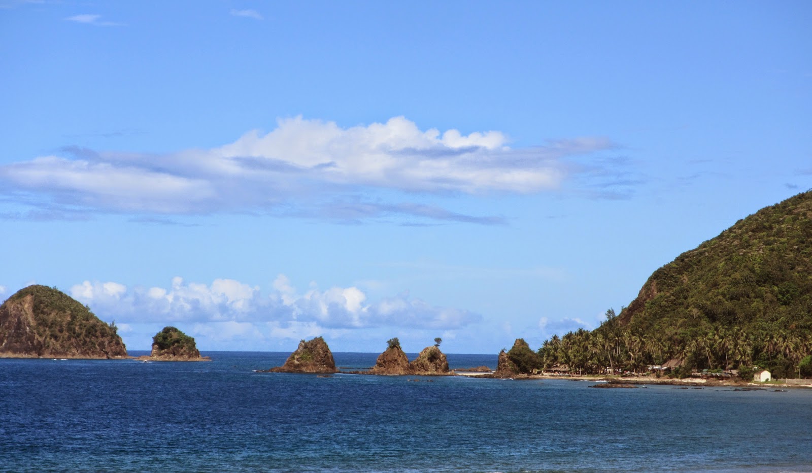
Diguisit rock formations at Aniao Islets


Baler is becoming popular as a destination to visit due to its proximity to Manila, that is, for road travel of more than six hours, not to mention that it offers varied tourist destinations and activities like surfing, beach and island hopping, nature trek, spectacular sunrise viewing, and a few more.

The statue of Pres. Manuel L. Quezon fronting the Museo de Baler


Our group of three left Cubao at 12:15 midnight boarding a Genesis airconditioned bus. We had a bus stop at around 3:00 A.M., I suppose in Nueva Ecija. The weather was good and the night was so inviting. I frequently peeped in the window of the bus and the darkness of the night showcased countless of stars above the sky.

The 600-year old giant balete tree


We arrived in Baler at 6:30 A.M. and we headed to our booked accommodation at Jam Jens Lodge through our contact Kuya Marlon but our reservation was no longer available since we were supposed to leave Manila at 7:30 P.M. based on the blog we have read. But the bus schedule was moved without definite time and so we waited till the actual departure of our bus.

The interior part of the balete tree


Good that Kuya Marlon, the owner of Jam Jens Lodge allowed us to use their residential toilet and bathroom facilities for clean-up for free. Without sleep, we pushed through for a breakfast in the rolling store just adjacent to Baler de Museo, our first tourist destination. The museum itself has equipped us with so much history about Baler in particular and Aurora in general.

Part of the trail leading to Ditumabo Mother Falls


It was not difficult for us to move around since we chartered a tricycle of Jam Jens for a day tour package at P1,000, literally for the whole day including the points where we bought our personal stuff and have our lunch and dinner.

one of the few bamboo bridges as part of the trail to Ditumabo Mother Falls


Just two blocks away, we visited the replica of Doňa Aurora’s ancestral house, the wife of the former Commonwealth President Manuel L. Quezon. The former was born in Baler and in fact the province got its name after her. Across the street is the Baler Church with its patron saint of San Luis Obispo de Tolosa. The church has a significant role in the history of the Philippines as it served as site of the “Siege of Baler” during the Philippine Revolution from 1898 to 1899.

An elevated concrete trail leads close to Ditumabo Mother Falls


We had a 30-minute drive to Barangay Quirino of the next municipality in Maria Aurora where the giant balete tree in enshrined in a converted lot to a park. It charges an entrance fee of P5 for kids and P10 for adults. Makeshift stores and souvenir shops surrounds the area.

It is believed this Banyan tree is the largest in Asia or locally known as balete tree. It is so huge that the size of the roots that it occupies is about 10 to 15 meters in diameter and it is possible for 15-20 adult people to squeeze into the center of its root network and the tree is about 60 meters tall. Because of its age, it has also been known as the “Millennium tree”. Getting inside the tree is the most thrilling part. Local kids are willing to tour the guests inside at a minimal tip.

The mini-falls few meters from Ditumabo Mother Falls


Ditumabo Mother Falls was our next destination where we had another 40-minute drive to San Luis, another municipality of Aurora. The tricycle we boarded just parked down the hydroelectric plant. From there, we had a mixed of river and dry trail trek. At some points, we had to have rock scrambling. We crossed few bamboo bridges and along our way giant water pipes leading to the falls.

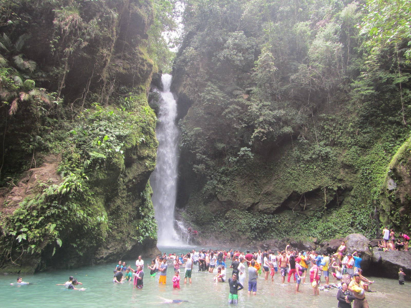
The crowded Ditumabo Mother Falls


The registration point to the water falls is so strict that no food and water is allowed beyond that point. Everything except camera and swimming gears has to be left at the registration point. No entrance fees are charged though you have to give a donation.

The Diguisit Water Falls


It was surprising to see that by the time we visited the Ditumabo Mother Falls, it was crowded with lots of people eager to experience this amazing nature showcase. The water was cold but it was very inviting to have a swim on its spacious and deep basin. The dramatic cliffs that hosts the powerful drop of the water falls are as spectacular as the water falls itself. By the time, we went back, some eateries and snack shanties were available to cool and feed us.

The Diquisit Beach


From San Luis, we had more than one hour drive heading to Diguisit Water Falls. It is accessible since it is just along the highway. From the opposite part, the scenic Baler Bay can be seen at some point and the totality of the Diguisit Rock Formations and the Aniao Islets can be captured.

The scenic Diguisit Beach


We had so much time then and so we stayed longer in Diguisit Beach Resort though as we drive back, we drop by again at the Diguisit Water Falls.

A swimming pool at the Diguisit Beach Resort


There is an entrance fee at the Diguisit Beach Resort and vehicles are paid separately for the entrance. Open and enclosed showers are available also.

A closer look of the Aniao Islets


Driving along the highway is quite breathtaking as you see the whole picture of Baler Bay and its neighboring islets. At some points, we obliged ourselves to stop and have a better picture with Baler Bay as the backdrop.

The Tromba Marina Sculpture


Tromba Marina sculpture is symbolic of the eight survivors of the tsunami which devastated Baler on December 27, 1735 since they climb to Ermita Hill, the highest point of Baler. From the Ermita Park, a concrete stairs of 278 is climbed to reach the highest peak where these survivors stayed where a giant cross is erected.

From atop the Ermita Hill Park


Staying on top of Ermita Hill is just relieving and refreshing as fresh sea breeze coming from Baler Bay gently touches your face. This place is so perfect to unwind. From this point, you can see the whole of Baler town, Sabang Beach, Cemento and Dima-Dimalangat Islet.

The 278 steps leading to the Giant Cross


Not all guests would brave to climb the 278 steps leading to the symbolic giant cross. When you dare do it, you would feel as if you were a part of the historic escape of the Tromba Marina survivors.

The historic giant cross landmark


Another 40-minute drive followed heading back to our accommodation in Sabang Beach to have a clean-up and freshen up.

Ending my Sunday with a Holy Mass at the Baler Church


As part of conserving electricity, the parish church celebrates holy mass outside the church. But it was better to stay outside since it is hot inside even if the electric fans are on..

Sunrise at Ampere Beach


Excited to witness a sunrise at Ampere Beach located in the municipality of Dipaculao, I woke up as early as 4:00 A.M. I was alone boarding the chartered tricycle. We waited till 6:00 A.M. but it was cloudy and no magnificent sunrise has unfolded to my sight. I was disappointed that it was a total failure then.

This rewarding scenery is more than enough to appease me


Driving back to my accommodation though was quite rewarding as I have seen a lot of sceneries that only a rural Baler can offer.

The replica of Doňa Aurora Quezon ancestral house


Before I finally returned to my accommodation from my Ampere trip, I dropped by at the Doňa Aurora Quezon ancestral house since the other day, I could not get a better picture since it was flocked with a crowd of tourists.

A cozy accommodation seen along my way, Bahia, I suppose


There are a lot of expensive accommodation in Sabang beach resort and two of them are the Bahia and Costa Pacifica. The following pictures showcase the elegance and grandeur of staying in the prime Baler accommodation of Costa Pacifica.

Part of Costa Pacifica


Part of Costa Pacifica


Part of Costa Pacifica


Part of Costa Pacifica


Tuesday, May 27, 2014

OUR LADY REGINA ROSARII

Location: Sitio Aguho Street, Sampaloc, Tanay, Rizal, Philippines
Visiting Time: 8:00 A.M. to 5:30 P.M. except Tuesdays
Coordinates: 14°30′N 121°17′E
Total Land Area: 13.5 hectares
Nearby Cities and Municipalities: Antipolo, Pasig, Angono, Taytay and Binangonan
Descriptive Summary:
Our Lady Regina RICA with RICA means Rosarii Institute for Contemplation in Asia was founded by the Dominican Sisters of Regina Rosarii in 2009 where it is situated in a diversified landscape of hills, valleys, forests, brooks, waterfalls, grasslands, and gardens. The statue of Regina Rosarii stands 71 feet. This place is an ideal one to experience silence, serenity and simplicity in a world of crisis, chaos and confusion.

View Regina Rosarii Institute for Contemplation in Asia in a larger map


Our Lady Regina Rosarii


EPIC PARC RAINFOREST CAMP (TANAY, RIZAL)

Location: Brgy. Bayucan, Sampaloc, Tanay, Rizal, Philippines
Coordinates: 14°30′N 121°17′E
Total Land Area: 20,000 square meters
Nearby Municipalities: Taytay, Binangonan, Angono
Nearby Body of Water: Laguna de Bay
Descriptive Summary:EPIC PARC which stands for Ecological Playground Integrated Commune for Prayer, Adventure, Recreation Culture is a 200-hectare rainforest nestled in the municipality of Tanay --- a part of Rizal province with pine trees, mountainous slopes, greeneries with breathtaking scenery and diverse landscapes with countless species of flora and fauna. As per record, it has sightings of 76 birds and century-old trees, wild and exotic plans abound.

Note: Since Google has no existing locator map of Epic Parc, the map provided here is the town of Tanay town proper which is still a 40-minute drive away from the place.


View Tanay in a larger map


A tree house in the midst of the Camping Ground


Tanay EPIC PARC Rainforest Camp offers a total relaxing stay as it has the best features which compliment nature. It promises you a one-package experience that is refreshing, educational, spiritual and eco-adventure that heals, recreates and revitalizes.

Part of the Rosary Trail


It has several unique nature trails that some are for relaxing and peaceful strolls during which campers can appreciate the beauty of the forest. Other trails offer rugged terrain for the thrill seekers.

The Anunciation Mystery: Part of the Rosary Trail


It has Rosary Trail which is a place for reflection and meditation. Another is Elma’s trail which is a 700-meter narrow, steep and muddy trail.

Part of the camping ground


You may also want to experience Durianan and Dagat-Dagatan Trails which is appropriate for trekking, jogging and running a race ala Suvivor Philippines as the ruggedness and wilderness of the forest challenges the camper’s journey back to the camp.

The Chapel of Our Lady of Queen of Heaven and Earth


Holy masses are officiated by invited priests if requested by the organizers of the retreats or other activities and functions held in this venue.


The EPIC House is a beauty all its own, the crowning glory of the place. It serves as the residence of the owner, Mrs. Annabelle P. Brown. She is also the President of the Alalay sa Pamilya at Bayan Foundation, Inc.

The usual amenities of a room or accomodation


Though, this camp is quite an isolated location, there is electricity power supply and so gadgets can be charged like mobile phones and other related stuff.

The spacious mess hall


The Mess Hall serves as the main dining area and reception lounge. There is specific schedule of serving meals which should be strictly followed.

Guests and Retreatants enjoying their sumptuous meal


The Culinary team of EPIC PARC are expertise in their field as the possibilities of bringing you the cuisine you like is endless. Just include it in your meal plans and presto!!!! they will be serve in your platter.

The way leading to the monkey trail


The Camp offers varied accommodations from camping grounds to standard rooms, dormitories and cottages good for more than 500 campers at one time.

The Amphitheater


Amphitheater is stone-laden, rip-rapped and open air. It is an excellent venue to perform and showcase one’s talents and skills.

ACTIVITIES
TEAMBUILDING 22 courses
TREKKING/TRAILS Rosary Trail, Dagat-Dagatan, Durianan & Elma’s Trail
GROUP DYNAMICS Bird and Fireflies Watching, Star and Moon Gazing, Bonfire


TOUR AND SEMINAR PACKAGES
TOUR CATEGORY PACKAGE ADULTS YOUTH
OTHER INCLUSION
Day Tours Tour 1 P200 P100 Tour of the ground only
Tour 2 P500 P400 With packed lunch (rice toppings with veggies and drinks
Tour 3 P1,000 P800 With Seminar P1,500/with served lunch at dining hall, use of Social Hall & Teambuilding facilities
Overnight Tours Tour 4 P2,000 P1,500 With Seminar P2,500/Overnight (24 hours) with 3 meals
Tour 5 P2,500 P2,000 With Seminar P3,000/Overnight (36 hours) with 4 meals and snacks
Tour 6 P3,000 P2,500 With Seminar P3,500/Overnight (48 hours) with 6 meals and snacks


FOR INQURIES AND BOOKINGS, PLEASE CALL:

Marievic Maala (09175026612; 5029917)
Mayet Timones (09295937328; 6375200)
Brgy. Bayucan, Sampaloc, Tanay, Rizal
apbfoundation@ymail.com