Tuesday, May 26, 2009

MOIUNT PALAY-PALAY CLIMBS (PICO DE LORO)

Location: Maragondon (Cavite) and Nasugbu (Batangas), Philippines
Major jump-off: DENR Station, Magnetic Hill, Ternate, Cavite
Minor jump-off: Sitio Fronda, Brgy. Papaya, Ternate-Nasugbu Highway, Nasugbu, Batangas
Elevation: 664 MASL (2,179 feet)
Days required / Hours to summit: 1-2 days / 2-5 hours
Specs: Minor climb, Difficulty 3/9, Trail class 1-3
Distinctive features: With a massive monolith adjacent to the summit, forests, scenic views of Cavite

My first two climbs in Pico de Loro were: June 12-14, 1998 and March 2-3, 2002. Our jump-off point was in Brgy. Papaya, Nasugbu, Batangas. It was so called Pico de Loro since its peak resembles to beak of a parrot and it has two peaks of which one is a massive stone which can only be climbed through harness.

Our group conquering the massive monolith of Mount Palay-Palay


The first time we climbed this mountain was with the EMBO Mountain Climbers and few acquaintance friends. It was the time when we were waiting for the next climb that Noemi Amador, who used to be my companion in all of my outings and major trips, tried to visit for the first time Majayjay Falls in Sta. Cruz, Laguna dated May 16 and 17, 1998. We met friends there in the person of: (1) Alexander “Alex” P. Vilar of Asian Spirit Airlines; (2) Ma. Rozanah “Chen-chen” G. Irisary and (3) Emmanuel Provido “Nuel” A. de Castro II of Wesarv Systems International; and (4) Oscar “Onching” F. Azarcon. The four invited us to join their mountaineering club called EMBO which stands for Exploration of Man Beyond ‘Orizon. Alex, Nuel and Onching were founding club members. We also met there some friends like Leonardo “Toti” M. Villamor of Toyota Motors Paranaque, Diego G. Castillo and Arnel M. Evangelista.

After a few get together and constant phone calls, our EMBO friends invited us to join their June 12-14, 1998 Pico de Loro Centennial Climb situated in Nasugbu, Batangas. This time, we invited Aldwin de Guia and Mon Crisol to join us including Noemi Amador and Jenny Ferrer. We were all sixteen participants of the climb namely: (1) Nuel de Castro; (2) Alexander Vilar; (3) Onching Azarcon; (4) Michael “Mhike” B. Fernandez – another EMBO Mountaineering Club founding member; (5) Chenchen Irisary; (6) Evelyn F. Varias and all the rest including myself were guest climbers, namely: (7) Jesus “Jojo” F. Borja Jr. of KLT Fruits, Inc.; (8)Emee P. Durban of UCPB Herrera Branch; (9) Mark Stephen “Mark” P. Endonilla; (10) Raymund Crisol of Allied Bank Edsa Extension Branch; (11) Aldwin de Guia; (12) Bernadette “Badette” C. de Jesus of Nesic Philippines, Inc.; (13) Noemi Amador; (14) Jenny Ferrer; (15) Diego Castillo; and (16) I.

A group picture at the summit


It was not purely a mountaineering activity since we also experienced rock climbing using harness to reach the other peak of the big massive rock formation of Pico de Loro. After descending the mountain, we went to Kutad Cove where we had night swimming and socials in a bonfire. We pitched our tents along the beach line. The following day, June 14, we almost spent our day in the beach together with the famous actor, Aga Mulach who’s enjoying jetski. He had with him his relatives boarding a private yatch.

The second time around, I was supposedly joining a qualifing test for the March 26-31, 2002 Mt. Halcon Major Climb and so I joined the March 2-3, 2002 Pico de Loro Climb in Nasugbu, Batangas. I thought then it would be less exciting for the second time but as the climb progressed, it turned out to be more challenging since unlike before this one was only a day climb. It helped us gain more stamina, endurance and strength as seasoned (?) and professional (?) mountain climbers. Together with me were my fellow PNB Mountaineering Club members, namely: Erwin C. dela Cruz (Expidition Leader); Christian Tagle (Lead Man) and his father, Arthur; Eduard “Jun” V. Mangyao, Jr.; Ricky Eslao; Connie Vasquez; Enrique “Ike” S. Abad; Jing Gumba; Menchu Segovia; and Antonio Alcaraz. Jun Mangyao served as my inspiration in the whole duration of the climb. Our entry point was in Sitio Hamilo, Brgy. Papaya boarding a jeepney from Nasugbu town proper. We started from the jump-off point at 11:00 A.M. of the first day and was at the peak at 2:38 P.M. We were back in the jump-off point at almost 5:00 P.M.

Spending an overnight at the Kutad Cove after our Mount Palay-Palay Climb


We boarded a jeepney to Brgy. Papaya proper and hired a motorboat to go to Kutad Cove in Hacienda Look owned by Henry Sy and Associates through a 20-minute motorboat ride from Brgy. Papaya port. We had our overnight along the beach of Kutad. Our socials was quite memorable in the sense that both Jun Mangyao and I were identified with each other during the body shots game. That game really gave me a sort of emotional satisfaction and hoped then it would not end. And at the same time, the game gave us an opportunity to know each other and became closer. It was on that night that Ricky and Connie confirmed their intimate relationship. I slept earlier at 12:00 midnight while the rest at 2:00 dawn. For the second time, I shared with the tent of Ike Abad together with Anton Alcaraz. The following day, we started our activity in cooking our breakfast and had swimming. It was such a very refreshing morning filled with so much fun and thrills. The sun was as playful as the group as it was not too hot to our tanning skin. Finally, our excitement diminished as our service motor boat arrived to cross us to Brgy. Papaya proper at almost 11:00 A.M. After our late lunch in Nasugbu, we boarded an airconditioned BLTB bus at 4:30 P.M. and arrived in Manila at 6:40 P.M.


You may also want to read my blog post of the Summary of My 100 Plus Climbing Portfolio  and the detailed blog post of my Asia Trilogy Climbs of Mount Fuji Climb (Japan), Yushan Climb (Taiwan) and Mount Kinabalu Climb (Malaysia).


THANKS FOR READING!


MOUNT UGO CLIMB

Location: Nueva Vizcaya and Benguet
Jump-off points: Kayapa, N. Vizcaya; Brgy. Tinongdan, Itogon, Benguet
LLA: 16.31916°N, 120.80166°E, 2150 MASL (7,054 feet)
Days required / hours to summit: 2-3 days, 9-10 hrs
Specs: Major climb, Difficulty 5/9, Trail Class 1-3
Distinctive features: Pine forests, highland villages, views of Cordillera peaks

Having fun along the trail


I had two climbs in Mount Ugo dated June 4-6, 1999 and November 1-4, 2006 both under PNB Mountaineering Club. Like the Mt. Napulawan Climb, Mt. Ugo offers a very refreshing and cold climate and this is located in Itogon, Benguet which was my second major climb. The first climb of the mountain marked the 9th anniversary of PNB Mountaineering Club. Mt. Ugo’s peak of 7,400 feet, is considered the highest of the Cordillera Mountain Ranges which covers partly of Nueva Vizcaya and Benguet, Mountain Province.

Resuming the second day trek from our campsite where we spent overnight


Mount Ugo is the highest peak in a chain of mountain ranges with an elevation of 2,150 meters above sea level or 7,052 feet. It is located in the boundaries of the provinces of Nueva Vizcaya and Benguet. Its name was derived from the Ibaloi word “Ugoan” which means “to cut the neck of throat”. It was discovered as one of the most favorite mountains to scale by the mountaineers when there was a tragic PAL plane crash in 1987 just few meters below its peak. Some professional mountaineers then volunteered to accompany the bereaved families of the plane crash victims with the assistance of the local guides in visiting the site for memorial activities. As such, its cool climate, unique scenery and flora had enticed some other mountaineers to experience scaling the mountain. PNB MC being a close ally to PALMC thru our very dear friend, Mr. Romy Antonio had shared scaling this majestic mountain as early as 1996 and by then became one of the most favorite peaks for induction climbs.

Heading to the summit


The second climb Mount Ugo dated November 1-4, 2006 was perfect since we were lucky to have a good weather. It was my only major climb for the year 2006 after my 11-month Qatar Work Tavel. 12 of the 13 pictures here were all from the second climb. The climb is consisting of 19 participants with six inductees and three guests. The jump-off point was in Kayapa, Nueva Vizcaya where we boarded a bus from Manila and we descended to Brgy. Tinongdan of Itogon, Benguet.

While at the summit


We had our chartered airconditioned bus which fetched us all in PNB Financial Center at almost 11:00 P.M. We were consist of 42 participants broken down into 33 regular members, 7 initiates and 2 guests. The members were: (1) Jose Enrique “Ike” S. Abad of PNB IT Group; (2) Johanna “Hannah” C. Acuna of Allied Bank – Head Office; (3) Rodante “Dante” D. Adajar of PNB PAIRD; (4) Sandy A. Alhambra of PNB Trust Division; (5) Noemi O. Amador of Allied Bank – Head Office; (6) Laudimer “Omel” G. Arandia of Blue Chips Management Corporation; (7) Maricris “Chris” B. Ballon of Allied Bank – Divisoria Branch; (8) Juanito “Jhun” C. Banela of CIBI; (9) Brenda B. Bernabe of Aztec Philippines Corporation.; (10) Policarpo Gregorio Osmundo “Ding” N. Capunitan; (11) Elmer C. Daus of PNB Office of SVP Ma. Cristina G. Munoz; (12) Ma. Salome “Sally” A. de la Cruz of Peoples Insurance; (13) Noel “Wewel” N. Dollentas of PNB Economics & Research Division; (14) Mary Jane “Jing” V. Gumba of Bank of Commerce – Head Office; (15) Norita “Norie” R. Jacala of PNB Cable Division; (16) Janet T. Lazarte of PNB GSD Accounting; (17) Manuel “Manny” I. Llesol of PNB Personnel Human Resource Policies and Planning Division; (18) Edmundo “Edu” C. Llondres of PNB SAAD; (19) Fidel O. Mendoza of PNB GSD; (20) Alvin J. Pascual of PNB Office of SVP Leopoldo A. Manuel; (21) Severo “Roy” Y. Pison IV of PNB Economics & Research Division; (22) Joseph “Jinky” G. Quiray of Peoples Insurance; (23) Sandra S. Reyes of PNB Trust Division; (24) Fortunato “Bong” C. Rosales of Pardee Computer; (25) Elino “Jun” Q. Sorquia, Jr. ; (26) Antonio “Tony” P. Sundiang of Tradecom Asia Pacific Gorporation and former PNB SVP of Trust Division; (27) Belinda Fatima C. Tan of Peoples Insurance; (28) Alan A. Valenzuela of Peoples Insurance; (29) Victor C. Victorino of CIBI; (30) Rolando “Rolly” O. Villanueva – PNB MC President and expidition leader; (31) Alberto “Abet” M. Zapanta, Jr. of PNB Reengineering Division; and (32) I.

Starting to descend from the summit


The pine forest as part of the trail in descending from the summit


On the otherhand, our initiates were: (1) Genevic “Gene” B. Baria of Angelus Medical Center; (2) Alona C. Beliganio of Belkin Management Consultancy Phils., Inc.; (3) Raymund “Mon” S. Crisol of Allied Bank – Aguirre Branch; (4) Erwin C. de la Cruz of Angelus; (5) Pompei Lopez; (6) Ma. Jeannie T. Mendoza of Allied Bank – Monumento Branch; (7) Norberto “Abat” Miranda, Jr.; and (8) Renato “Ren” S. Solinap of PNB International Eximbills Processing Division. There were two guest climbers, namely: (1) Ma. Concepcion of PNB Personnel Human Resource Policies & Planning Division, and (2) Ma. Consuelo “Connie” T. Vasquez of Alsons Cement Corporation. I considered this as my worst climb since there was a typhoon which started in the late afternoon of Day One until we reached the jump-off point.

Tinongdan hanging bridge


Almost done trekking leading to the barangay hall where I received my certificate of climb completion


You may also want to read my blog post of the Summary of My 100 Plus Climbing Portfolio  and the detailed blog post of my Asia Trilogy Climbs of Mount Fuji Climb (Japan), Yushan Climb (Taiwan) and Mount Kinabalu Climb (Malaysia).


THANKS FOR READING!

MOUNT TARAK CLIMB

Note:  Tarak Ridge is a part of Mount Mariveles

While at Peak 1 of Mount Mariveles

After a long absence in mountaineering activities since November 29, 1999 or 2 years, 2 months and 24 days to be exact, I rejoined again PNB Mountaineering Club’s climb with so much enthusiasm and excitement. The said climb was in the 3,700 feet Mt. Tarak in Mariveles, Bataan dated February 23 and 24, 2002. I felt then, it was my first time to climb a mountain. We were consist of twelve participants, namely: Fellow Philnabankers: Arthur S. Tagle and 14-year old son, Christian Dominique (also an inducted member); Ricky N. Eslao; Enrique “Ike” S. Abad; and Tony M. Alcaraz; former Philnabanker Jenny Ferrer; Erwin C. dela Cruz of Angelus Medical Center as the Expedition Leader; Eduard “Jun” V. Mangyao, Jr. of USAID as Lead Man; Jing V. Gumba of Bank of Commerce; Menchu B. Segovia; Connie Vasquez and I. I considered this climb as one the finest since it gave us an excellent weather condition, ideal group size, perfect and scenic campsite; good camaraderie as all the participants were seasoned regular members who has been together in previous climbs and the logistics were fairly good.

Enjoying the cold morning at Tarak Ridge campsite

We first boarded Mt. Samat Ferry Express in CCP Bay Terminal at 8:30 A.M. of the first day (Feb. 23) and arrived in the Port of Capinpin, Orion, Bataan at 9:32 A.M. From the port, we boarded a chartered jeepney at 9:55 A.M. and arrived in Alas-asin Barangay Hall of Mariveles at 10:51 A.M. We started our trek at 11:00 A.M. and we reached the Gate Point of the mountain at almost 12:00 noon where we had our lunch. Gate Point is a grassy clearing with two big shady trees grown apart and the point where trekking cardiac assault starts. We resumed trekking again at 12:35 noon heading for Papaya River and stayed there for a rest for more than 30 minutes. An almost two hours cardiac assaults followed and reached the scenic campsite where we pitched our tents at 4:45 P.M. Hours followed were fun-filled even after our dinner and had socials until 11:00 P.M. This evening affair personally marked a spectacular night for me. We endlessly sang songs, talked and laughed as my companions drank bottles of gin diluted with pomelo. The moon then was right above us; full and simply huge.

The Tarak Ridge

The following day (Feb. 24) at 7:10 A.M. was our summit assault for 30 minutes and was back in our campsite after an hour. Early morning at the campsite has a soothing cool wind that inspired us to cook our breakfast and for our packed lunch. The magnificent morning scenery offered us an irresistible invitation to have some pictorials. We started descending the beautiful mountain at 8:50 A.M. and took our lunch in the Gate Point where we stayed there for almost two hours and had siesta time until 1:30 P.M. The group left me at 4:00 P.M. in Alas-asin Barangay Hall for Port of Capinpin while I proceed to Bataan Export Processing Zone in Mariveles alone.

You may also want to read my blog post of the Summary of My 100 Plus Climbing Portfolio  and the detailed blog post of my Asia Trilogy Climbs of Mount Fuji Climb (Japan), Yushan Climb (Taiwan) and Mount Kinabalu Climb (Malaysia).


THANKS FOR READING!

MOUNT PULAG CLIMB


Spending overnight at Camp 2

My fourth major climb under PNB Mountaineering Club was Mt. Pulag on November 27 to 29, 1999. Mt. Pulag is the third highest mountain in the Philippines which is being dubbed as the “roof of Luzon” is 2,930 meters or 9,610 feet. The first two highest mountains are in Mindanao wihich are both inactive volcanoes with Mount Apo in Davao as the highest mountain at 2,954 meters or 9,692 feet and followed by Mount Dulang-Dulang at 2,938 meters or 9,637 feet located in Kitanglad Mountain Range. Mount Pulag is not in itself a volcano. This majestic mountain has been part of the folklore of the various mountain tribes for generations. It’s believed to be the home of forest spirits who protect the tribes and assure bountiful harvests. For me, climbing this mountain is a feast for my senses. The slopes are covered with pine trees and grassy meadows. The soft tuffs of grass that cover the trail cushion every step to the summit. The air was crisp and gentle blows over the mountain as we ascended towards the summit that gave us a very refreshing atmosphere and the spectacular summit panorama. The mist was all around me and for one moment then, I knew what it felt like to walk in the clouds. Although, our climb was gradual, the altitude, distance and cold weather as well as occassional downpour made our trek slightly difficult. Thus, we made rhythmical squelching sounds.

The said climb has 54 participants which consist of 43 members, 2 initiates and 9 guests. The members were: (1) Rolly Villanueva – expidition leader; (2) Jose Enrique “Ike” S. Abad of PNB IT Group; (3) Ricardo “Ricky” N. Eslao of PNB IT Group; (4) Norberto “Abat” Miranda Jr.; (5) Antonio “Tony” M. Alcaraz of PNB IT Group; (6) Sandy A. Alhambra of PNB Trust Division; (7) Elmer C. Daus of PNB Office of SVP Ma. Cristina G. Munoz; (8) Romeo “Jun” B. Galang, Jr. of PNB IT Group; (9) Janet I. Lazarte of PNB GSD Accounting; (10) Manuel “Manny” I. Llesol of PNB PAIRD; (11) Edmundo “Edu” C. Llondres of PNB SAAD; (12) Norman G. Mosuela of PNB IT Group; (13) Jessica “Je” M. Parina of PNB Corporate Affairs Office; (14) Severo “Roy” Y. Pison IV of PNB Economics & Research Division; (15) Sandra S. Reyes of PNB Trust Division; (16) Benito “Benet” L. Sakdalan of PNB Corporate Affairs Office; (17) Marigrace “Grace” E. Serafica of PNB ATM Division; (18) Alberto “Abet” M. Zapanta of PNB Reengineering Division; (19) Johanna “Hannah” C. Acuna of Allied Bank –Head Office; (20) Ma. Noemi O. Amador-Capunitan of Allied Bank – Head Office; (21) Maricris “Chris” B. Ballon of Allied Bank Divisoria Branch; (22) Raymund “Mon” S. Crisol of Allied Bank – Aguirre Branch; (23) Ma. Jeannie I Mendoza of Allied Bank – Monumento Branch; (24) Juanito “Jun” C. Banela of CIBI’ (25) Victor C. Victorino of CIBI; (26) Laudimer “Omel” Arandia of Peoples Insurance; (27) Alona C. Beliganio of Belkin Management Consultancy Philippines, Inc.; (28) Alan A. Valenzuela of Peoples Insurance; (29) Genevic “Gene” B. Baria of Angelus; (30) Erwin C. de la Cruz of Angelus; (31) Nenita “Nenet” A. Caringal of SM Lazo Medical Center; (32) Omega “Megs” P. Olano of SM Lazo Medical Center; (33) Joselito “Lito” D. Perinion of SM Lazo Medical Center; (34) Andrew M. Bay of CITEM; (35) Jose Martin F. Duyala of CITEM; (36) Brenda B. Bernabe of Aztec Philippines Corporation; (37) Mary Jane “Jing” V. Gumba of the Bank of Commerce – Head Office; (38) Fortunato “Bong” C. Rosales of Pardee Computer; (39) Ma. Menchu B. Segovia; (40) Elino “Jun” Q. Sorquia; (41) Ma. Consuelo “Connie” I. Vasquez of Alsons Cement Corporation; (42) Wilma S. Mosuela of PNB IT Group; and (43) myself.

Enjoying a calm morning at Camp 2 with my climbing buddies

There were only 2 initiates, namely: (1) Arthur “Art” S. Tagle of PNB IT Group and (2) Marco Rei Antonio “Marco” W. del Mundo of CITEM. The 9 guests were: (1) Marilyn M. Santiago of PNB IBS Group and an Ayala Mountaineer and (2) his boyfriend, John “Totit” R. Jaromahum; (3) Katerina “Kat-kat” S. Claraval of CITEM; (4) Mark Victor V. Sales of CITEM; (5) Arnold B. Enciso of CIBI; (6) Phillip M. Diaz of Allied Bank – Head Office; (7) James L. Bulanon – brother of Menchu B. Segovia; (8) Glenn Carlos A. de Guzman – my guest; and (9) Renee “Dee” R. Molina of Allied Bank – Head Office.

Baguio City was a part of this trip as our chartered bus was only up to this place. We boarded three jeepneys from Ambangeg in a 10-kilometer steep track for almost four hours going to Babadak Rangers Station in which we travelled through a very rough and muddy road which lasted for more than six hours or from 5:20 to 11:55 A.M. The trek from the jumpoff point started at almost 1:00 P.M. despite the heavy downpour, freezing temperature and strong winds. The following day of November 28 was very rewarding as we had ample time to photograph the beautiful scenery within the vicinity of The Plateau and Myra’s Peak and socials followed until 3:00 P.M. We had our summit assault at almost 4:00 P.M. and induction of initiates followed. Back in our campsite at around 5:30 P.M., the view was fantastic --- the sky looked like God’s palette, as He was about to finish painting the day into night.

We had a disastrous night because a heavy downpour coupled with very strong winds leveled down some of our tents but not ours in the group of Roy Pison and Jun Galang. Some were soaked in water as the whole camp was flooded. The following day, as we descended to Babadak Rangers Station for Baguio City, I felt an incredible sense of nostalgia as I was completely leaving the majestic mountain.


You may also want to read my blog post of the Summary of My 100 Plus Climbing Portfolio  and the detailed blog post of my Asia Trilogy Climbs of Mount Fuji Climb (Japan), Yushan Climb (Taiwan) and Mount Kinabalu Climb (Malaysia).

THANKS FOR READING!

MOUNT PINATUBO CLIMB

Location; Between the boundaries of Zambales, Tarlac and Pampanga, Philippines
Major jump-off: Brgy. Sta. Juliana, Capas, Tarlac
Elevation: 960 MASL (3,150 feet)
Days required / Hours to crater: 1 day, with options of: 45 min 4×4 + 2 hrs hike OR 4-5 hours trek
Specs: Minor climb, Difficulty 2/9, Trail class 1
Distinctive features: The trail has narrow shallow O'Donnell water streams, it has desert-like flat, long Crow Valley Gunnery Range which leads to its magnificent crater lake with color blue green to deep blue depending on the season.

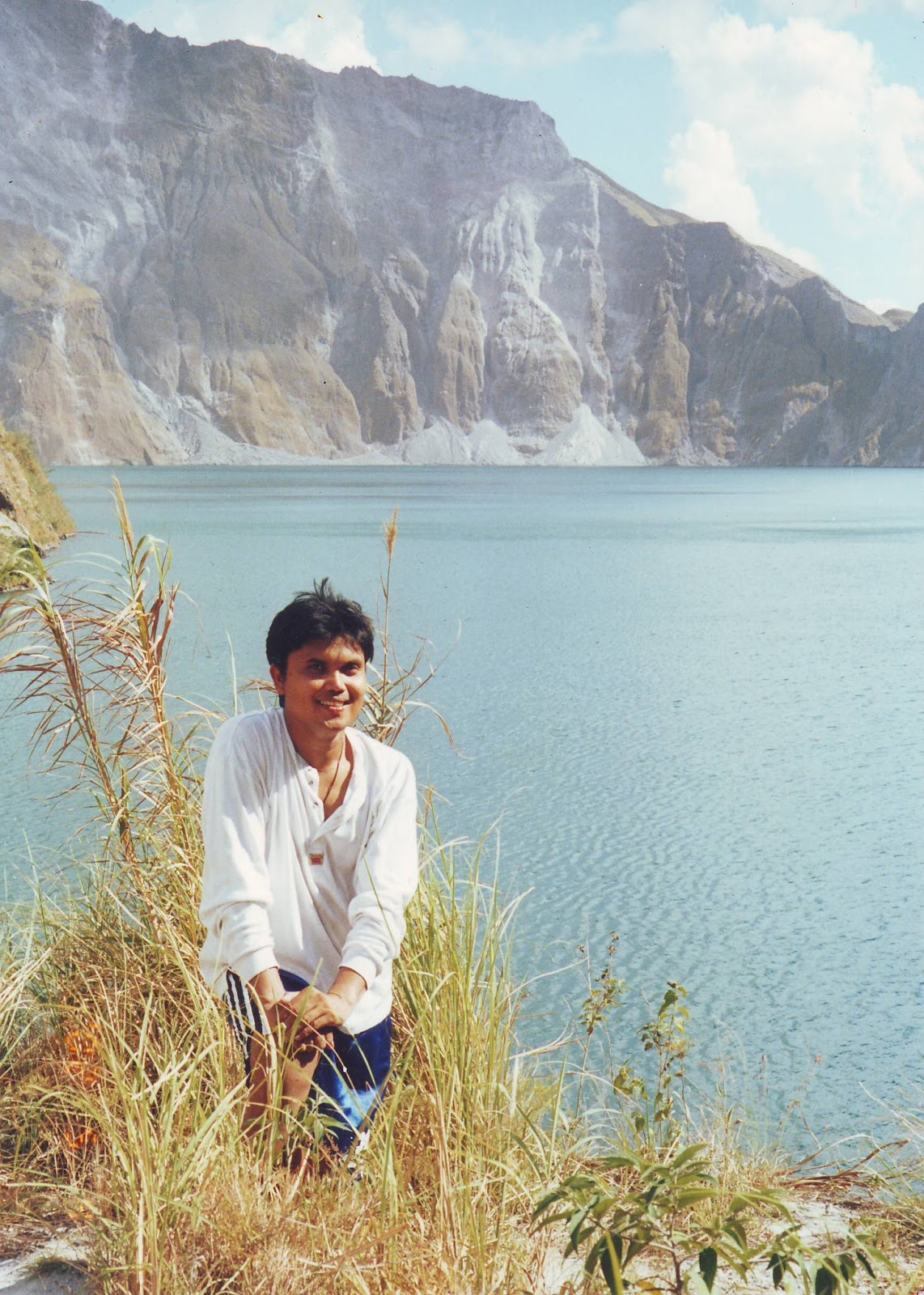
The majestic crater lake of Mount Pinatubo


The May 4-5, 2002 Mt. Pinatubo Climb was my last climb with PNB Mountaineering Club before leaving for my Uganda volunteering placement but one of the most memorable mountain scaling I ever had. It was absolutely a wonderful experience due to the magnificent sceneries from start to finish where there was no boring and dull moment for my feasting eyes salivating in awesome appreciation. I was actually hesitant to join then since a lot of those who visited this mountain told us how they suffered their climb due to the extremely hot sun that almost lead them to retreat and surrender. But our climb offered such a perfect weather where the sun was playful enough to give us a not-so-hot trekking sessions for us to enjoy an endless picture taking. There were a lot of rampaging creeks that offer such cool waters every time we soak our bodies Except for the creeks, everything seemed to be dry but gentle blows of cool breeze give us a refreshing feeling. I could say that Mt. Pinatubo is perfect for photography enthusiasts both amateurs and professionals.

A few narrow and shallow water streams crossings


On the other hand, it is with pride to include Mt. Pinatubo in my mountaineering profile of activities since it is so famous throughout the world. As per record, the most destructive volcano in the Philippines is Mount Mayon of Albay with 46 eruptions. However, most of the foreigners knew it more than any other mountains in the Philippines with its very devastating eruption way back June 15, 1991 has completely invaded the international media mileage, after 450 years of peaceful slumber blowing off a 300 meter cap. A lot of stories and media footages were published. I learned that its volcanic eruption shot 35 kilometers into the sky, showering an area of 200 square kilometers with millions of tons of ash and rock and creating a crater jewel-blue lake 2.5 kilometers wide. Consequently, its force of explosion blew off its summit reducing its height from 1,700 to 1,400 meters (5,577 to 4,593 feet. Its legend tells us that Mt. Pinatubo is home to Apo Malyarik, “The Great Provider”and the spirits of the ancestors of some 30,000 nomadic Aeta Negritos found in the higher elevation settlements in Pampanga, Tarlac and Zambales Provinces. Mount Pinatubo is 90 kilometers or 55 miles north-west of the capital city of Manila.

Take the "Give-me-five" rest


Our group was actually manageable in the sense that we were only a total of eight persons, namely: (1) Jenny Ferrer, (2) Enrique “Ïke”Abad, (3) Eduard “Jun“ Mangyao and (4) Johanssen “Jojo” B. Capsa of USAID Manila Office, (5) Mary Jeanne Bejar Santiago of CITEM, (6) Eileen V. De Gala of PNB Balayan Branch, (7) Renee “Dee” Molina of Allied Bank – Head Office, and (8) me. We left Manila boarding an airconditioned Philippine Rabbit bus on the eve of May 3, 2002 at 9:00 P.M. It was Ike who actually organized the climb since he was in that place and he has a lot of relatives who assisted him to make our climb a successful one. We arrived in Ike’s residence in Brgy. Sto. Rosario, Capas, Tarlac at almost 1:00 dawn of May 4 and had our bedrest along Lake Tambo which is just 30-minute drive away from the jump-off point.

Having fun along the trail


We had an amazing morning as we woke up and had our breakfast along the tranquil Tambo Lake. We started our trek at around 8:00 A.M. The trail that we followed was the former Crow Valley Gunnery Range along the O’Donnell stream bed in which we used the entry point in Brgy. Sta. Juliana, Capas, Tarlac. It is actually a flat, long valley that leads right up to the crater. We had regrouping in the campsite located in the fool hill before a 20-minute assault to the crater at 1:00 P.M. It was really therapeutic to see the volcano’s lake crater which I can summed up as an enchanting reward for a fearless explorer like me. Though swimming in the crater is prohibited, our group disregarded the guideline and enjoyed the very cool waters of the lake instead. The following day, May 5, was purely a downhill trekking which started at almost 8:00 A.M. and was in the jump-off point at almost 12:00 noon. We had an hour drive boarding a 4 x 4 all-weather all-terrain truck owned and drove by Charlie M. De Jesus who is the husband of Ike’s sister-in-law back to Sta. Juliana where a lunch was served for us. Another hour of drive going back to Ike’s residence in Capas. We left in Capas at 5:00 P.M. and was home at almost 8:00 P.M.


You may also want to read my blog post of the Summary of My 100 Plus Climbing Portfolio  and the detailed blog post of my Asia Trilogy Climbs of Mount Fuji Climb (Japan), Yushan Climb (Taiwan) and Mount Kinabalu Climb (Malaysia).


THANKS FOR READING!


MOUNT NYARANGARA CLIMB

Location: Boundaries of Buhweju and Sheema Counties, Bushenyi District, Uganda, East Africa
Entry point: Nyakashaka Village, Bushenyi District
Exit point: Nyakyiragugu Village, Sheema Country
Elevation: 1,540 MASL (5,052 feet)
Days required / Hours to summit: 1 day / 2 hours
Specs: Minor climb, 2/9 Difficulty, Executive Climb
Distinctive feature: The trail is gradual and there are only two dominant species grow on it, the Eucalyptus trees, low-growing bushes and Ehongwa flowers making it very easy to trek to the summit

Not ready for the first climb since I was not in climbing outfit


I was not really ready for a mountain climbing in Uganda in terms of mountaineering outfit and gears since I never anticipated that it was a good place to continue my climbing hobby in the Philippines. Besides, the bulk of my plane baggage were work-related stuff due to my 14-month work there as documented in my blogUganda Work Travel

The trails in every mountain I climb in Uganda are relatively easy as compared to our mountains which are tropical and rain forests. Uganda has an average elevation of 1,100 meters or 3,609 feet above sea level. It not surprising that it has a cold climate and to add that its weather pattern is being influenced by Victoria Falls. Bushenyi, my place of assignment is in a higher elevation of 1,300 meters or 4,265 feet. Which means that it only takes 240 meters or 787 feet to scale Mount Nyakarangara from its jump-off point.

Overlooking the villages from the summit


I had two climbs in Mount Nyakarangara. I was with Stephen and Enock the first time I climbed the mountain dated August 25, 2002 and with Grant Gilbertson (British VSO Volunteer), Patricia Tivadar (Romanian Medical Doctor) and Behram Daruwalla (Indian National) The first time I climbed was exciting since it was my first to climb in a foreign country. This mountain is actually located between the borders of Buhweju and Sheema counties of Bushenyi District. I was with the company of two Ugandans, namely: Stephen Kataraiha (WRAF Rural Trust’s client) and Enock Bagyenda (WRAF Rural Trust staff). It was indeed a fun climb because the terrain was relatively easy and gradual.

At the summit with my VSO Colleagues: Behram Daruwalla (Indian) and Grant Gilbertson (British)


The trail was generally grown with low bushes, ordinary grasses and a few Eucalyptus trees. The weather that time was pretty cool and soothing winds refreshed us from time to time. Its peak offered such a great scenery overlooking the nearby villages and counties. I was also able to see in full picture and dimension some mountains situated far and near this mountain. There was only one similarity I noticed in these mountains --- they did not have thick forests but rather grown by bushes, ordinary grasses and a number of Eucalyptus trees. Some parts halfway to the peak of this mountain was burned down in preparation for the rainy season where tea is usually grown and cultivated.

Joining me at the summit were Behram Daruwalla (Indian) and Grant Gilbertson (British) with wife, Dr. Patricia Tivadar (Romanian national)


I never experienced any degree of difficulty in the whole duration of the climb compared to my fun and day climbs in the Philippines that most mountains’ terrains are quite difficult to climb. The location of this mountain is about 15 kilometers away from my VSO Uganda placement in Nyakashaka. Our group also trekked down the Obururuma Rapids in Nyakyiraguju River located in Karyanga Village of Igara county and still a part of Bushenyi District.

One of my afternoon walks at Obururuma Hillcrest adjacent to Nyakarangara jump-off point


You may also want to read my blog post of the Summary of My 100 Plus Climbing Portfolio  and the detailed blog post of my Asia Trilogy Climbs of Mount Fuji Climb (Japan), Yushan Climb (Taiwan) and Mount Kinabalu Climb (Malaysia).


THANKS FOR READING!


MOUNT NATIB CLIMB

Location: Orani, Bataan, Philippines
Major jumpoff: Brgy. Tala, Orani
Minor jumpoff: Kanawan (Hanging Bridge), Morong
Elevation: 1,287 MASL (4,222 feet)
Days required / Hours to summit: 1-2 days / 4 -5 hours Specs (Backtrail): Major climb, Difficulty 5/9, Trail class 1-3
Specs (Traverse): Major climb, Difficulty 6/9, Trail class 1-3
Distinctive features: Scenic views of Central Luzon; Woodlands; Tropical forests and it is infested with limatik (blood-sucking leech)

Sea of clouds at Mount Natib's summit


My fifth climb under PNB Mountaineering Club dated September 26 and 27, 1998 made a difference in Mount Natib in Orani, Bataan for it was the first time that I experienced a freezing night inside our tent and I considered it more memorable than Mount Batulao. Abet Zapanta, a senior member then, was my climb buddy. He was very supportive and awesomely inspiring companion. He was always there to help me when I needed him the most especially that the trail and terrain towards the peak was so difficult because the very stiff rocky slopes of the mountain were very slippery and some parts of it were so densely forested area.

The rocky, slippery, steep and limatik-infested trail


Mount Natib is located in the heart of Bataan Natural Park of 23,700 hectares or 58,500 acres in the midst of lowland dipterocarp rainforest. Its peak has an elevation of 1,253 meters or 4,111 feet. We were twelve then consisting of six members, five initiates and a guest. The members were: (1) Noel N. Dollentas – Expidition Leader; (2) Alberto “Abet” M. Zapanta – sweeper; (3) Norita “Norie” R. Jacala; (4) Romeo “Jun” B. Galang; (5) Sandy A. Alhambra and (6) Sandra S. Reyes. The initiates were: (1) Noemi Amador, (2) Juanito “Jun” R. Banela and Victor C. Victorino of Credit Investigation Bureau, Inc. (CIBI); (4) Roy Pison; and (5) I; and Henry “Joel” A. Dimacali, Abet’s friend, as guest climber. This time, we had a travel variation since we boarded M/V Stella Mariz Ferry Boat of Grand Seaway Ferries, Inc. from CCP Complex Port Terminal going to Lamao in Bataan and boarded a jeepney to Orani, Bataan up to the jump-off point. On our way back to Manila, we went to Balanga, Bataan in Brenda Bernabe’s house where a sumptuous lunch was served and back again to the Port of Lamao.

Regrouping before finally ascending to the cardiac assault trails


After the climb, it would be rewarding to spend a night on the refreshing Sinagtala Farm Resort


You may also want to read my blog post of the Summary of My 100 Plus Climbing Portfolio  and the detailed blog post of my Asia Trilogy Climbs of Mount Fuji Climb (Japan), Yushan Climb (Taiwan) and Mount Kinabalu Climb (Malaysia).


THANKS FOR READING!

MOUNT NAPULAWAN CLIMB

My induction to be a member of PNB Mountaineering Club

It was indeed a very memorable climb not only because of its side trips but because it was my first major climb in which I was inducted a regular member of PNB Mountaineering Club. The said climb was in Mount Napulawan in Hapao-Hungduan which is a part of Mountain Province dated November 28 to December 2, 1998. Climbing to the breathtaking summit of this mountain was really an endless trekking as we passed through several mountains. Notably, these mountains were all exciting and dramatic and immediately overawe myself as an onlooker. But I was prepared for this by all that I’ve known from the accounts given by the club’s members who already climbed this mountain. And I was keyed up to respond to that kind of beauty.

While along the trail overlooking the neighboring mountains

I was inducted along with 12 others as the club’s Batch 14 on its summit called Camp Dunuan at 7:45 in the morning on November 30, 1998 by Policarpo Gregorio Osmundo N. “Ding” Capunitan assisted by Rolly Villanueva. It was freezing then and all of us male initiates wore only short pants and our upper body was bare. The night before induction was extremely freezing and there was light rains. When I rested in my tent together with Roy Pison and Jun Galang, I wore two thermal jackets, with two t-shirts inside, two socks, hand gloves, muffler and bonnet and I could not sleep well because I kept on chilling. We were all thirty-two with thirteen members, thirteen inductees, two guests and four guides. The members were: (1) Rolly Villanueva – expidition leader; (2) Jun Galang – lead man; (3) Manny Llesol – sweeper; (4) Ding Capunitan; (5) Sandy Alhambra; (6) Sandra Reyes; (7) Chika Vite; (8) Norie Jacala; (9) Elmer Daus; (10) Tony Sundiang; (11) Fidel O. Mendoza; (12) Noel Dollentas; and (13) Abet Zapanta. The inductees were: (1) Noemi Amador; (2) Roy Pison; (3) Chris Ballon; (4) Jenny Ferrer; (5) Marie Jane V. Gumba; (6) Benjie Autencio; (7) Jun Banela; (8) Victor Victorino; (9) Jesie Sayas; (10) Neil Raymundo; (11) Janet Lazarte; (12) Henry Salazar; and (13) I. Lito Capuz and Judith Palero were the guests. Our group of inductees was Batch 14 and we were simply the best batch ever that PNB Mountaineering Club has produced.

Our evening socials in the midst of freezing night

After we descended from the mountain which was the eve of November 30, we stayed overnight in Hungduan Municipal Hall. In same venue, a cultural show was prepared by the folks of Hungduan for us hosted by the lady vice mayor. The show was an age-old Ifugao ritual entitled “Mumbaki” in which medicine priests offer animals like pigs and chickens to their gods for good harvest and good health. Dinner was served out of the animals offered in the ritual. The following day, December 1, we had a side trip to Banaue and Sagada. This was the second time I have been in this place since April 17-19, 1998 together with some PNB Makati Avenue officemates. In Banaue, we visited its Museum and Terrace View Deck. We also visited the Bontoc Museum and proceed to Sagada where we stayed in two separate groups in Country Inn and Restaurant and Masferre’s Lodging House. We visited the following: (1) Sagada Weaving, (2) Hanging Coffins, (3) Sagada Parish Church, (4) Sagada Cemetery, and (5) Echo Valley. I joined dinner with the group but slept early and did not join the evening socials because I was mad with Rolly Villanueva and besides I was sad because my favorite buddy, Abet Zapanta did not join the Sagada side trip together with Henry Salazar, confidante Neil Raymundo and Judith Palero.

The following day, December 2, I decided not to join the Sumaguing Caving and persuaded Jenny Ferrer and Janet Lazarte to join me instead in roaming around the place. Our group left Sagada and proceed to Baguio City and had a memorable evening socials in Fondue Café and Folk House. That same night, we pushed for Manila and reached home at almost 5:00 in the morning of December 3 but I managed to report to work just a little bit late because I washed first my dirty clothes in the climb.


You may also want to read my blog post of the Summary of My 100 Plus Climbing Portfolio  and the detailed blog post of my Asia Trilogy Climbs of Mount Fuji Climb (Japan), Yushan Climb (Taiwan) and Mount Kinabalu Climb (Malaysia).


THANKS FOR READING!

MOUNT MANABO CLIMB

While at the campsite before break-up camp the following day

In celebration for the birthday (March 8) of our fellow member in PNB Mountaineering Club, Marie Jane V. Gumba, one of my favorites, she organized the Mt. Manabo Fun Climb in Lipa, Batangas dated March 9-10, 2002. Our group of 23 participants was divided into two as to the day (first batch) and night (second batch) trekkers. I was with the first batch which left Pasay City through three separate service cars at 1:00 P.M. I hitched with Ding and Noemi’s Capunitan’s white Nissan pick-up together with Dee Molina of Allied Bank, Jenny Ferrer of Yuchengco Group of Companies and Janet Lazarte of PNB. In separate cars were: Jun Banela and Arnold Enciso of CIBI and Philnabankers: Manny Llesol, Roy Pison, Ike Abad, Anton Alcaraz and Ricky Eslao. We met in Fiesta Mall in Lipa City of Batangas at 3:20 P.M. and started our uphill trek at 4:12 P.M. where we reached the peak at 5:33 P.M. and settled there for an overnight stay in a very breathtaking and scenic campsite. Founding member of PAL Romy Antonio and sweetheart Philnabanker Je Parina arrived at almost 6:30 P.M. who initiated the socials with a drinking spree.

During the evening socials

We already finished our dinner and was starting our socials when the night trekkers of eight arrived at almost 9:00 P.M. The ever vibrant and charming birthday celebrant, Jing Gumba paraded to our campsite equipped with food and liquors for her birthday celebration. She was chanting with excitement though she felt tired then. She was accompanied by our equally excited members, namely: Jun Lee of Colorite Photo Center of Olongapo City, Menchu Segovia of Frameworks establishment of Malolos in Bulacan, Melanie “Lani” P. Santos of BPI Savings Bank formerly from Development Bank of Singapore (DBS), Connie Vasquez of Jianshe Motorcycle Industries Philippines Corporation, Elmar Portento of Raco-Haven Automation Phils., Inc. , Alona C. Beliganio of Soundtechs Hearing Care Professionals and Jose Martin F. Duyala of Center for International Trade Exposition & Mission (CITEM). Socials continued until 2:00 dawn of March 10.

The peak was cold and we needed to have thick wears in the form of jackets and sweat shirts. The cold temperature was comparable to that of Mt. Natib in Orani, Bataan and Mt. Cristobal in Dolores, Quezon. To wake up early in the morning was really rewarding since the enchanting scenery was just as fascinating as it was. Our cameras were endlessly grinding in order to capture the best shot possible. A few of us remained in their tents to experience an extended soundly sleep. We had our breakcamp on the morning of March 10 at 7:30 A.M. while a few descended at 8:00 A.M. Our group consisting of Jing, Connie, Jenny, Ike, Dee, Anton, Janet, Martin, Mechu and Ricky was left and had our breakfast. We started the downhill trekking at almost 9:00 A.M. and was at the jump-off point at passed 10:00 A.M. We arrived in Manila at 1:00 P.M.


You may also want to read my blog post of the Summary of My 100 Plus Climbing Portfolio  and the detailed blog post of my Asia Trilogy Climbs of Mount Fuji Climb (Japan), Yushan Climb (Taiwan) and Mount Kinabalu Climb (Malaysia).


THANKS FOR READING!

MOUNT MACULOT CLIMB

Location: Cuenca, Batangas, Philippines
Major Jumpoff: Mountaineer’s Store, Brgy. 7 “Siete”, Cuenca, Batangas
Exit point (traverse): Brgy 5 (to Grotto), Cuenca
Elevation: 706 MASL at Rockies (2,316 feet) / 930 MASL at the summit (3,051 feet)
Days required / Hours to Rockies / summit : 1 day / 1-2 hr / 2-4 hr
Specs: Minor, Difficulty 3/9 (Rockies); 4/9 (Traverse) Trail class 1-3
Features: Scenic views of Taal Lake and other mountains along Taal Lake, rock formations, forests, steep trail.

Taken at the Rockies with Taal Lake at the background


I was able to climb Mount Maculot twice dated October 11, 1998 and February 7, 1999 located in Cuenca, Batangas with a breathtaking scenery of Taal Volcano and the majestic Taal Lake. Mount Maculot are good for fun and workout climbs.

The first time under PNB Mountaineering Climb was an Initiate wherein we were all fifteen with six members, 8 initiates and a guest. The members were: (1) Chika Vite – Expidition Leader; (2) Abet Zapanta – sweeper; (3) Jun Galang; (4) Manny Llesol; (5) Sandra Reyes; and (6) Sandy Alhambra. The initiates were: (1) Neil James G. Raymundo – Abet’s friend; (2) Jesiebel “Jesie” V. Sayas of CIBI; (3) Jun Banela; (4) Victor Victorino; (5) Roy Pison; (6) Noemi Amador; (7) Maricris Ballon; and (8) I. For the second time, Joel Dimacali was our guest climber. It was my first meeting with Neil James and I find him a nice guy. He was such a witty conversationalist.

Ascending to the summit of Mount Maculot


Our batch really missed mountain scaling. With this, we suggested to a few PNB Mountaineers who were close to us to organize climbs in preparation to major climbs. On February 7, 1999, eight of us, namely: (1) Jenny Ferrer, (2) Abet Zapanta, (3) Neil Raymundo, (4) Chika Vite, (5) Lito Capuz, (6) Sandy Alhambra, (7) Manny Llesol, and (8) I decided to scale Mt. Maculot in Cuenca, Batangas for just a day hike. This was the second time that I have been there and my objective for that time was to minimize the time in the assault and descending to the jump-off point because at least I already defined the trail and the required effort I need to successfully complete the climb in a minimum period of time. The climb, on the other hand, was very inspiring because the participants were all close to me. They were the few chosen ones for me. My favorites Abet and Neil were with me to attend the 5:00-6:00 P.M. mass in San Isidro Labrador Parish Church in Taft Avenue, Pasay City because it was Sunday.


You may also want to read my blog post of the Summary of My 100 Plus Climbing Portfolio  and the detailed blog post of my Asia Trilogy Climbs of Mount Fuji Climb (Japan), Yushan Climb (Taiwan) and Mount Kinabalu Climb (Malaysia).


THANKS FOR READING!

MOUNT KYANGYENYI CLIMB

Location: Kibingo District, Uganda, East Africa
Entry and Exit point: Parish of Kyangyenyi Subcounty, Kibingo District
Elevation: 1,555 MASL (5,102 feet)
Days required / Hours to summit: 1 day / 2 hours
Specs: Minor climb, 2/9 Difficulty, Cardiac assault trails
Distinctive feature: The lower side is grown with Prunu African as part of their agricultural community project and some grazing area. The trails in the middle part is grown with Pinus Oocarpa and leading to the summit are grown with few Eucalyptus and low-growing bushes. The summit is rocky and grown with low-growing bushes.

I reached the Parish of Kyangyenyi Subcounty in a a number of monthly market day. It the time where farm produce and other trading items are being sold in one open area. When some elders knew that my hobby is mountain climbing, they pointed out to me that Mount Kyangyenyi is a good mountain to climb. The mountain is the backdrop of Kyangyenyi subcounty.


The local villagers who volunteered to be my guide for free


The October 19, 2002 Mt. Kyangyenyi Climb. This is the highest mountain of Bushenyi District located in Kyangyenyi sub-county, Sheema county in my VSO Uganda Placement. Our entry point or better known as the jump-off point was the Rweibaare Village just four kilometers of Kakindo Trading Center. It was Ugandan Nelson Twebaze who drove me from my Nyakashaka residence to the jump-off point of 45 minutes who served to be my guide. Such drive has given me an opportunity to see such an amazing scenery of rolling hills and valleys and the locals where we passed by has given me such a warm welcome being a “muzunggo” (foreigner) along our way in the Nyakitoko Parish, Ryamasa Village, Muzira Parish, Kakindo Trading Center and Rweibaare Village. In fact, some locals voluntarily accompanied us to the summit and back to the jump-off point. It was headed by a teenager named Lawrence Sajja together with some kids, namely: Turyahabwe Julius, Ahimbisibwe Innocent, Kansiime Richard, Twinamasiko Isaac, Ndebesa Didas and some other unidentified kids.

Based on the reading of the altimeter, the elevation at the jump-off point was 1,122 MASL (3,681 feet). Thus, measuring its summit at 1,555 MASL, I had an actual climb of 433 MASL or 1,421 feet above sea level.


Lawrence Sajja and the local kids after our climb


Honestly, I really suffered with this climb for it has such an almost endless cardiac assaults and there was no gradual trekking up to its summit. I never had any physical or body conditioning like jogging and exercises before the climb. But the trail was well-defined and like Mt. Nyakarangara, it was generally grown with bushes, ordinary grazing grasses and Eucalyptus trees. The summit was absolutely amazing and beautiful and the cold breeze was just soothingly therapeutic. I treated the local volunteer guides with lunch when we were at the summit. In the jump-off point, in Lawrence’s house, Nelson and I were invited for refreshments and ample rest and a crowd of locals came just to see me. Obviously, they were greatly amazed by my presence most especially when I spoke their Runyankole language.


You may also want to read my blog post of the Summary of My 100 Plus Climbing Portfolio  and the detailed blog post of my Asia Trilogy Climbs of Mount Fuji Climb (Japan), Yushan Climb (Taiwan) and Mount Kinabalu Climb (Malaysia).


THANKS FOR READING!


MOUNT IRAYA CLIMB

Location: Basco, Batanes, Philippines
Major Jumpoff: Sitio Banaraw near Basco Airport
Elevation: 1,009 MASL (3,310 feet)
Days required / Hours to summit: 1 day / 3-4 hours
Specs: Minor climb, Difficulty 4/9, Trail class 1-3
Distinctive features: Its summit provides the scenery of the whole Batan Island as well as overlooking the Pacific Ocean, China Sea, Balintang Channel and Luzon Strait.


Basco Airport as captured from the midpoint of Mount Iraya

The October 2, 2003 Mount Iraya Climb. This was a part of my September 25 to October 3, 2003 Batanes Tour. Mount Iraya is a dormant volcano and the highest point of the Batanes group of islands standing at 1,008 meters or 3,307 feet above sea level whose last eruption was recorded in 505 AD. It is located in Batan island and is adjacent to Basco, the capital of Batanes province. The climb was a package arranged for me by Del Millan amounting to P1,200 with Philip Cardona as my guide. Incidentally, five students of Batanes Polytechnique College (BPC) climbed the mountain, namely: Emil Canedo, Rey Cabizon, Jerold Camacho, Reynaldo L. Ballada and Harvey M. Gutierrez and they joined us while we were on our way to the mountain’s shoulder.

At the summit with the climbers from Batanes Polytechnique College

I really anticipated that the climb was a difficult one but it turned out to be easier than I expected. Its height and trail was comparable to Mt. Maculot of Batangas. Halfway from its shoulder to the peak were cogon and one has to resort to a four-wheel drive. From the jump-off point after the Basco Airport to the shoulder is rainforest and thus a lot of shades were present because of the abundant trees growing on it.

Back to the jump-off point, Basco Airport

It took me and Philip barely four hours to reach the peak as we stayed in its midpoint waiting for the magnificent open skies to showcase the whole Basco and the airport runway and its neighboring Sabtang and Itbayat islands. But the clouds opened in segments only. The thick clouds were not as cooperative as we expected since it only opened in seconds and then it closed again and so we could not capture the best pictures we wish to have. We took our lunch on its peak and rested there for 30 minutes but we were forced to descend as it was very cold in the summit coupled with strong winds and the clouds never opened completely for us to get the 360 degrees scenery. Descending the mountain took us more than an hour to do so with less difficulty. The students were running down continuously teasing each other. At the jumpoff point, Philip treated us with fresh buco taken from the coconut trees owned by their family.

My guide Phillip Cardona at the summit while the clouds is covering the view

Having fun with the BPC students

While at the windy and cold summit

You may also want to read my blog post of the Summary of My 100 Plus Climbing Portfolio  and the detailed blog post of my Asia Trilogy Climbs of Mount Fuji Climb (Japan), Yushan Climb (Taiwan) and Mount Kinabalu Climb (Malaysia).


THANKS FOR READING!

MOUNT CAMIGUIN DE BABUYANES CLIMB


MOUNT CAMIGUIN DE BABUYANES

Location: Camiguin Island, Cagayan Valley Province, Philippines
Elevation: 712 m (2,336 ft)
Coordinates: 18°50′00″N 121°51′36″E
Total Area: 24.62 Square KM (9.51 square miles)
Blogger Note: Camiguin de Babuyanes is located in the island of Camiguin de Babuyanes which is a part of the province of Cagayan Valley. More information of it can be read in Wikipedia

View Mt Camiguinin a larger map

The overlooking view from the summit of Mount Camiguin de Babuyanes


The October 12, 2003 Mount Camiguin de Babuyan Climb. This was actually a part of my Babuyan Islands Group tour. It is the highest point of Camiguin Island, an extinct volcano with two small lakes near its peak and measures 712 meters or 2,336 feet high. In preparation for the climb, I stayed overnight on October 11, 2003 in the house of the 50-year old Esperanza de la Cruz Acupan together with my handsome teener friend, Francis Dalo, a fourth year high school student then of the Lyceum of Camiguin. Her place is just close to the mountain’s jumpoff point located in Sitio Pagitpit, Brgy. Naguilian, Camiguin.

During the actual date of the climb, our group of six (6), left Esperanza’s house at 8:15 A.M., namely: (1) 48-year old Rogelio delos Santos and (2) 42-year old Dionisio Alejo (both hired guides); (3) Eden Acupan (Esperanza’s daughter); (4) Lina dela Cruz (Esperanza’s sister); (5) Francis Dalo; and (6) I. It was only a minor climb but I really felt the extreme difficulty of pursuing its peak. Our group was only the second climbers after 21 years when two (2) Americans did a research on this volcano wayback 1982. So, an unfriendly and hostile trail was expected by us. Our guides had to make a clearance in this thickly forested mountain all the time and the terrain was bad. We used the four-wheel drive system for us to sustain the stiff sticky terrain. Most of the time, we positioned ourselves in such a way that we are like entering an igloo house just to fit in with the narrow trails because of the thick trees abundantly growing everywhere. On our way to the summit, we passed thru two small lakes in two (2) distant separate locations. We reached the peak at 12:08 Noon.

It was evident that Mount Camiguin de Babuyanes hosts dense tropical forests that harbor a rich variety of native and migratory wildlife.  This mountain is categorized as a stratovolcano where its steep slopes are heavily covered with primary and secondary lowland and sub-montane forests.  According to my research, a diversion selection of 70 terrestrial plant species across 44 different families of traditionall medicinal plants for traditional healing are found in within the area of the mountain based on a documented comprehensive quantitative ethnobotanial study, like Vitex negundo (commonly known as Lagundi), Kalanchoe pinnata (Katakataka), Plectranthus amboinicus (Oregano), Plectranthus scutellarioides (Mayana), and Callicarpa candicans (Tigaw) are the few ones of these.

The mountain according to a documented survey also serves as a rich habitat mammals, birds, and reptiles and amphibians like the indigenous populations of the Philippine warty pig (Sus Philippensis), Phillippine deer, Asian palm civet, and various bat species.  The forests of the mountain also provide critical habitats for localized and migratory avifauna, including the Ryukyu Scops-Owl (Otus elegans) and the Short-crested Monarch (Hypothymis helenae).  Multiple native species of lizards, snakes, and frogs inhabit the humid undergrowth of the volcanic slopes.

As we continued to explore the mountain, we cut most of the trees at the summit, so that we can capture a rewarding 360 degrees viewpoint overlooking the amazing lowlands and hilly topography of Camiguin with vast rolling plains and sprawling green fields and white sand beaches as well as with the neighboring Pinon Islet and Pamuctan Island.   We can also see the subsidiary volcanic cones and domes --- such as Minabel to the north and Caanoan to the east --- are located on the northern and lower parts of Camiguin Island below the main peak of the mountain.

We stayed at the peak from 12:08 Noon to 1:22 P.M. not only to appreciate its awesome scenery but also to have our lunch and siesta time and endless picture taking. In addition, the peak is abundantly grown with a number of expensive and exotic orchids. We descended the mountain at 1:23 P.M. and reached Esperanza’s house at 3:28 P.M. where a buco fruit treat was awaiting us. Francis and I left at 4:50 P.M. and arrived in his ancestral house at 5:40 P.M. in Sitio Baribar, Brgy. Naguilian, Camiguin where we spent overnight. 

Sitio Baribar is approximately 3 kilometers from Barangay Balatubat proper.  Thus, we trekked back to my accommodation in Barangay Balatubat the following day.  There was no means of land transportation available and so there was no choice but to walk only.


You may also want to read my blog post of the Summary of My 100 Plus Climbing Portfolio  and the detailed blog post of my Asia Trilogy Climbs of Mount Fuji Climb (Japan), Yushan Climb (Taiwan) and Mount Kinabalu Climb (Malaysia).


THANKS FOR READING!