Location: Pagudpud, Ilocos Norte, Philippines
Updated: November 2019
Note: The original blog post has been pushed down with the recent visit on top pages
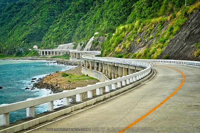
The 1.3-kilometer winding road of Patapat Viaduct
Patapat Viaduct is also called Patapat Bridge which connects the tip of Ilocos Norte province to Cagayan Valley province and it is overlooking Pasaleng Bay. It edges on the other side of the West Philippine Sea. Along this long and winding viaduct is the Mabugabog Falls, which is a mini-hydro plant.
The northernmost edge of the viaduct
The bridge is consist of 76 number of spans allowing the passing vehicles to have a load limit of 15 tons or 15,000 kg. It is a two-lane single carriageway (one lane per direction) with a width of 9.42 meters or 30.9 feet. It has a design life of 45 years and was constructed by Hanil Development Co. Ltd under the overall management of DPWH-PMO-PJHK and was completed and opened to traffic in October 1986. It rises along the town's coastal mountains, which is the starting point of the Cordillera Mountain Range. (Wikipedia)
Seated near the northernmost edge of the viaduct
Our group headed by my boss, Mrs. Lucia M. Llego, headed to this tourist attraction early morning before we settled for an overnight in one of the resorts of Pagudpud.

The Patapat Viaduct of Pagudpud, Ilocos Norte is a 1.3 km elevated concrete coastal bridge highway by 31 meters (102 feet) above sea level constructed along winding mountainside in the northernmost section of Ilocos Norte. As per record, it is the 4th longest bridge in the Philippines where the longest is the 2.2 km San Juanico Bridge which connects Leyte to Samar. It is 16 kilometers away from Pagudpud town proper. If you happen to be here at Patapat Viaduct, then, you should not miss to experience Saud beaches where we headed next for an overnight.

This highway is footed on the rock seashore just several meters along the picturesque mountainsides which gives motorists a spectacular view of the Pasaleng Bay. Its construction has solved the problem of landslides in the area which before was a peril to the motorists.

I still remember that wayback on October 3, 2003 when I rode in a public transport bus heading to Aparri, I asked the bus driver and the passengers that I be allowed to have a picture along the Patapat Viaduct where they all gave me a resounding “Yes” since I was only traveling that time alone. The bus conductor was the one who took the picture. This was the time after I just had my Batanes Trip and heading for Aparri heading for my Camiguin de Babuyanes Trip.
In my recent trip, we drove along this impressive view in order for us to reach Saud Beach of Pagudpud, dubbed as the Boracay of the North. Prior to this, we spent the whole morning touring at Cape Bojeador Lighthouse and Bangui Windmills. We settled in Saud Beach for a refreshing beach swim.


No comments:
Post a Comment